
The Kīlauea crater rim at Hawaiʻi Volcanoes National Park starts filling around 9 a.m. on a clear morning. Arrive before 8 or after 4 and the wall is yours.
The Big Island is less crowded than Oʻahu and Maui at nearly every attraction here, but it’s also much larger. At roughly 4,000 square miles, it covers more land area than all the other Hawaiian islands combined. Kailua-Kona to Hilo is a two to three hour drive depending on the route, and the Hāmākua Coast route takes the full three hours if you stop at the pullouts. A rental car is not optional here.
Table of contents
On this list: an active volcano, the highest point in Hawaiʻi at 13,803 feet, black and white sand beaches on opposite coasts, Hawaiian history sites dating back centuries, and a few places that rarely make the short lists. Six categories, 23 destinations, free to well over a hundred dollars depending on what you choose.
Use it as an orientation tool, not a checklist. If you have three days, pick one zone and stay in it. You could spend a week on the southern and western sides alone.
All 23 Destinations: Map, Prices, and Planning
The table covers all 23 destinations with prices, typical duration, and best-for notes. The zone breakdown below the map shows how to group them into days without crisscrossing the island.
Prices, details, and map locations below last verified May 2026.
| Name | Duration | Price | Best for |
|---|---|---|---|
| 1Kailua-Kona Waterfront (Details ↓) | 1–2 hrs | Free | Dining, sunset walk |
| 2Kealakekua Bay (Details ↓) | Half day | Free | Snorkeling, history |
| 3Punaluʻu Black Sand Beach (Details ↓) | 1–2 hrs | Free | Sea turtles, beach |
| 4South Point (Details ↓) | Half day | Free | History, green sand hike |
| 5King Kamehameha Statue (Details ↓) | 30 min | Free | History, scenic drive |
| 6Puʻukoholā Heiau (Details ↓) | 1 hr | Free | Hawaiian history |
| 7Waipiʻo Valley (Details ↓) | 30–60 min | Free | Overlook, photos |
| 8Pololū Valley (Details ↓) | 1–2 hrs | Free | Hiking, coast views |
| 9Kaumana Caves (Details ↓) | 1–2 hrs | Free | Geology, adventure |
| 10Kahuku (HVNP) (Details ↓) | 1–3 hrs | Free | Hiking |
| 11Kehena Black Sand Beach (Details ↓) | 1–2 hrs | Free | beach |
| 12King's Trail (Details ↓) | 1–2 hrs | Free | History, coastal hike |
| 13ʻAkaka Falls (Details ↓) | 1 hr | $5/person + $10/vehicle | Families, waterfalls |
| 14Rainbow Falls (Details ↓) | 30–45 min | $5/person + $10/vehicle | Families, easy visit |
| 15Hāpuna Beach (Details ↓) | Half day | $5/person and $10/vehicle | Swimming, beach day |
| 16Huliheʻe Palace (Details ↓) | 1 hr | $16/person | Hawaiian history |
| 17ʻImiloa Astronomy Center (Details ↓) | 1–2 hrs | $19/adult | Science, culture, kids |
| 18Puʻuhonua o Hōnaunau (Details ↓) | 1–2 hrs | $20/car | Hawaiian history |
| 19Hawaiʻi Volcanoes National Park (Details ↓) | Full day | $35/car | Volcano, hiking |
| 20Kona Coffee Belt (Details ↓) | 1–2 hrs | Free–$40 (tour) | Coffee, scenic drives |
| 21Seahorse Farm (Details ↓) | 1–2 hrs | ~$50/person | Kids, marine life |
| 22Mauna Kea Summit (Details ↓) | Half–full day | Free, 4WD needed (tours extra) | Stargazing, summit views |
| 23Thurston Lava Tube (Details ↓) | 30–60 min | Incl. HVNP fee | Geology, families |
Where to start
Staying on the west side (Kona, Waikoloa, Kohala): The Kailua-Kona Waterfront and Huliheʻe Palace share the same downtown stretch and take a morning. Hāpuna Beach is 40 minutes north. You can see Puʻukoholā Heiau, the King Kamehameha Statue, and Pololū Valley in a full day in North Kohala. Kealakekua Bay and Puʻuhonua o Hōnaunau are 15 minutes south of Kona and pair well together.
Staying on the east side (Hilo or near the park): Hawaiʻi Volcanoes National Park is 45 minutes from Hilo and takes a full day on its own. You can see Rainbow Falls and ʻAkaka Falls in a half-day Hāmākua waterfall run. Mauna Kea and ʻImiloa Astronomy Center are both Hilo-adjacent.
Traveling with children: ʻAkaka Falls, Rainbow Falls, Thurston Lava Tube, and the Seahorse Farm are the four most accessible stops on this list for kids. Add Punaluʻu Black Sand Beach for sea turtle sightings.
Hawaiian history is your main focus: Kealakekua Bay, Puʻuhonua o Hōnaunau, Puʻukoholā Heiau, Huliheʻe Palace, the King Kamehameha Statue, and the King’s Trail together cover the arc from ancient settlement through the Kamehameha era. Expect two days and driving both coasts.
Outdoors with fewer people: Mauna Kea, Kealakekua Bay by kayak or boat, South Point plus Papakōlea Green Sand Beach, early morning Pololū Valley, and Kaumana Caves are the five least-crowded options on this list.
Most visited
Even the four busiest places on this list have room to spread out, and shifting your arrival by an hour usually does more for you than picking a different destination. We give the off-peak window for each.
Hawaiʻi Volcanoes National Park
One of two national parks in Hawaiʻi, Hawaiʻi Volcanoes National Park sits on the Big Island’s windward side and covers a large area in the southeast. The Park was designated as an International Biosphere Reserve in 1980, a World Heritage Site in 1987, and a National Park in 1916.
Today, it covers more than 500 square miles of land. It is centered on Kīlauea, the active volcano. Throughout the park, you can see the aftermath of past eruptions and lava flows, and the Park’s visitor center sits next to Kīlauea’s summit crater, Halemaʻumaʻu. Parts of Mauna Loa, the island’s largest volcano, are also within the boundaries of the National Park.
Kīlauea has erupted frequently since 1983, but not continuously and not always in the same place. The long 1983 to 2018 eruption ran from Puʻu ʻŌʻō on the East Rift Zone, and the 2018 summit collapse ended it. Since December 23, 2024 the summit has been in an episodic lava-fountaining eruption inside Halemaʻumaʻu, with individual episodes lasting hours rather than weeks. Check the USGS Hawaiian Volcano Observatory status page the morning you go, because there is no schedule to plan around.
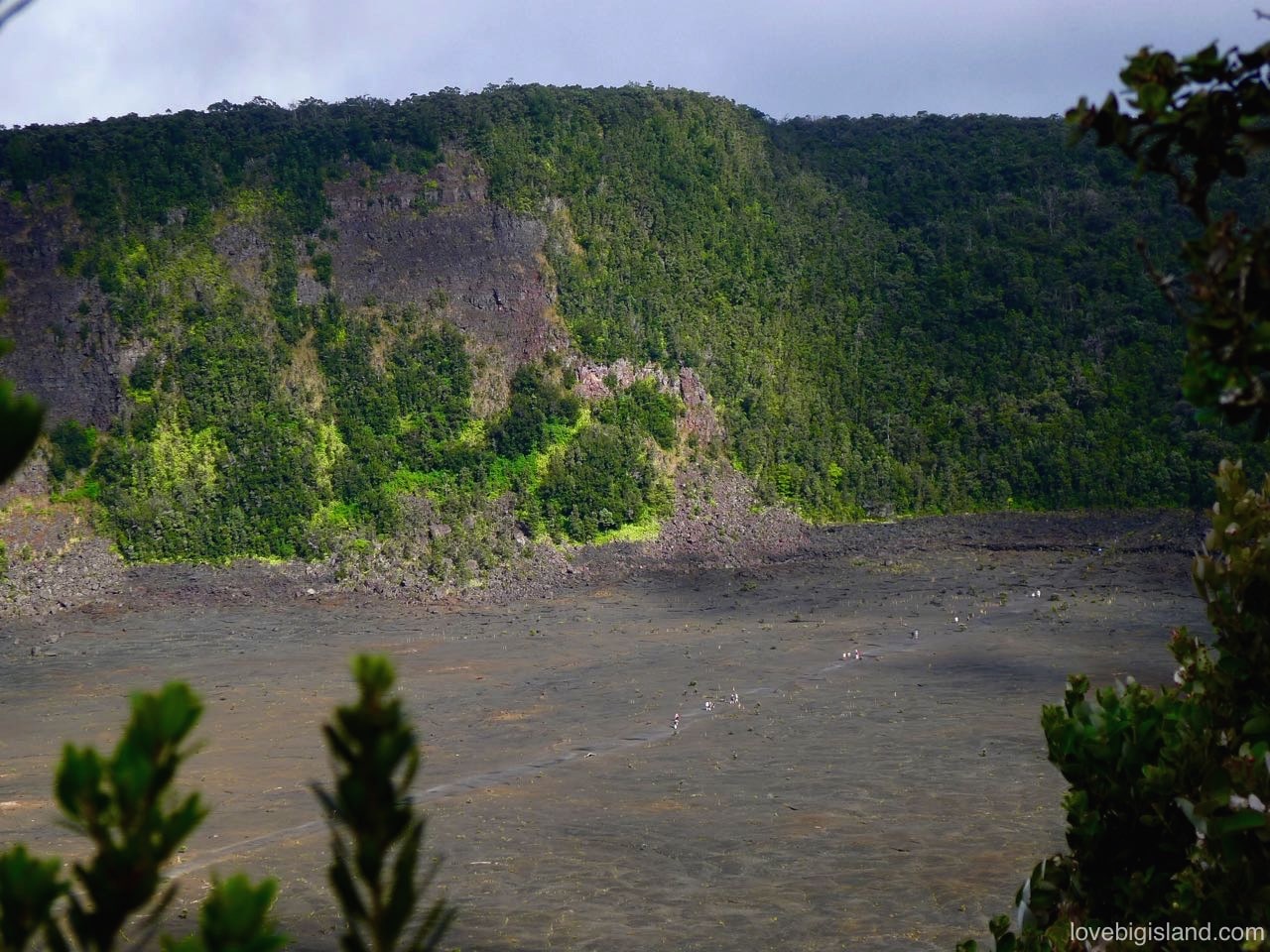
Hikers cross the floor of Kīlauea Iki crater in Hawaiʻi Volcanoes National Park. Our Kīlauea Iki hike write-up has the 3.3-mile loop, the 400-foot descent and where to park.
Good to know: The National Park is the most-visited attraction on the Big Island, and at certain times, many of its easy-accessible areas, such as Thurston Lava Tube, can become congested. Visiting earlier or later in the day avoids those “rush hours.”
Favorite activities in the park
Top activities include seeing lava, hiking, camping, volcano viewing, and scenic drives (Chain of Craters Road). The following video shows four of our favorite stops in the park:
- The Halemaʻumaʻu crater overlook at the Jaggar museum (now closed, but several great overlooks remain)
- The Thurston lava tube
- The Kīlauea Iki crater
- Part of the Chain of Craters road.
Combine with: Thurston Lava Tube, which is inside the park near the visitor center, and Punaluʻu Black Sand Beach, about 30 minutes south, on a southern loop back toward Kona.
Kailua-Kona Waterfront
Kailua-Kona is the main hub on the Big Island’s west coast, about 15 minutes south of the Kona airport. It is by far the largest town on this side of the island. The Kona waterfront runs along Aliʻi Drive, with dozens of bars, restaurants, kiosks, hotels, tour operators, and shops, most with clear views of the ocean.
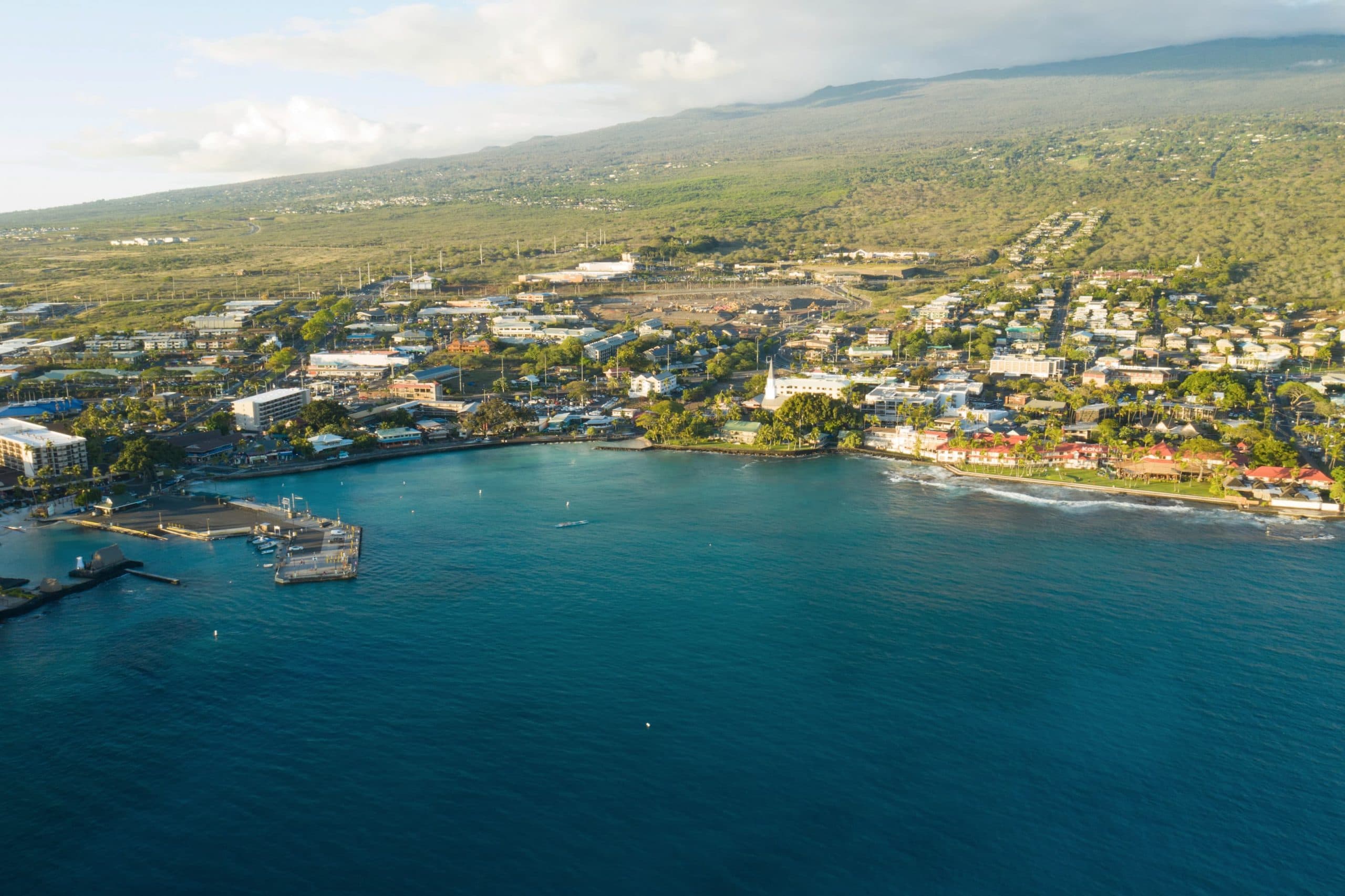
Downtown Kona and Kailua Bay. Credit: Hawaii Tourism Authority (HTA) / Heather Goodman
Good to know: If you’re staying in Kailua-Kona, it is an easy base: the restaurants, shops and Kailua Pier are all within walking distance. Sunset is the best hour for a walk down Aliʻi Drive, and the seaside restaurants fill up right after it. Several boat tour operators leave from Kailua Pier, so you can jump on a snorkel tour from town.
Combine with: Huliheʻe Palace, a short walk from Kailua Pier, or the northern Kona Coffee Belt farms, a 10-minute drive uphill from Aliʻi Drive.
The Mauna Kea Summit
The Big Island is made up of five volcanoes. Two of them, Kīlauea and Mauna Loa, are inside Hawaiʻi Volcanoes National Park. Mauna Kea, the island’s tallest volcano, is outside it and reaches 13,803 feet above sea level. Measured from its base on the ocean floor rather than from sea level, it is the tallest mountain on Earth.
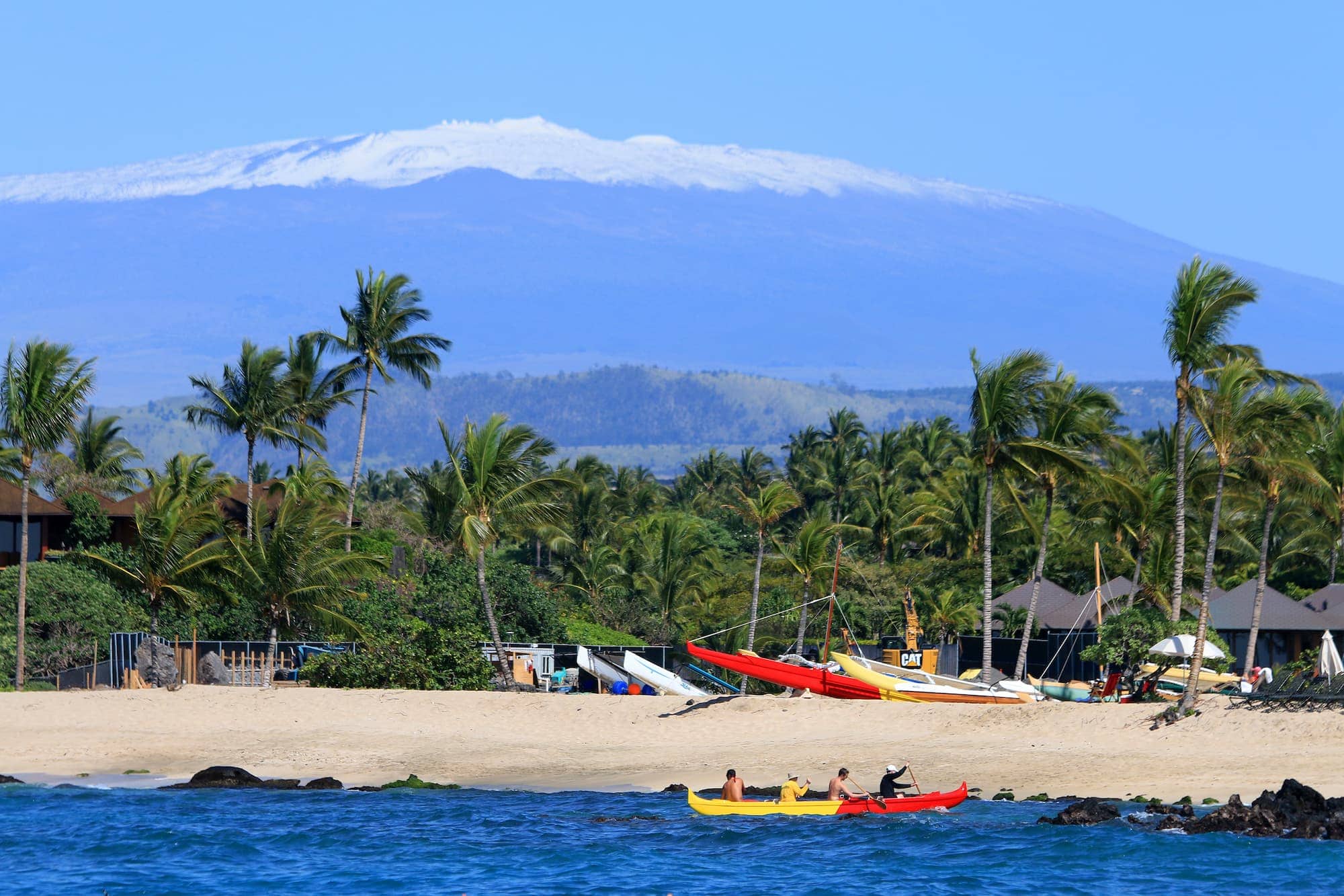
The sometimes snow topped Maunakea (with telescopes) stands over the island, and you can see it from many beaches. Image credit: Hawaii Tourism Authority (HTA) / Kirk Lee Aeder
The Maunakea Visitor Information Station sits at 9,200 feet, up the access road that leaves Saddle Road at milepost 28, and it is open daily from 9 a.m. to 9 p.m. with no entrance or parking fee.
The pavement ends about 300 yards past the station and the next four and a half miles are steep graded gravel. 2-wheel-drive vehicles are not permitted above the station at all. That is a rule under Hawaiʻi Administrative Rules chapter 20-26, not a suggestion, and and station staff turn back visibly muddy vehicles too, to keep invasive seeds off the mountain.
The nightly telescope program at the visitor station ended in 2019 and has not come back. After twilight the staff still step outside and give a laser-guided sky talk when the weather and the roster allow, and there is one free telescope evening a month that needs a reservation. You can also see more stars from the station than from the summit: there is around 40 percent less oxygen at 14,000 feet than at sea level, and night vision is one of the first things to go.
Stargazing from Mauna Kea ranks among the best things to do at night on the Big Island.
Good to know: Mauna Kea means “white mountain,” for the snow that often sits on its summit. Stop at the visitor station for at least 30 minutes to acclimatise before driving higher, and if you are going up for sunset, get there an hour and a half to two hours ahead.
Don’t go above the station if you are under 13, pregnant, have been scuba diving in the previous 24 hours, or have a heart, respiratory or blood pressure condition. That is a Center for Maunakea Stewardship rule.
There is no fuel on the mountain and the nearest stations are around 35 miles away in Hilo, Waimea and Waikoloa Village, so fill up first. The summit area closes 30 minutes after sunset: you can stay on the mountain to stargaze, but you have to come back down below the Park 2 parking area to do it.
Cell phones and radios are restricted above the station because they interfere with the telescopes. The road and weather hotline is (808) 935-6268.
Combine with: ʻImiloa Astronomy Center in Hilo, which has a planetarium and exhibits that put the summit’s telescope research next to Hawaiian navigation by the stars. The two pair well as a Hilo-based day.
Kealakekua Bay
In 1778, British explorer Captain James Cook arrived in Hawaiʻi, becoming the first westerner to arrive in the islands. He visited several of the islands, but made frequent stops at Kealakekua Bay on the Big Island. The deep bay allowed him to bring his big ships close to shore, providing protection from the rough open waters. While at Kealakekua, he did repairs on his ship, and met and mingled with the local Hawaiian communities that lived nearby, exchanging gifts and pleasantries.
Eventually a skirmish broke out at Kealakekua and Cook was killed. Today, a monument stands along the shore in his honor, and the bay is a protected Marine Life Conservation District. It is one of the best places to snorkel on the Big Island, with shallow and deep water, tropical fish, sea turtles and coral.
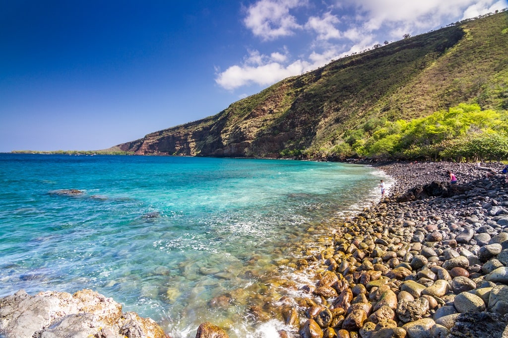
Nāpōʻopoʻo Beach is a small rocky beach in the Kealakekua Bay State Historical Park. Image credit: Nnachappa64 – Own work, CC BY-SA 4.0, Link
Good to know: You cannot drive to Kealakekua Bay. It is accessible via boat tour, by kayak, or hiking, only. Our Kealakekua Bay guide walks through the boat, kayak and hiking options.
Combine with: Puʻuhonua o Hōnaunau, about 15 minutes south along the coastal road. The two share the same stretch of the south Kona coast and are easy to pair in a single half-day.
Kid-friendly
ʻAkaka Falls and Rainbow Falls need less than half a mile of walking, and at the Seahorse Farm kids hold the animal.
ʻAkaka Falls
ʻAkaka Falls drops 442 feet, free-fall, into a stream-eroded gorge. A paved 0.4-mile loop path runs through the state park, past massive banyan trees and bamboo. The path has steps, so it isn’t wheelchair accessible.
Good to Know: The park is open daily from 8:30am to 5:00pm. Non-residents pay $5.00 per person to enter plus $10 per vehicle to park, credit card only; Hawaiʻi residents with an ID or driver’s license pay neither. Cell reception at the park is poor. Pay online before you drive up. The lot is small and stays full through the middle of the day.
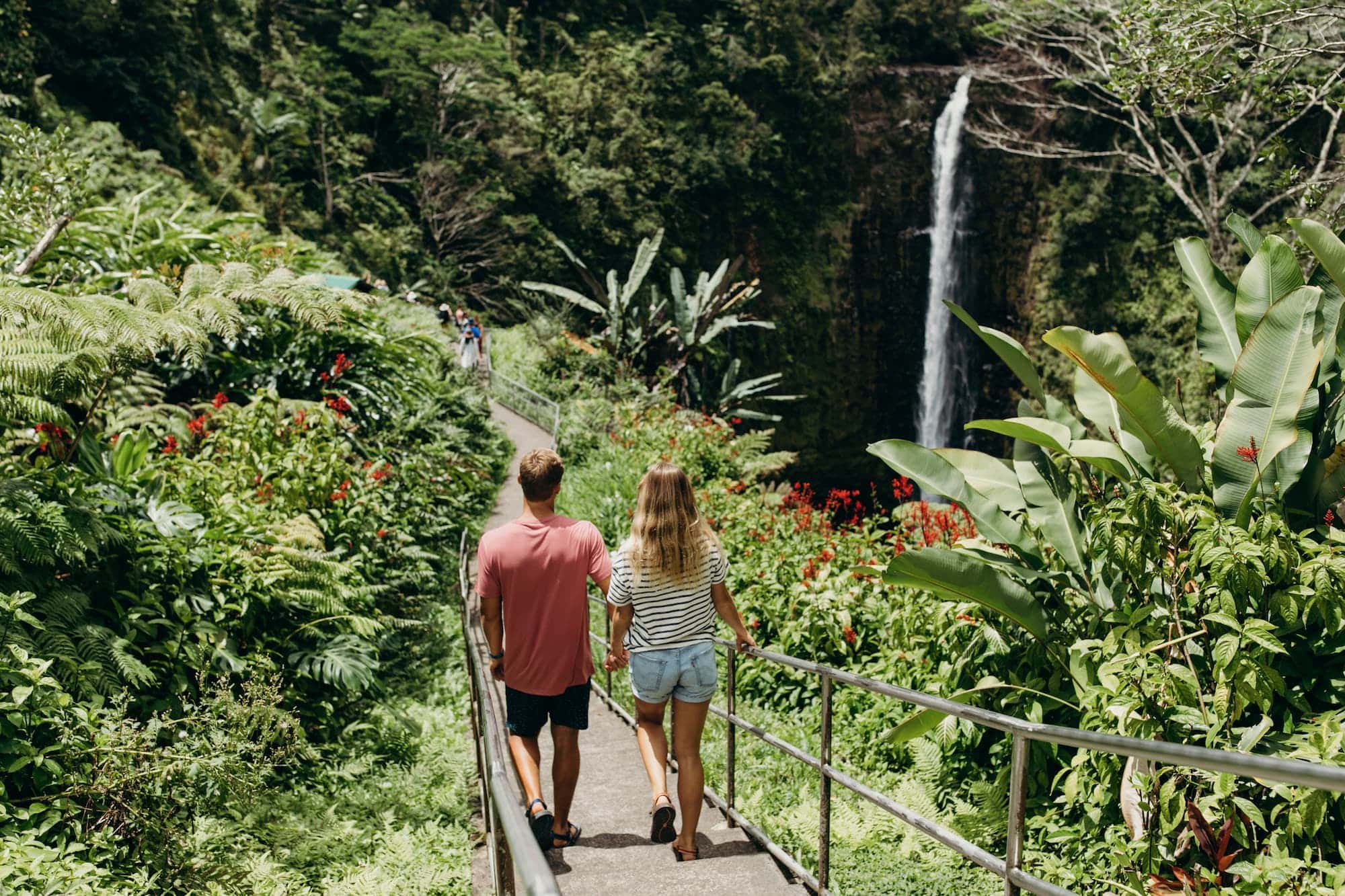
Walking towards the ʻAkaka Falls lookout point. Credit: Hawaii Tourism Authority (HTA) / Heather Goodman
Combine with: Rainbow Falls in Hilo, about 30 minutes south, and the drive along the Hāmākua Coast toward Waipiʻo Valley. Together they fill a half day from Hilo.
Seahorse Farm
The Hawaiʻi Ocean Science and Technology Park’s research campus houses a number of small business that focus on emerging renewable energy, aquaculture, and other ocean-based sustainable technologies. Among them is the Seahorse Farm, where you get to see how seahorses are hatched and raised. You also get to hold one during the tour, the hands-on part of the visit. The rest of the hour covers their development, diet, intelligence and lifespan.
Good to Know: Tours run Monday through Friday only, and the farm is closed weekends and on Christmas Day. A tour takes about an hour. Reservations are required, and the slots sell out, so book online well ahead. Arrive 30 minutes early to check in and read the handling rules, which the staff take seriously.
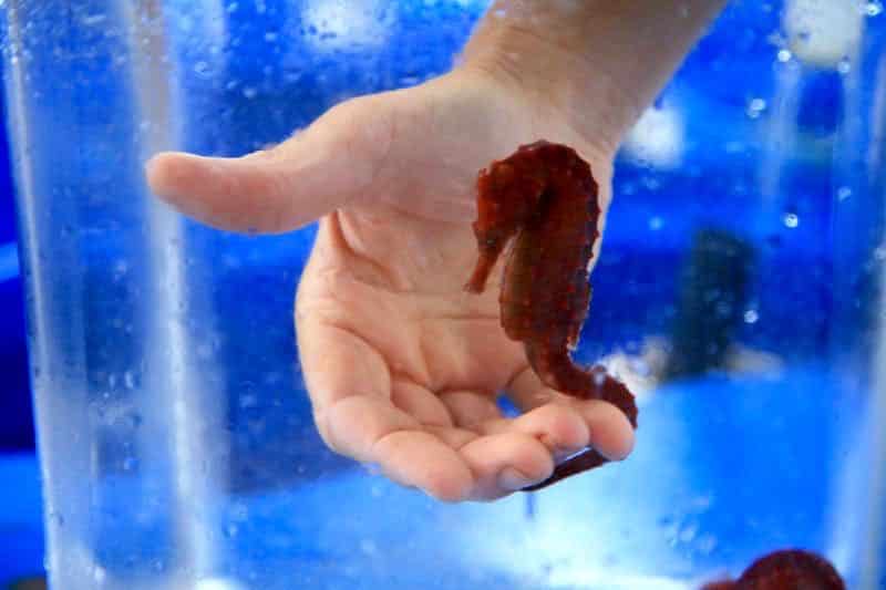
You can hold a seahorse during the tour at the Ocean Rider Seahorse Farm. Image credit: the Ocean Rider Seahorse Farm
More kid-friendly farm tours
There are many animal-related tours on the Big Island, ranging from small insects (beehives and honey production) to large (rescued) farm animals. You can also pay a visit to a petting zoo in Volcano or get some goat therapy in Honomū, tour an octopus farm in Kona, take out a shelter dog for a day trip, or even get to see zebras and flamingos in an exotic animal shelter.
Combine with: Kailua-Kona Waterfront, about 15 minutes south, for lunch or an afternoon on Aliʻi Drive. Both are close to the Kona airport, a good first or last day of a west-side stay.
Waiānuenue (Rainbow Falls)
Rainbow Falls, a few minutes from downtown Hilo, is an 80-foot waterfall on the Big Island framed by a rocky stream bed and dense jungle growth. You can park almost within sight of the falls, and there’s a short staircase that brings you to the top of the falls for an alternative view.
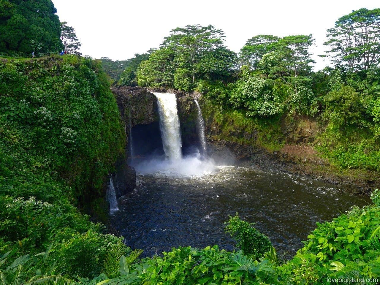
The volume of Waiānuenue, the rainbow falls, changes on a daily basis. This is what the falls look like after a good rain upstream
Good to know: If your kids are up for a little longer walk, check out the nearby Waiʻale Trail to explore another waterfall.
Combine with: ʻAkaka Falls State Park, about 30 minutes north on the Hāmākua Coast, for a waterfall run from Hilo. ʻImiloa Astronomy Center is in town and makes a good add-on, especially on a wet morning.
When can you see rainbows at the Rainbow Falls?
The mist around the falling water makes the rainbows. The main viewing area for the rainbow falls is east of the falls, so if you want to see rainbows while looking at the falls, you need to do so in the morning (because the sun rises in the east).
Outdoors
The outdoor stops: a black sand beach with turtles, a lit lava tube, the sea cliffs at the island’s southern tip and a half mile of white sand.
Punaluʻu Black Sand Beach
Punaluʻu Beach sits on the southeast coast of the Big Island: a crescent of black sand, with sea turtles hauled out on it almost daily. You can walk the coastline on either side of the bay. Go in the early morning or late afternoon when the sun is not too hot.
Good to Know: The turtles are protected. Know the distances before you walk down. Stay at least 10 feet from a honu (green sea turtle) resting on the sand and at least 50 feet from a Hawaiian monk seal if one has hauled out, 150 feet if she has a pup with her. These are NOAA Fisheries rules.
A field trick for judging the distance: hold a thumbs-up at arm’s length, and if your thumb covers the animal completely you are far enough back. Never touch or feed one, keep dogs on a leash, and stay behind any signs or barriers.
Bring a to-go lunch or snacks for the beach. As of August 2026, the nearby Punaluʻu Bake Shop, the self-described southernmost bakery in the United States, is closed after storm damage from Hurricane Lala, so check ahead before counting on it.
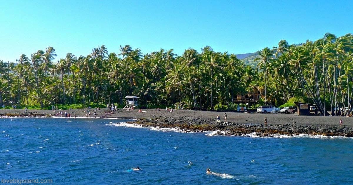
Punaluʻu is a good place for swimming, taking in the sun and snorkeling (turtles)
Combine with: Hawaiʻi Volcanoes National Park, about 30 minutes north, as part of a southern loop day. South Point and Papakōlea Green Sand Beach are about 45 minutes southwest for those extending the route.
Thurston Lava Tube
Thurston Lava Tube, or Nāhuku, is a 500-year-old underground “cave” that was once a main artery of Kīlauea Volcano, transporting lava underground along the volcanic rift zone. The National Park keeps it the best-maintained lava tube in Hawaiʻi, with a paved walking path through it. You walk through the tube and exit at the far end.
Good to Know: The tube is lit between 8 a.m. and 8 p.m., and the walk is about 1.5 miles round trip from the Kīlauea Iki Overlook. Thurston is one of the most popular stops in Hawaiʻi Volcanoes National Park, and the middle of the day is when the queue forms at the entrance. Come outside the lit hours and you will need your own light.
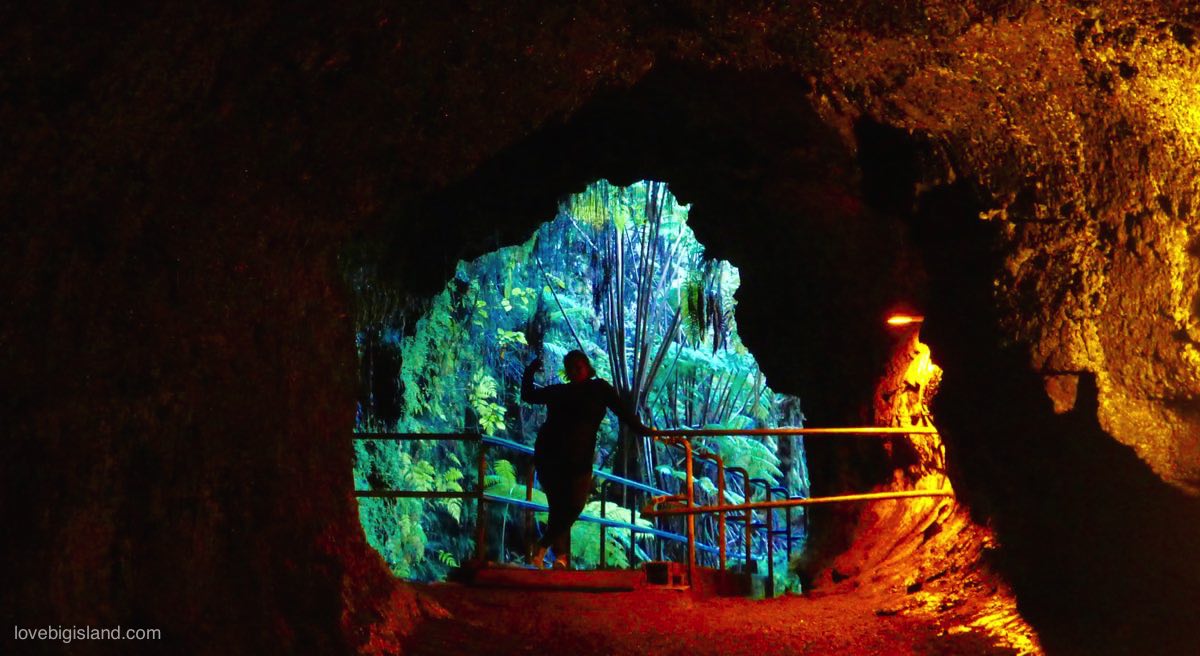
Explore this 500 year old lava cave that could fit a truck in Hawaiʻi Volcanoes National Park
See our overview of lava tubes on all Hawaiian islands for more caves to explore.
Combine with: The Kīlauea Iki Trail, which starts a short walk from the lava tube trailhead. It is a 3.3-mile loop with a 400-foot descent to the crater floor and the same climb back out, and the Park puts it at two to three hours. Parking at the Kīlauea Iki Overlook is very limited at peak hours; starting from the Kīlauea Visitor Center instead adds two miles and saves you circling for a space.
South Point
Ka Lae, “South Point,” is the southernmost tip of the Big Island. Polynesian voyagers reached Hawaiʻi in the 13th century, roughly 750 to 800 years ago, and Ka Lae is one of the earliest known settlement areas on the island; it still holds the ruins of Hawaiian temples. It has tall sea cliffs and long open views. There is also a green-sand beach, Papakōlea, in this area, which requires a 2.5 mile hike.
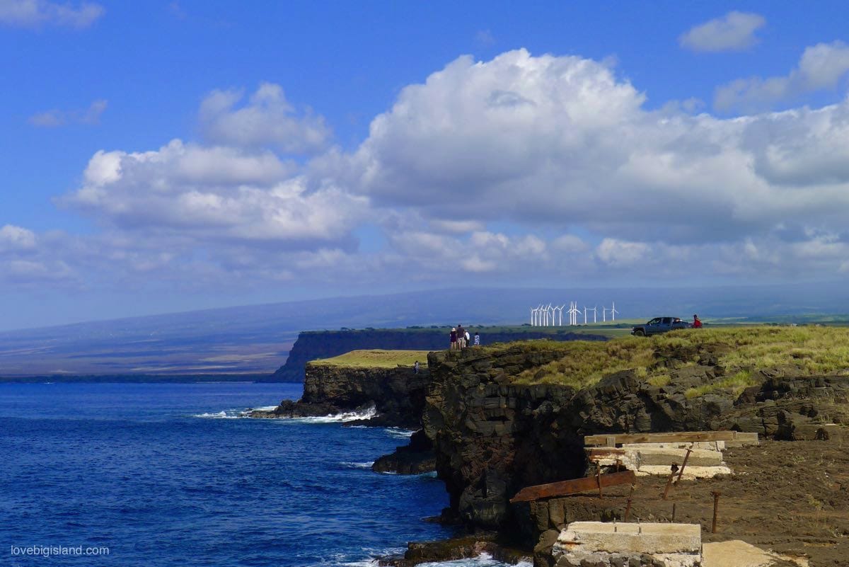
Ka Lae is a good stop on your way to Papakōlea (green sand beach)
Good to Know: Ka Lae has been a National Historic Landmark since December 1962, listed as the South Point Complex. The Park Service marks it “restricted,” which means the Park Service withholds the locations of the archaeological sites.
It is not a park: there is no visitor center, no ranger station and no facilities of any kind out there. Our Kaʻū District guide lists the other stops on the south shore, and our Papakōlea guide covers the 2.5-mile hike to the green sand.
Combine with: Papakōlea Green Sand Beach, whose 2.5-mile access hike begins from the South Point road. Drive to South Point, hike to Papakōlea, return to the road. The hike takes 1.5 to 2 hours round trip.
Hāpuna Beach
Hāpuna beach is on our list of favorite Kona beaches and is the white-sand beach we send people to first. It’s a half mile long, almost always sunny (less than 10 inches of rain a year), and on calm days it has a continuous, mellow shore break. Snorkeling is also possible (bring or rent your gear beforehand), and the state provides lifeguard services.
Good to Know: Gates open at 7:00am and close at 8:00pm, with the park itself running to 7:30pm. Entry for non-residents is $5.00 a head and parking is $10 a vehicle; residents with an ID pay neither.
Shade is scarce, and the few shaded spots go early. The state warns of rip currents and a pounding shore break when the surf is up: waves over 3 feet are for experts only. The food concession at the park is closed while the state tenders a new one, so bring what you need.
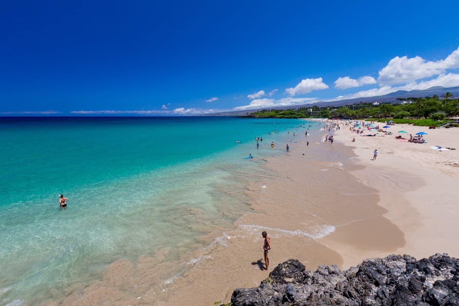
There is little shelter from the sun at the long white sand beach at Hāpuna bay. Credit: Hawaii Tourism Authority (HTA) / Tor Johnson
Our guide to the most popular beaches on the Big Island lists the other beaches by coast.
Combine with: Puʻukoholā Heiau National Historic Site, about 15 minutes north along Queen Kaʻahumanu Highway, for a half-day that covers the beach and the temple built for Kamehameha.
Hawaiian History, Art, & Culture
These are the main ones; our guide to historical and cultural sites on the Big Island has the longer list.
Huliheʻe Palace
The Huliheʻe Palace, a waterfront estate of six rooms, shows how Hawaiian royalty once vacationed and relaxed along the shores of Kailua-Kona. A getaway place for the royal families and their high chiefs, the palace was restored in the 1920s and it now contains artifacts and offers guided tours.
Good to Know: The palace is in downtown Kailua-Kona and is open Wednesday to Saturday, 10am to 3pm, with last entry 30 minutes before closing. Self-guided admission is $16 for adult visitors and $14 for ages 6 to 17, with residents, seniors and military at $12 and children 5 and under free. The docent-led Moʻolelo tour runs $20 for all ages and usually starts at 11:30am, depending on which docents are in that day. Book online.
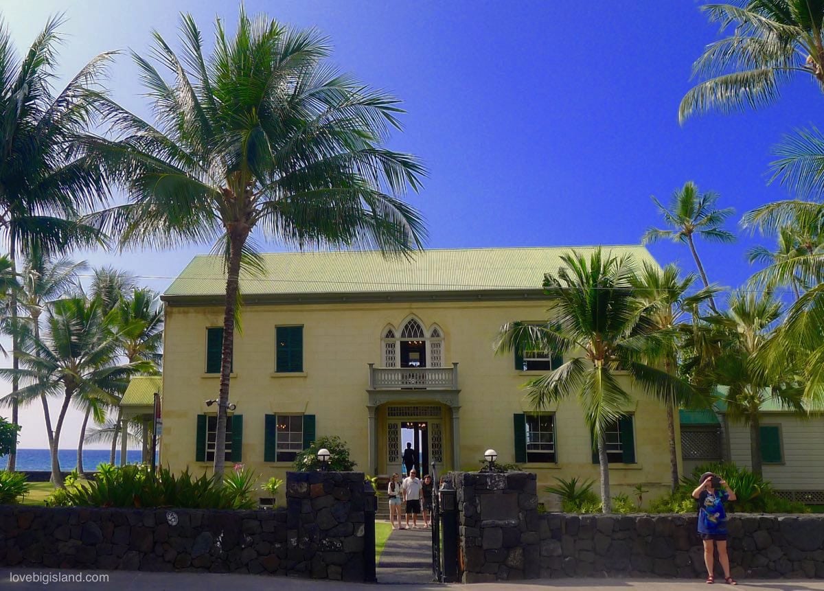
The Huliheʻe Palace in Kailua-Kona is a former vacation home of Hawaiian royalty, now a museum of period furniture and artifacts.
Combine with: Kailua-Kona Waterfront, which begins right outside the palace gates. Start a morning walk down Aliʻi Drive at the palace, before the shops fill up.
King Kamehameha Statue
The northern part of the Big Island, named Kohala after the volcano that built it, was the birthplace of Kamehameha, Hawaiʻi’s most famous king. The statue standing here was recovered from the sea floor after the ship carrying it sank near the Falkland Islands.
Good to Know: The Kamehameha Statue is a short drive from Pololū Valley and downtown Hāwī. Pair all three on one North Kohala drive.
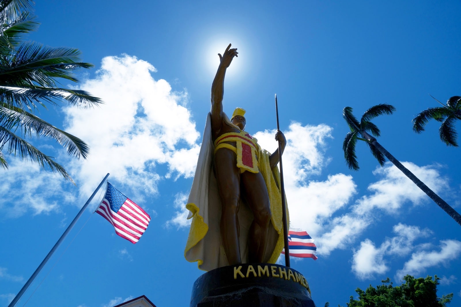
The Kamehameha statue in front of the North Kohala Civic Center (Kapaʻau, HI). Credit: Hawaii Tourism Authority (HTA) / Blake Bronstad
Combine with: Pololū Valley, about 15 minutes east at the end of the Kohala Mountain Road. Downtown Hāwī is a minute from the statue and worth a short stop for food before continuing.
ʻImiloa Astronomy Center
The ʻImiloa Astronomy Center is a scientific and cultural discovery center on the University of Hawaiʻi Hilo campus. Its exhibits put the astronomical research on top of Mauna Kea next to how Hawaiians have navigated by the night sky for centuries. It has rotating special exhibits and a planetarium.
Good to Know: ʻImiloa is a 1-hour museum stop, good for a rainy day in Hilo. Try to time your visit with a planetarium show.
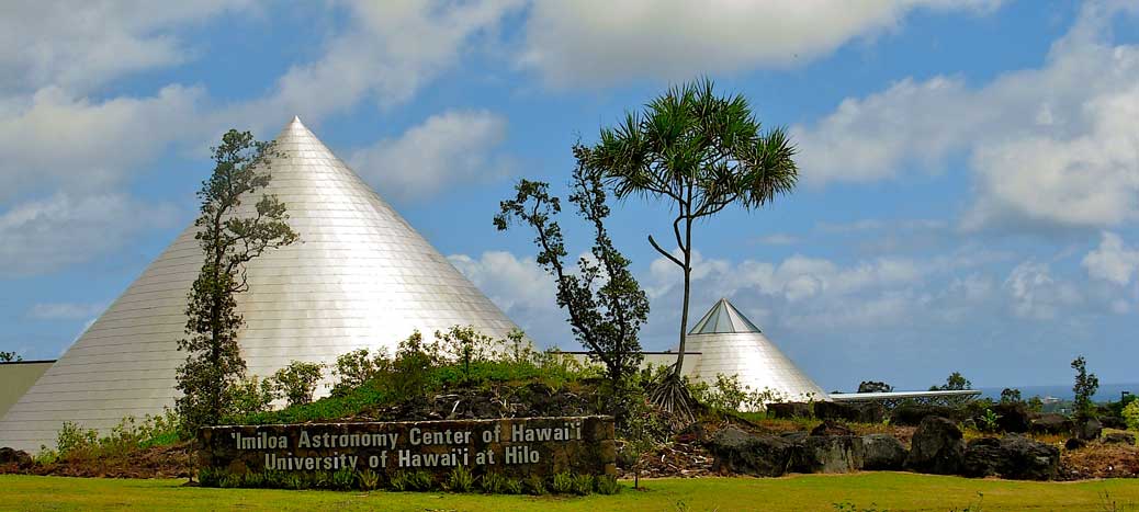
The ʻImiloa Astronomy Center of Hawaiʻi in Hilo, the Big Island. Photo credits: Brewbooks on Flickr under a CC BY-SA 2.0 licence
Combine with: Rainbow Falls, about 10 minutes away in central Hilo, for a half-day that stays within town. If you are also driving up Mauna Kea or taking a stargazing tour, pair the two.
Puʻuhonua o Hōnaunau
Puʻuhonua o Hōnaunau was a “place of refuge,” or in today’s terms, a rehabilitation center for ancient lawbreakers. Staffed and run by high priests, those who had broken a “kapu,” or ancient law, could find their way to established refuges, like Puʻuhonua o Hōnaunau, to seek forgiveness and perform penance. Each district had a place of refuge like this one.
Good to Know: Entry is $20 per private vehicle, or $10 per person on foot or by bicycle, and the pass is good for seven days. The self-guided route and the audio tour cover the same ground, and cultural demonstrations run almost every day. There’s no published ranger-talk schedule; call the park at (808) 328-2326 to find out what is on the day you plan to go. The gates close 15 minutes after sunset.
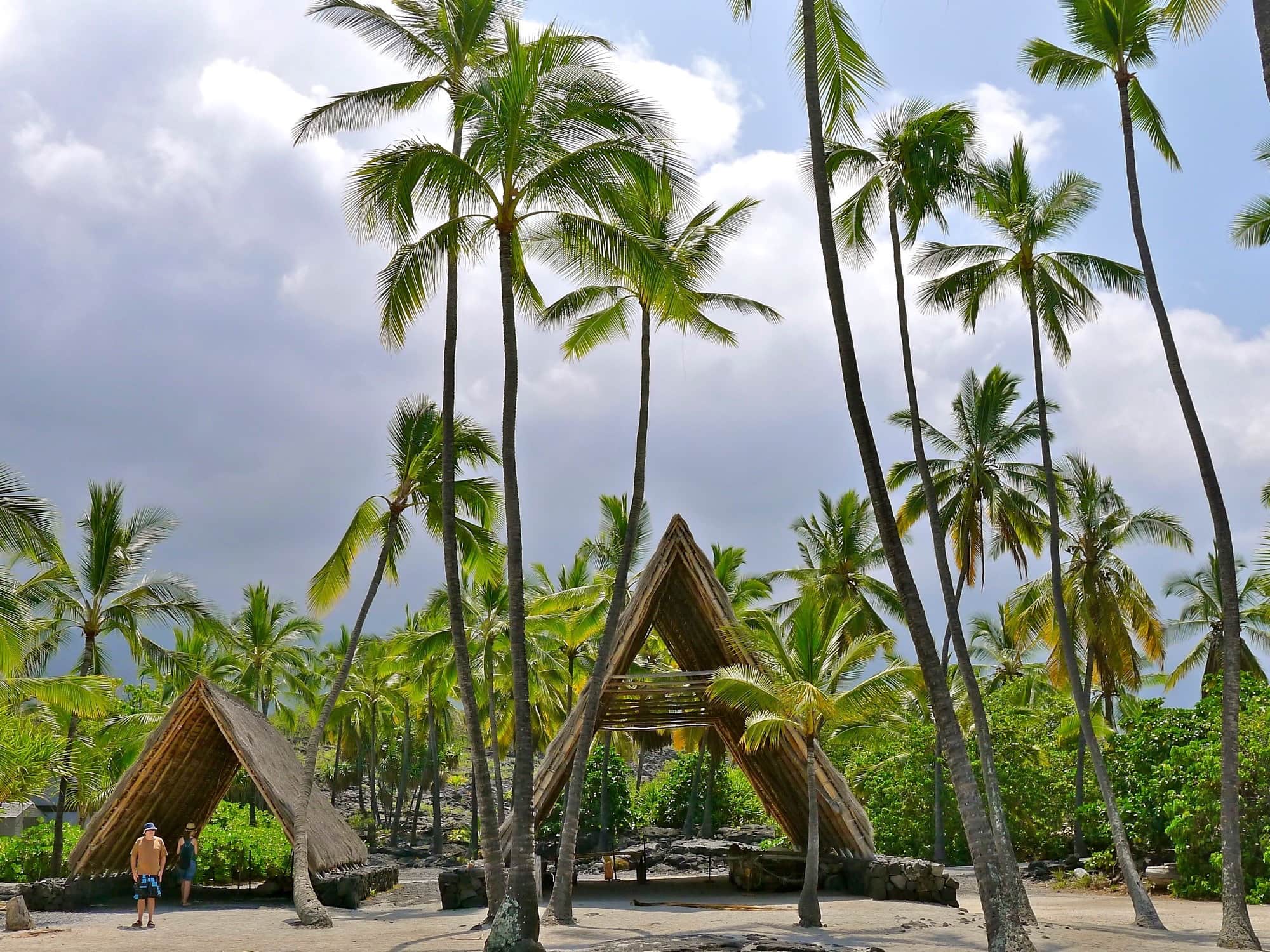
Reconstructed Halau that acts as a shelter for canoes on the Royal Grounds
Combine with: Kealakekua Bay, about 10 minutes north on the coastal road. A snorkel trip or kayak at Kealakekua followed by the self-guided walk at Puʻuhonua makes a practical sequence for the south Kona coast.
Puʻukoholā Heiau National Historic Site
Puʻukoholā Heiau is a temple built in honor of King Kamehameha. It was once a multi-purpose complex, used for ceremonies of war and for sacrifices of worship, most heavily during the time of Kamehameha’s rule and conquest of the other islands.
Good to Know: The site is free, with no entrance pass required. Rangers are in the park daily and often give talks or walk the grounds with visitors, but there’s no fixed schedule and it depends on who is on that day. Read up on it beforehand in case you arrive between talks. Wear closed-toe shoes to walk the complex, and bring plenty of water: there is no shade at all.
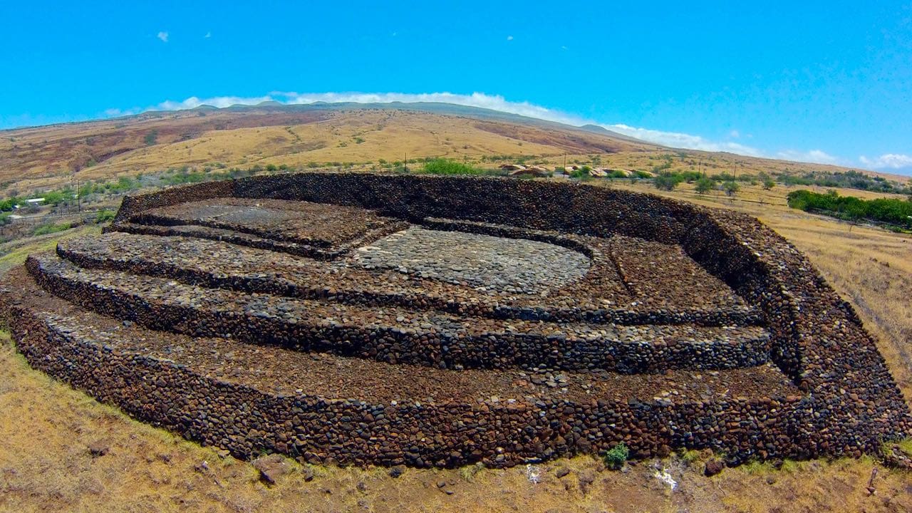
The Puʻukoholā Heiau National Historic Site. Image credit: NPS
Combine with: Hāpuna Beach, about 15 minutes south on Queen Kaʻahumanu Highway, for an afternoon at the water after the heiau visit. The King Kamehameha Statue in Kapaʻau is 30 to 40 minutes north for those doing a full North Kohala day.
Scenic and Photogenic Spots
A coffee hillside above Kailua-Kona and two Kohala valleys with black sand beaches at the bottom:
Kona Coffee Belt
Coffee is grown all over the Hawaiian Islands, but none is as well known as Kona Coffee. Grown in the “Kona Coffee Belt” that hangs above Kailua-Kona, Kona coffee is one of the most successful agricultural industries on the island. These upcountry hillsides are loaded with coffee farms, many offering daily tours of their properties, with tastings included.
Good to know: A farm tour is the best first stop of a Kona morning, and most run before the heat builds. Greenwell Farms in Kealakekua is the easiest one to plan around: the guided tour of the farm and the processing works is free, runs twelve times a day between 9 a.m. and 3 p.m., and takes 45 to 60 minutes.
No reservation is needed unless your group is over 15, and arrive 10 to 15 minutes before the departure you want. The route is unpaved and uneven with some climbing, and you cannot walk the farm unescorted. Our list of Kona Coffee tours compares the farm tours by price and length.
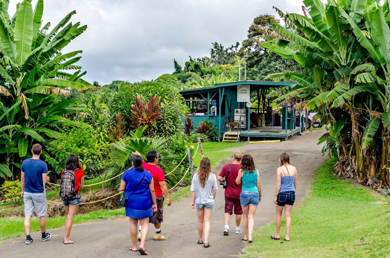
Visitors take a Kona Coffee Farm Tour at the Greenwell farm. Source: here by user horspowr1001 under a CC BY-NC 2.0 license
Combine with: Kailua-Kona Waterfront, a 10-minute drive downhill from most of the farms. Most tours wrap by early afternoon, leaving time for the water.
Waipiʻo Valley
Waipiʻo Valley sits at the eastern end of the Kohala Forest Reserve. The overlook at the top of the valley gives an expansive view of the valley, its black sand beach, and the mountain ridges behind it.
Waipio Valley road is closed
Waipiʻo Valley Road is closed to visitors and access to the valley floor and the subsequent valleys is not possible anymore. The Waipiʻo Lookout is still accessible.
Good to Know: The road down into the valley has been closed to general visitor traffic under a Hawaiʻi County emergency rule since February 2022. The county has amended that rule repeatedly rather than lifting it, most recently in the 15th amendment dated January 2025, and it has posted no reopening notice since. The lookout at the top has stayed open throughout. Check our Waipiʻo Valley guide for the current position before you drive out there.
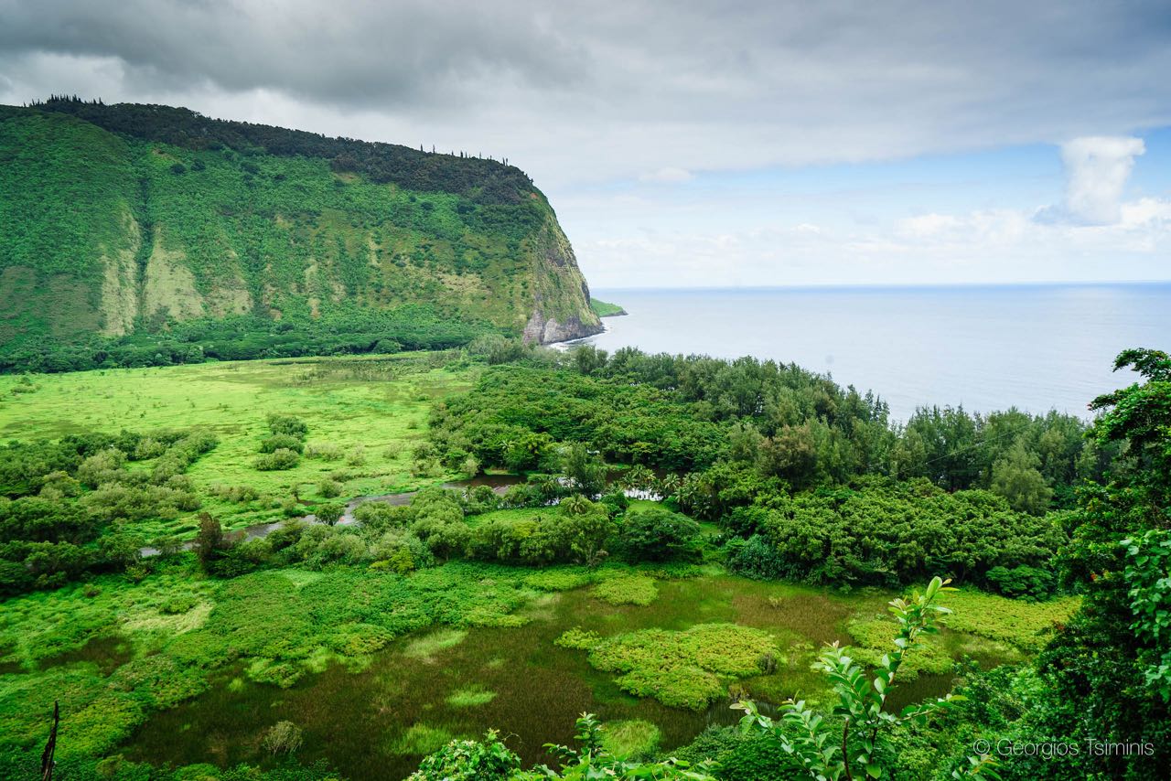
Looking down the steep access road into Waipiʻo Valley. Image credit: Georgios Tsiminis
Combine with: ʻAkaka Falls State Park, about 45 minutes south on the Hāmākua Coast. The King Kamehameha Statue and Pololū Valley are 30 to 40 minutes north for those continuing up the Kohala coast.
Pololū Valley
On the west end of the Kohala Forest Reserve, opposite Waipiʻo Valley, is Pololū Valley. Here, a short hike takes you down into an undeveloped stretch of rocky coast, with hiking trails that allow you to explore miles further. Old-growth forests line the coast, with views down the coast.
Good to Know: Accessing the valley at Pololū requires a short, downhill hike of about a half mile. Be sure to bring snacks and water with you, as no services are present at Pololū.
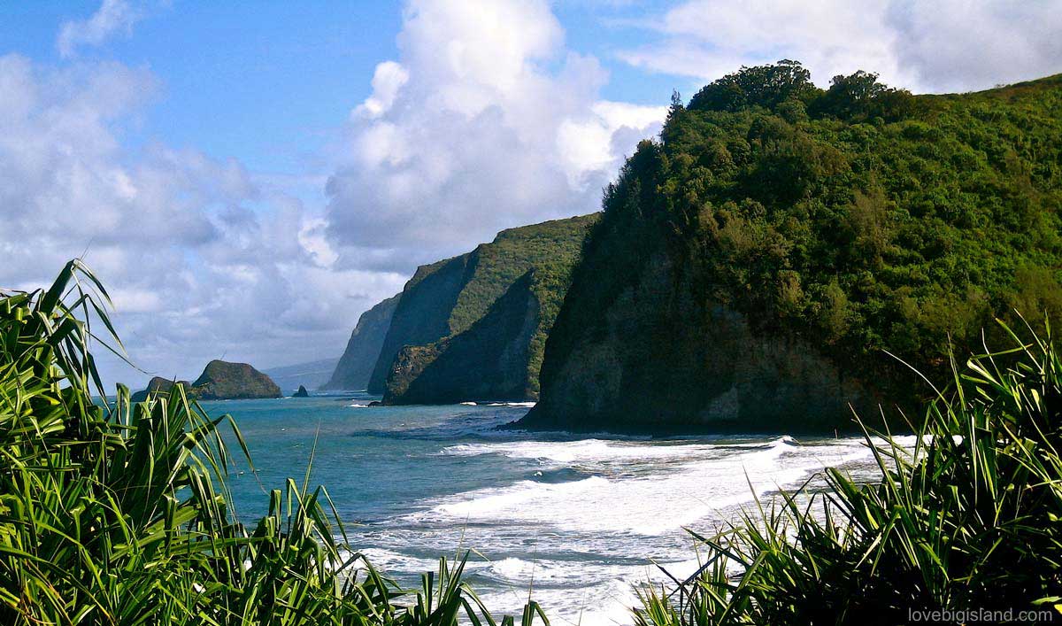
View of the Pololū black sand beach and the dramatic cliffs in the direction of Waipiʻo Valley
Combine with: The King Kamehameha Statue in Kapaʻau, about 15 minutes west, and downtown Hāwī just beyond it. Waipiʻo Valley is on the other end of the Kohala Forest Reserve for those making a full Hāmākua day: budget five to six hours for both valleys and the drive between.
Hidden Gems
Places that rarely make the short lists.
Kaumana Caves Park
Kaumana Caves Park is the entrance to part of a 25-mile lava tube created by Mauna Loa’s 1881 flow. You can explore the first two miles of it from the park entrance, hiking into the cave and following the tube underground. The ceiling and caverns range from just a few feet to 30 feet in height, with many rock formations and minerals on the walls.
Good to know: Closed-toe shoes are a must due to sharp lava rock, and be sure to bring a flashlight, as it gets dark in the cave. Watch for low ceilings and slippery, wet rocks. This is a county park with no rangers and no lighting inside, so nobody is checking on you. Go with someone else.
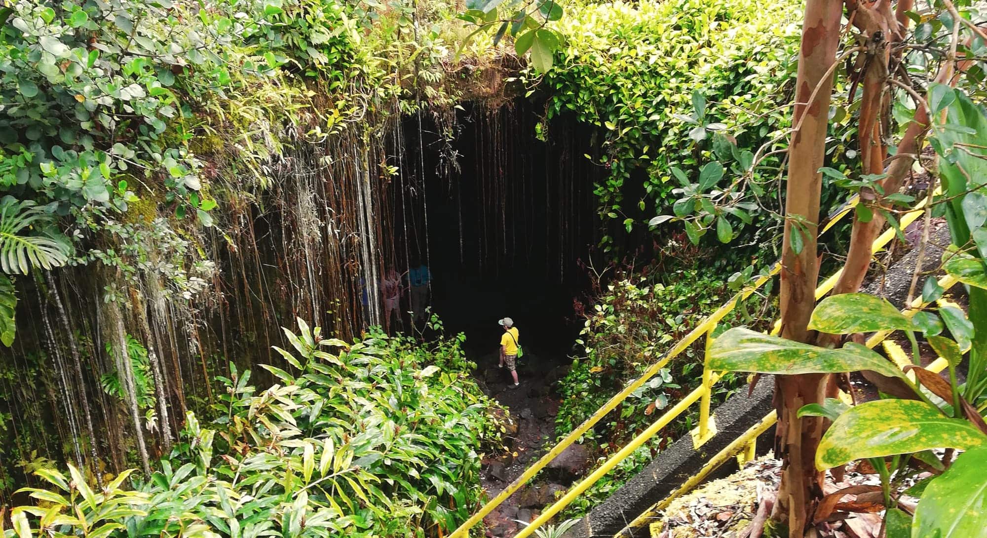
Climb down a steep ladder to get to the lava tube entrance of the Kaumana Caves
Combine with: Rainbow Falls, about 15 minutes toward downtown Hilo, as a second stop on the way back into town. Thurston Lava Tube in Hawaiʻi Volcanoes National Park is the other accessible lava tube on the island, lit and paved where Kaumana is neither.
Kahuku
The Kahuku Unit of Hawaiʻi Volcanoes National Park sits in the southeast corner of the Big Island, separate from the main area of the park. It’s small in comparison. A couple of trails wind through grassy pastures and old cinder cones, with long views east and southeast.
Good to know: Kahuku is open Thursday through Sunday, 8 a.m. to 4 p.m. only. Turn in near the 70.5-mile marker on Highway 11 in Kaʻū. This part of the Park is for hiking, not lava viewing. Bring your own water: there’s none at the unit, and little else in the way of services. Check all the trail options here.
Combine with: Punaluʻu Black Sand Beach, about 20 minutes north on Route 11. Both are on the same road and easy to sequence on a southeastern loop day.
Kehena Black Sand Beach
Kehena Black Sand Beach is the counterculture beach of the Puna District. Drum circles and yoga groups turn up here regularly, and the beach is entirely clothing optional.
Good to Know: The nearby town of Pāhoa was almost destroyed by an eruption in 2014. Swing through town to see where the lava stopped (behind the school), and walk downtown for the shops and restaurants.
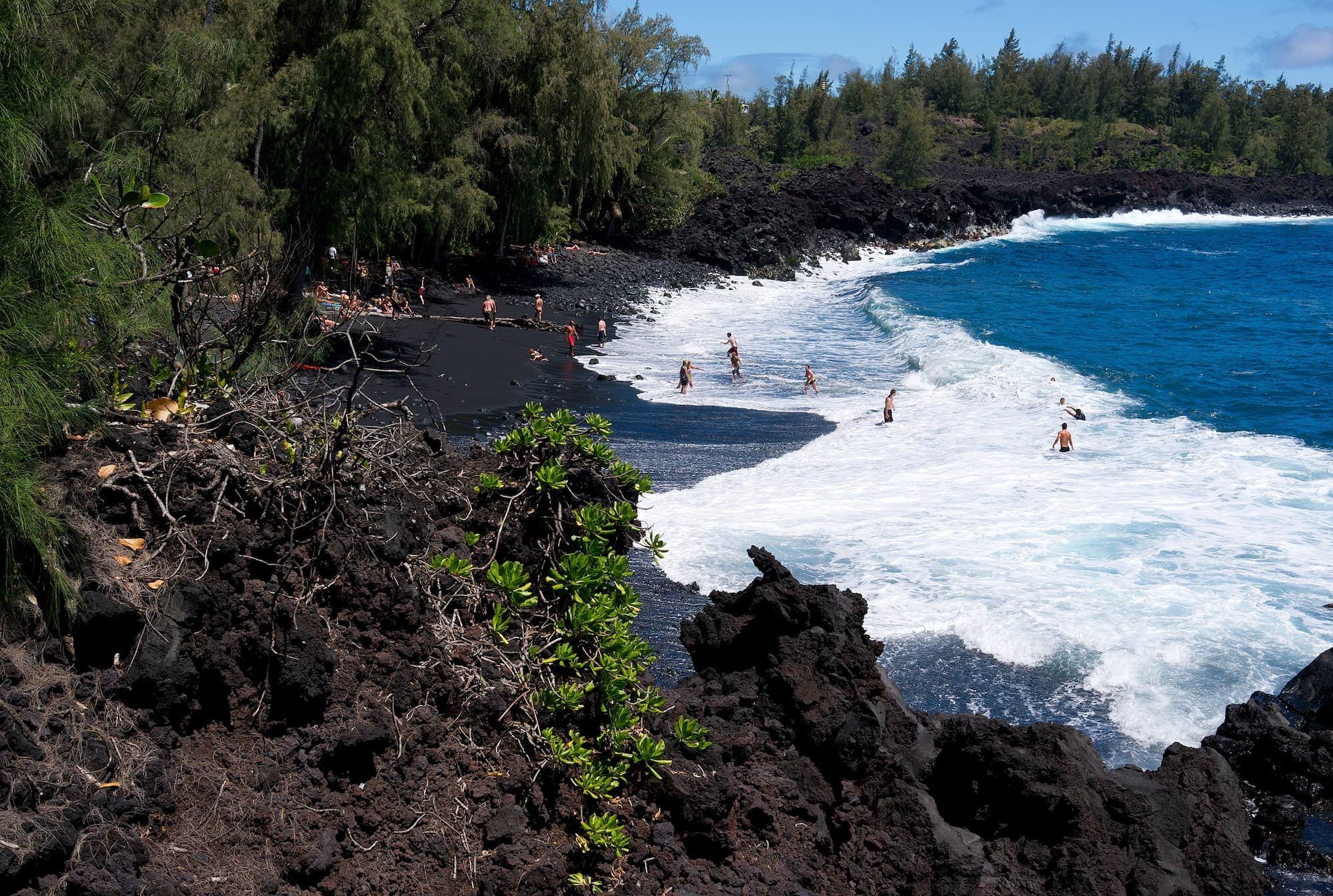
Kehena Beach is a narrow black sand beach on the east shore of the island of Hawaiʻi, in the Puna district. Image by Frank Schulenburg, CC BY-SA 3.0, via Wikimedia Commons
Combine with: A stop through Pāhoa town, about 10 minutes north, to see where the 2014 lava stopped behind the school and to find food before or after the beach. Lava Tree State Monument is another nearby Puna stop worth 20 minutes on the way back.
King’s Trail (The Ala Kahakai National Historic Trail)
The King’s Trail was the main travel corridor around the island in ancient Hawaiʻi, the coastal highway of its day. Today the National Park Service protects it as the Ala Kahakai National Historic Trail, a 175-mile corridor and network of trail sections rather than one continuous path, and individual stretches are still being reopened.
One of the most accessible places to walk it is at ʻAnaehoʻomalu Bay. From Queen’s Marketplace, you can hike the King’s Trail in either direction. The trail runs out into open lava field with no shade at any point. Bring sun protection and plenty of water. Have a bathing suit handy for a dip in the bay afterwards.
Good to Know: Also nearby is Petroglyph Park, a resting area for travelers in old times. Here, you can see the drawings they made.
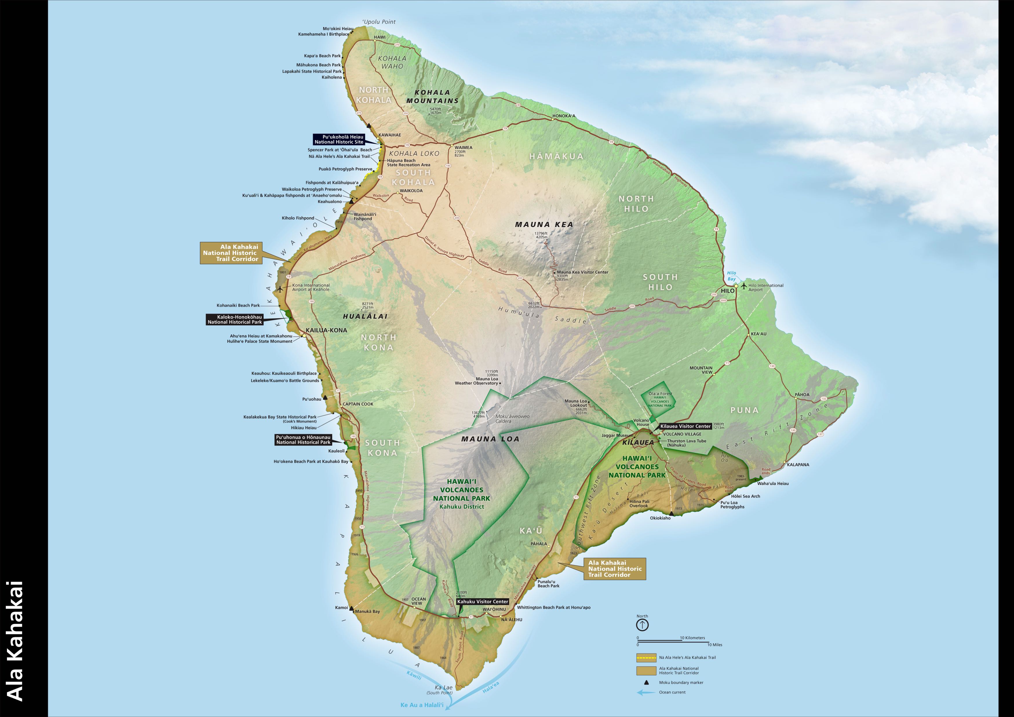
Ala Kahakai National Historic Trail is a 175-mile corridor and trail network. It traverses through hundreds of ancient Hawaiian settlement sites and over 200 ahupuaʻa (traditional land divisions). Image source: NPS
Combine with: Petroglyph Park, which sits directly alongside the King’s Trail section at ʻAnaehoʻomalu Bay. Puʻukoholā Heiau is about 20 minutes north for those continuing up the coast.
Lists of best places to see on the other islands
Are you also visiting other islands?
If so, have a look at our other “favorite sights and destinations” guides for Kauaʻi, Oʻahu, and Maui. These guides use the same format as this one (a few favorites in each of the following categories: most visited, kid-friendly, hidden gems, scenic, outdoors, and history & culture) and are a good introduction to where to go on those islands.
See the Big Island on a Budget
Hawaiʻi is expensive. Flights and accommodations are among the priciest in the country, and food, rental cars, lūʻaus, excursions, and tours pile on from there.
A lot of what people come here for costs nothing. Beaches, hikes, ocean access, picnic spots, and several of the historical sites on this list are free or close to it.