
Pohoiki black sand beach did not exist before 2018. When Kīlauea’s lower East Rift Zone eruption poured lava into the ocean nearby, the waves ground that fresh rock into black sand and piled it into the bay in a matter of weeks. It is the youngest black sand beach on the Big Island, at Isaac Hale Beach Park in lower Puna, at the end of Highway 137 past Kaimū.
This is not a swimming beach. A dangerous shore break and strong currents run along the sand, and a lifeguard tower overlooks it. The same eruption left several warm ocean ponds at the park and cut off the boat ramp, which a 2025 dredging project reopened for 1 day.
Table of contents
- The Isaac Hale Beach Park
- Directions to Pohoiki Beach and the beach park
- About Pohoiki Black Sand Beach
- The uncertain future of Pohoiki beach
- History: how the 2018 eruption created Pohoiki beach
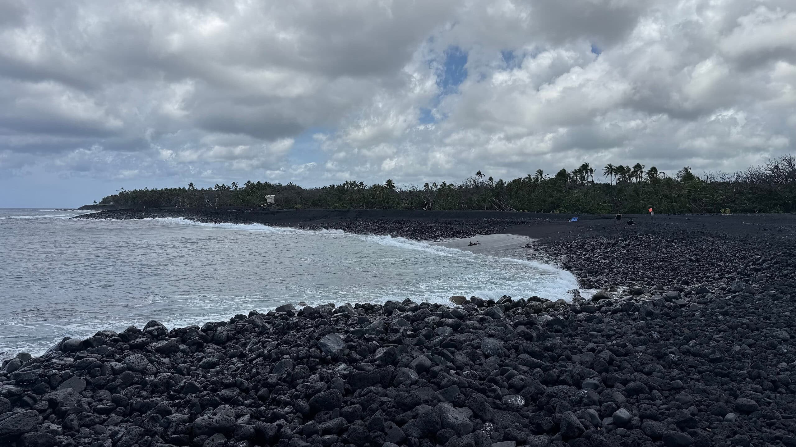
Lava boulders line the water’s edge at Pohoiki, making it hard to enter the ocean even on calm days. The sand is coarse and the waterline rocky because the beach is only a few years old. Shore break and strong currents run along it.
Isaac Kepoʻokalani Hale Beach Park
Isaac Hale is a county beach park with no drinking water and only portable toilets. Please kōkua (help, assist) to keep the park safe and clean for your ʻohana (family) and everyone else.
- Park hours are 7:00 a.m. to 8:00 p.m. daily.
- There is no drinking water in the park, so bring plenty when you visit.
- There are portable toilets available.
- A lifeguard tower overlooks the beach
- The lava flow created several natural ocean thermal ponds. The ponds are not disinfected. Stay out if you have an open wound; the Department of Health warns of bacterial infections. Enter these ponds at your own risk.
- There is a dangerous shore break on the new black sand beach and dangerous ocean currents which could cause injury. Enter the ocean at your own risk.
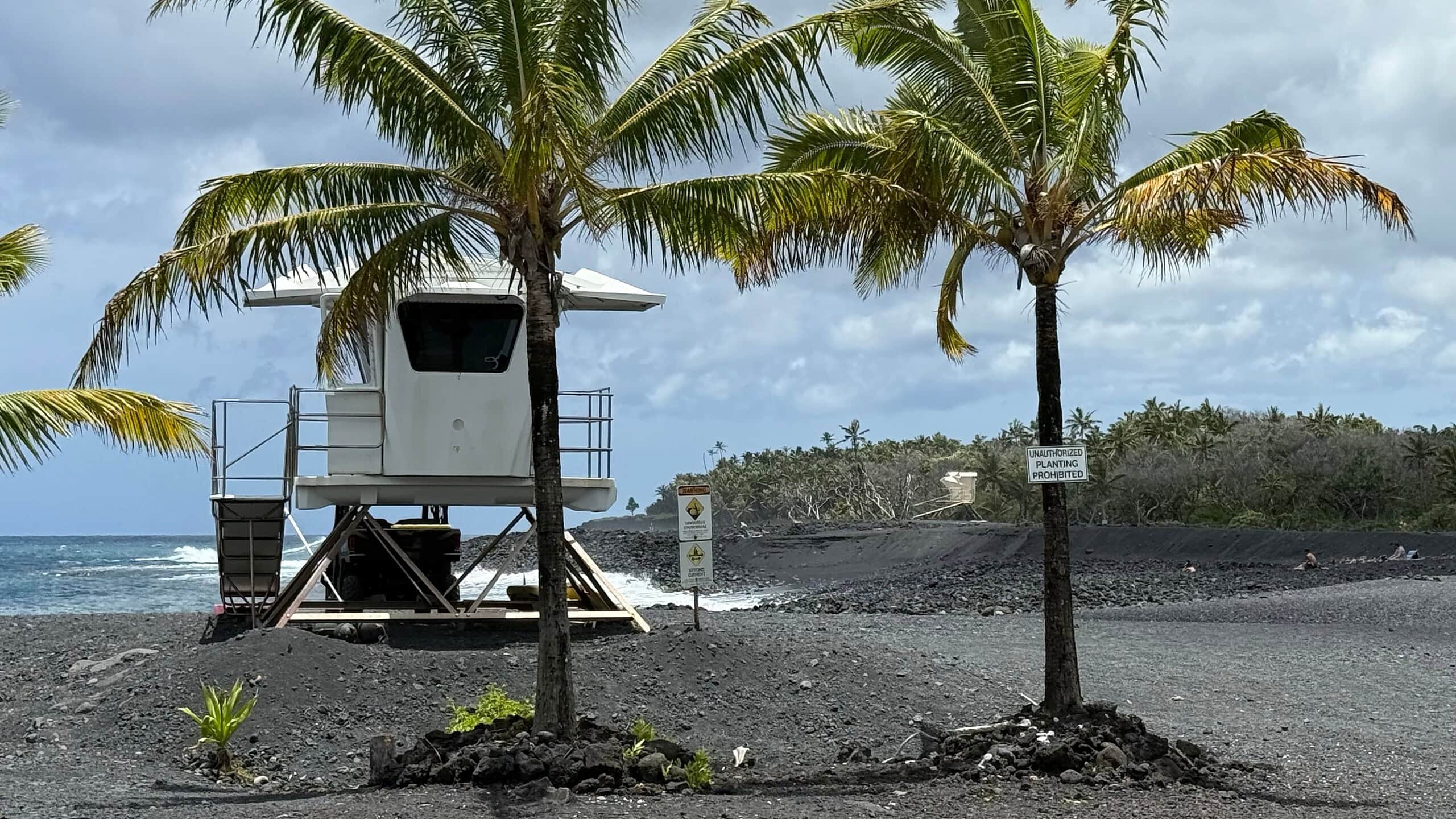
The lifeguard tower at Isaac Hale Beach Park overlooks Pohoiki black sand beach. The beach is not safe for swimming: the shore break and the currents are both strong. Lifeguard is on duty during park hours, 7 a.m. to 8 p.m.
Directions to Pohoiki (Isaac Hale Beach Park)
Pohoiki Beach sits at the intersection of Pohoiki Road and the scenic Kapoho-Kalapana Road (Route 137) in the Puna district of Hawaiʻi Island. These roads were overrun by lava, but by November 2018 a new road between MacKenzie State Park and Pohoiki was cleared.
The simplest route from Pāhoa is to follow Hwy 130 to its end, then turn left onto Hwy 137, which now ends at Pohoiki. The drive takes you past Kaimū Beach Park and along one of our favorite scenic drives.
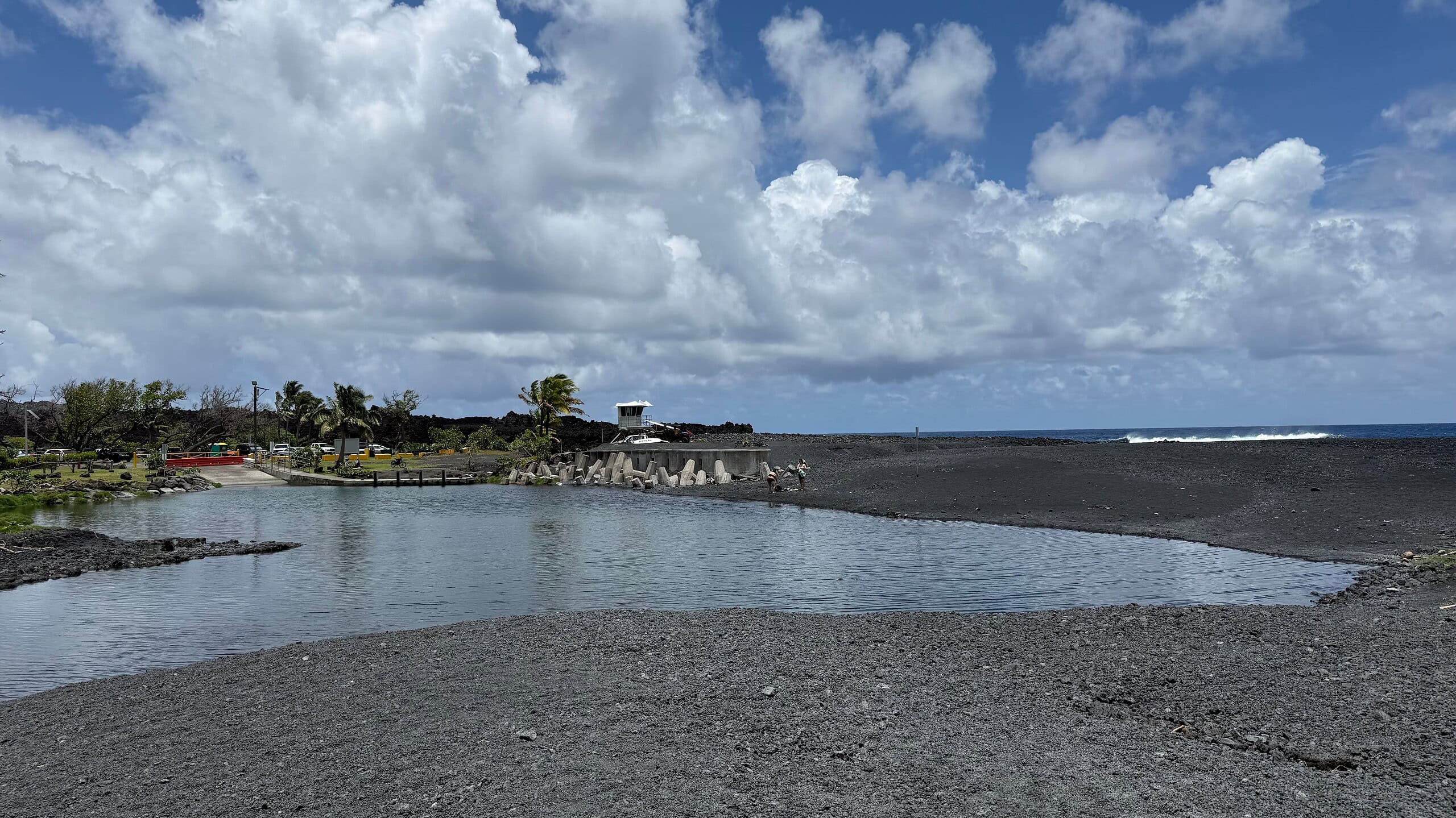
Looking back from the black sand at Isaac Hale Beach Park: the lifeguard tower, the warm ocean thermal pond near the boat ramp, and the parking area are all visible. The solidified lava along the coastline marks the edge of the 2018 Kīlauea flow that created this beach.
Pohoiki black sand beach
Pohoiki, officially Isaac Hale Beach Park, is a varied stretch of coast in the Puna district: a recreation area, several warm ocean thermal ponds, the young black sand beach, and a boat ramp that is the only ocean access in the district.
Pohoiki bay was almost filled with lava, but the flow stopped 230 ft (70 m) from the harbor. The surf breaks Bowls, Shacks, and Dead Trees are gone, buried along with part of the park.
The boat ramp and most of the park survived, and in the months after the eruption black sand piled into the bay to form the beach that is there today.
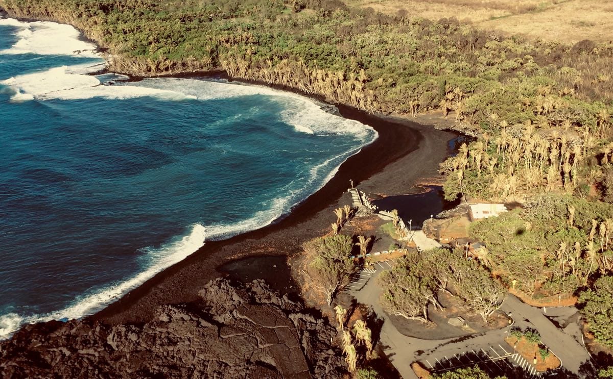
On this aerial image from August 31, 2018 you can see a new black sand beach of lava fragments forming in front of the Pohoiki Boat Ramp. Image credit: USGS
The beach started out steep and coarse, and the waves have been grinding the lava fragments finer ever since.
The uncertain future of Pohoiki black sand beach
Black sand beaches that form this fast often wash away within a few years, because no new lava is feeding them sand. Kaimū black sand beach, down the coast, has been shrinking slowly the same way.
Pohoiki is the only boat launch in the Puna district, and the fishing community lost its ocean access when the 2018 sand and lava sealed the ramp off. In 2025 the state and county dredged roughly 42,000 cubic yards of sand and rock from the ramp’s entrance channel, a $9.28 million project to reopen it. The park closed for the work on September 2, 2025 and reopened on November 12, 2025. It then took less than 1 day for the ocean currents to close off the harbor again.
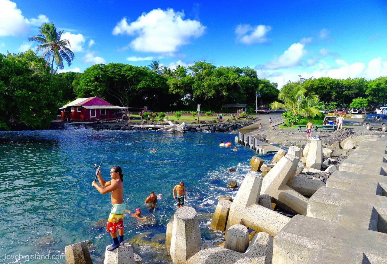
Before the 2018 eruption people surfed and swam off the Pohoiki pier and boat ramp.
History: how the 2018 eruption created Pohoiki beach
Between early May and early August 2018, surface lava flows from the Lower East Rift Zone (LERZ) eruption destroyed more than 700 houses and buried some of the most loved spots in Puna: the Kapoho Tide Pools and the Ahalanui Hot Ponds.
Isaac Hale (Pohoiki) beach park came within 230 ft of being buried but survived. This video (on Instagram) shows what Pohoiki looked like when the 2018 eruption was just starting. All the coastline in the second part of the video below (beyond the pier) has since disappeared under lava.
At the end of the eruption, 13.7 square miles of the Big Island were covered by new lava, and more than 1.3 square miles of new land was created. The eruption also created new land and new black sand:
Land, for example: lava flowing into the ocean built 875 acres (3.5 km^2) of new delta. Some of this delta may collapse into the ocean again, but the Big Island will probably have grown by about one square mile.
Black sand also formed in bulk. When hot lava hits the ocean it solidifies fast and shatters into small fragments, which the waves then grind into fine black sand. Every grain of black sand on Hawaiʻi’s beaches was once red-hot lava.
This black sand washed, and still washes, along the nearby coast, building several new black sand beaches. One of them formed in front of the Pohoiki boat launch: (new) Pohoiki black sand beach.
In October 2018, just months after it formed, the new beach looked like this:
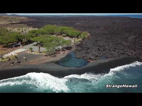
(Video credit: StrangeHawaii). Check out the first 7 minutes of this video to see what the hike to Pohoiki from MacKenzie State Park is like.