Waimea is paniolo country: the Big Island’s cowboy town, built around Parker Ranch. It sits above 2,500 feet on Kohala, the oldest of the island’s five volcanoes, where the air runs cooler than the coast and low cloud drifts over green cattle pastures. People come for the ranch-town setting and the farmers markets and restaurants. The climate is closer to the Scottish highlands than a tropical beach.
It works as a cooler base than Kona. Waipiʻo Valley and the Kohala coast are both within reach, and the town has some of the island’s best bed and breakfasts.
Table of contents
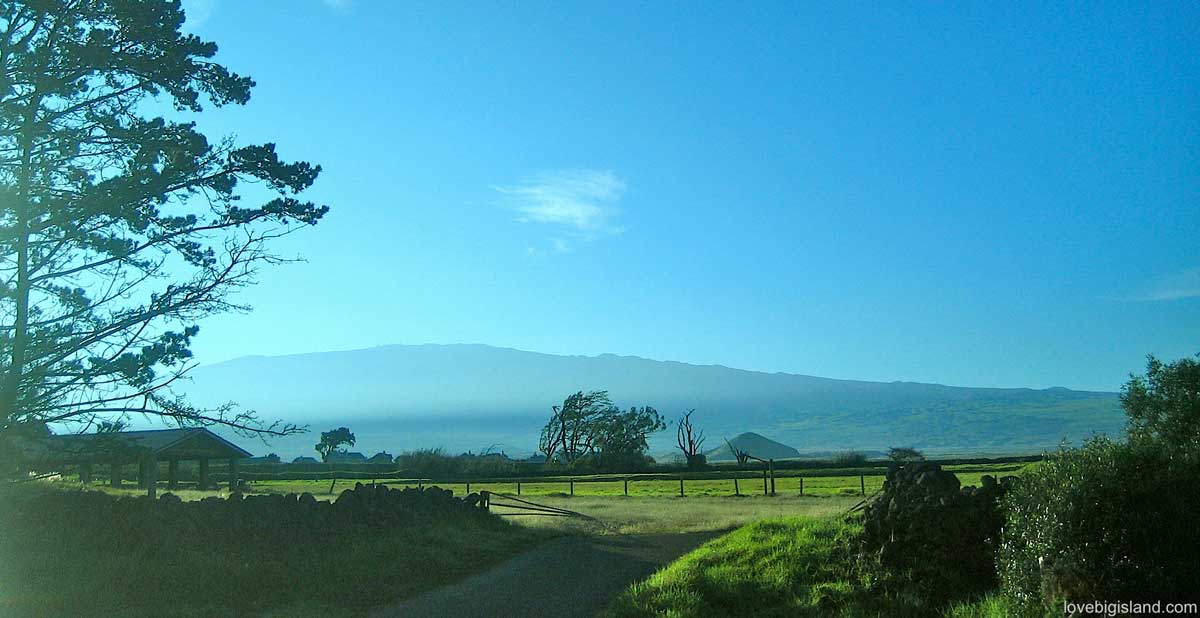
Waimea is yet another face of the Big Island, and often reminds us of the Scottish highlands
Until recently, Waimea was a company town, its life largely set by the Parker Ranch. At 130,000 acres, the Parker Ranch is one of the biggest cattle ranches in the United States, and a strong ranch-town atmosphere still runs through Waimea. You can sample it in the restaurants and cowboy outfitters around town, and in the gift shops.
Activities in Waimea
Waimea is best known for its cowboy heritage and the rodeo, but there is more to do here than ranch culture. Nearby Waipiʻo Valley is one of the most scenic spots on the island, but since February 2022 a county emergency rule has barred all pedestrians from the road down, so the overlook is as close as you can get. Horseback riding is another natural fit, as half of all the island’s horseback riding tours are based here.
Read more about activities in and around Waimea.
Farmers Markets in Waimea
Waimea has a couple of farmers markets worth a stop for fresh local produce and a good breakfast. Market days are Wednesday and Saturday. You can find more information on Waimea’s farmers markets here.
Accommodations in Waimea
Waimea has only a few hotels and vacation rentals, but it is home to some of the best bed and breakfasts on the Big Island. Find out more in our guide to accommodations in Waimea.
Directions to Waimea
Waimea sits in south Kohala, a short drive up from Kailua-Kona or a ride on the hele-on bus. By car, Kona is 40 miles (about 1 hr 10 min), Hilo 56 miles (1 hr 20 min), and Volcano Village 85 miles (2 hr 10 min).
The weather in Waimea
Waimea’s weather is the main reason it feels unlike the rest of the island: cooler, cloudier, and wetter than the Kona coast just down the hill. For the monthly averages of temperature, sunshine hours, cloudy days, and rainfall, see our monthly average weather for Waimea.
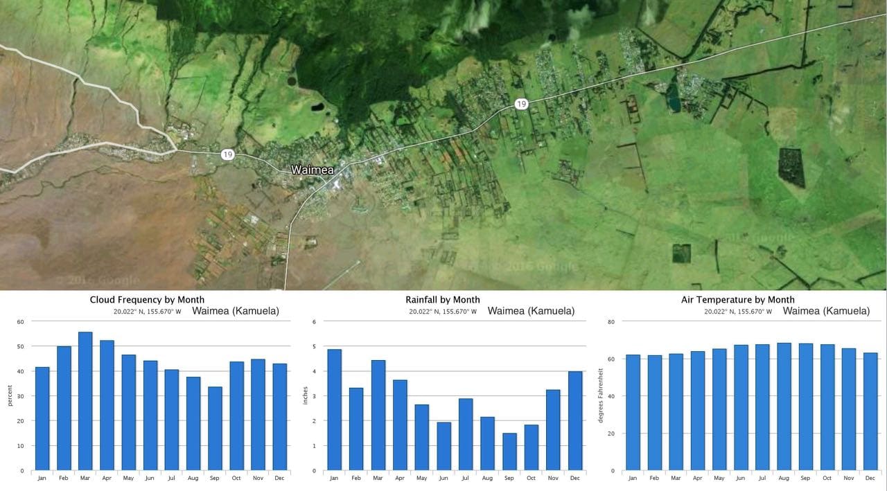
Average monthly cloud frequency, rainfall and temperature for Waimea on the Big Island of Hawaiʻi
For current conditions and the forecast, have a look at the NOAA forecast.
Interactive Map of Waimea
We have added what we think are the most important stops and activities in and around Waimea on an interactive map. Click any icon to find more information about that local activity, shop, or hotel/vacation rental.
Are you looking for the map of another part of the Big Island? We also have interactive maps of:
Why is Waimea sometimes called Kamuela?
Three places in Hawaiʻi share the name Waimea: a valley on Oʻahu, a village on Kauaʻi, plus this town on the Big Island. To cut the confusion, a naming committee chose a second name for the Big Island town, honoring the Parker family, who owned much of the land around Waimea and played a big part in Hawaiian history. “Kamuela” is the Hawaiian form of “Samuel”. Samuel Parker (1853 to 1920) was three-quarters native Hawaiian and played a large role in Hawaiian politics during the islands’ assimilation into the United States.
Waimea is still the official name of the town, and on road signs and in conversation with locals, Waimea is all you will see or hear. You really only need “Kamuela” for a mailing address or when searching for the town online.
Read more about the history of the Waimea/Kamuela naming confusion in this blog post on the naming history.
More than one Waimea in Hawaiʻi
Hawaiʻi has more than one Waimea. One is a town on Kauaʻi, right next to the famous Waimea Canyon. Waimea Bay, the big-wave surf break, is on Oʻahu. The Waimea in this guide is the one on Hawaiʻi Island, the Big Island.