Mauna Loa erupted for two weeks, from November 27 to December 10, 2022. It was the volcano’s first eruption since 1984, a 38-year gap, and it stayed confined to the uninhabited northeast flank the entire time: no threat to any community, no evacuation order. That eruption is history now. This page documents it and is not updated in real time.
Mauna Loa is the largest active volcano on Earth and covers half of the Big Island. It has erupted 34 times since 1843, with gaps ranging from months to decades. As of USGS’s most recent update (July 2026), the volcano sits at the lowest alert level, Normal/Green, with all monitored activity within background range. An FAQ below covers whether it’s still dangerous and what it means for your trip.
Table of contents
- Mauna Loa Q&A + Official Resources
- Mauna Loa Eruption Updates
- Mauna Loa Eruption Images
- Mauna Loa History
- Why did people suddenly start talking about Mauna Loa?
- Map of previous Mauna Loa eruptions
- The 1984 eruption of Mauna Loa (almost covering Hilo)
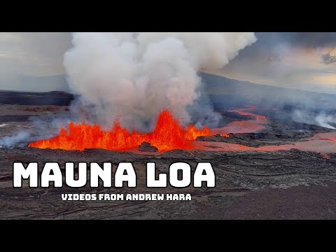
But first: a teaser! This following compilation was made by 4 parties heavily involved with the reporting of the recent 2018 LERZ eruption. It consists of material provided by Andrew Hara, edited by Dane DuPont, with music by Ikaika Marzo, and with special thanks to Paradise Helicopters.
Questions and Answers: Mauna Loa
To get you started, here are some questions and answers about the 2022 eruption that often come up:
Q: Is Mauna Loa erupting now?
Mauna Loa is no longer erupting. Lava supply to the fissure 3 vent on the Northeast Rift Zone ceased on December 10 and sulfur dioxide emissions have decreased to near pre-eruption background levels. You can read more about the recent eruption here.
Q: Should travel plans to the Hawaiian Islands be postponed or cancelled?
The eruption is over and there is no need to change travel plans to any of the Hawaiian Islands at this time.
Q: Is this eruption a danger to people on Hawaiʻi Island?
All lava that exited Mauna Loa’s summit was restricted to the unpopulated upper northeast flank. The northeast flank is not populated and does not pose a threat to any communities at this time.
To help you get up to speed on Mauna Loa, we recommend reading the Mauna Loa FAQ published by the USGS. Topics include the current status of the volcano, how the Volcano Alert Level is determined, the hazards and consequences of an eruption, what the name Mauna Loa means, and what scientists are doing to predict the next eruption.
Eruption resources
The following official resources are worth keeping an eye on for any future activity:
- Mauna Loa webcams
- Hawaiʻi Volcanoes National Park (eruption viewing page)
- USGS Mauna Loa updates
- Hawaiʻi Emergency Management Agency
- Active Civil Defense Alerts
- Hawaiʻi PODD videos and live streams.
- Our own lava viewing guide
- Mauna Loa FAQs
- Hawaiʻi Vog information dashboard
- County of Hawaiʻi lava viewing resources
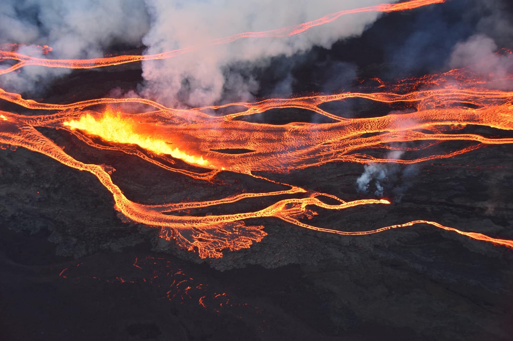
Aerial photo of the Mauna Loa eruption showing a line of fissure vents erupting above 10,000 ft elevation on the Northeast Rift Zone. Image courtesy of Civil Air Patrol.
Eruption map
Another good resource is the following eruption map which is frequently updated by a local citizen. You can use the toggles on the map to see historical flows (a good predictor for a future direction the flow might take), pictures, and more.
The Latest Mauna Loa Activity Updates
We list the most up-to-date official updates from the Hawaiʻi County Civil Defense Agency and the USGS below.
USGS Eruption Updates
During the eruption, the USGS provided daily updates. For the current status, see the USGS website directly.
USGS’s final eruption update (December 13, 2022, 07:17 AM HST)
Mauna Loa stopped erupting on December 10. Lava supply to the fissure 3 vent on the Northeast Rift Zone ceased that day and sulfur dioxide emissions decreased to near pre-eruption background levels; volcanic tremor and earthquakes associated with the eruption were greatly diminished.
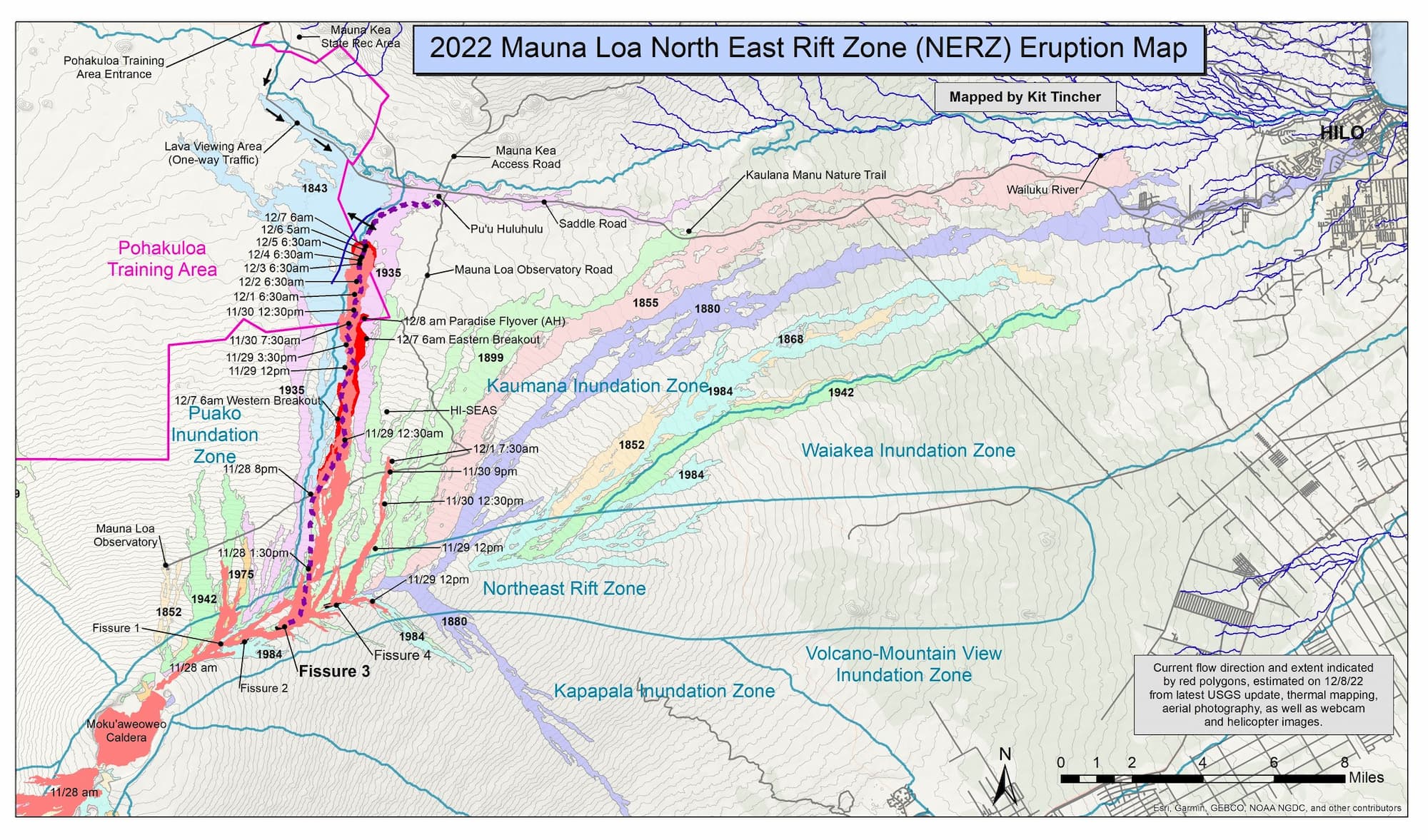
December 8 eruption map showing the 2022 Mauna Loa lava flows overlayed on historic eruptions. Image credit: Kit Tincher.
Images of the November 27, 2022, summit eruption of Mauna Loa
For the first time in 38 years, Mauna Loa started erupting.
Just before midnight at approximately 11:30 p.m. HST on November 27, an eruption began in Mokuʻāweoweo, the summit caldera of Mauna Loa, inside Hawaiʻi Volcanoes National Park.
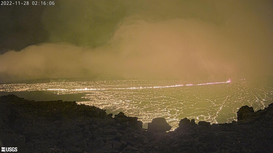
Webcam image of the Mauna Loa summit caldera from when the eruption was just a few hours old, with lava already covering a wide area.
In the early morning the USGS made a first helicopter overfly and already saw large rivers of lava flow down the slopes:
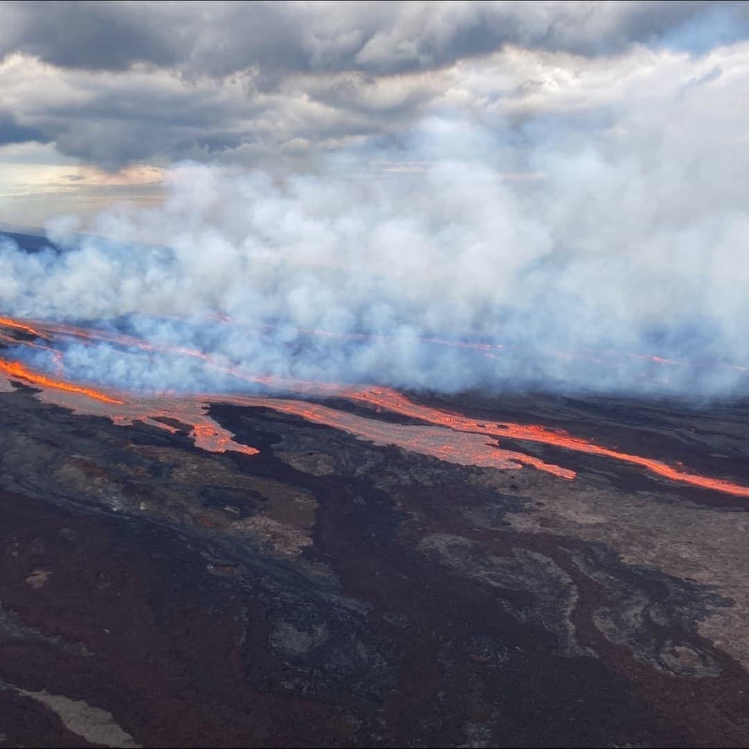
USGS Hawaiian Volcano Observatory confirmed that lava has erupted out of the NE Rift Zone and is flowing in the direction of the Daniel K. Inouye Highway (Saddle Road). Image credit: USGS
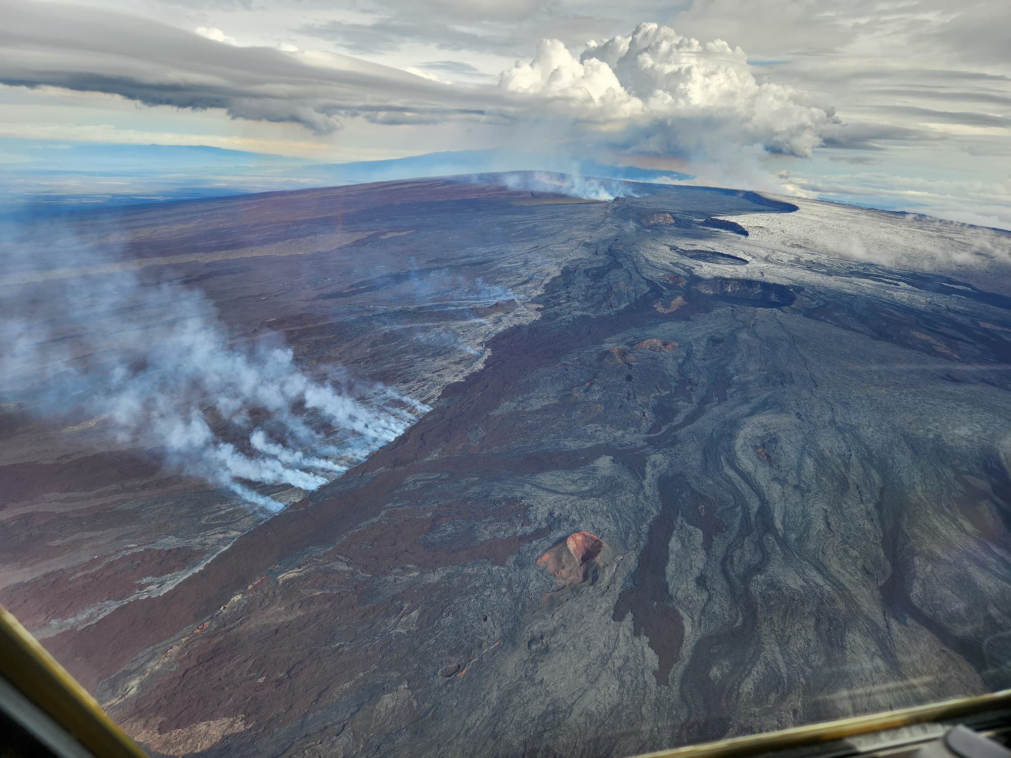
Aerial view of Mauna Loa summit with Lua Hou in the foreground followed by Lua Hohonu, South Pit, and Mokuʻāweoweo summit caldera. A small dusting of snow covers the ground east of the summit. The steaming fissure was active during the beginning of the eruption, but this morning the lava in the summit caldera had already cooled to a black color. The white plume in the background is rising from the fissures in the Northeast Rift Zone. USGS photo J. Schmith
Private companies also made their way up there to capture impressive views of lava fountains.
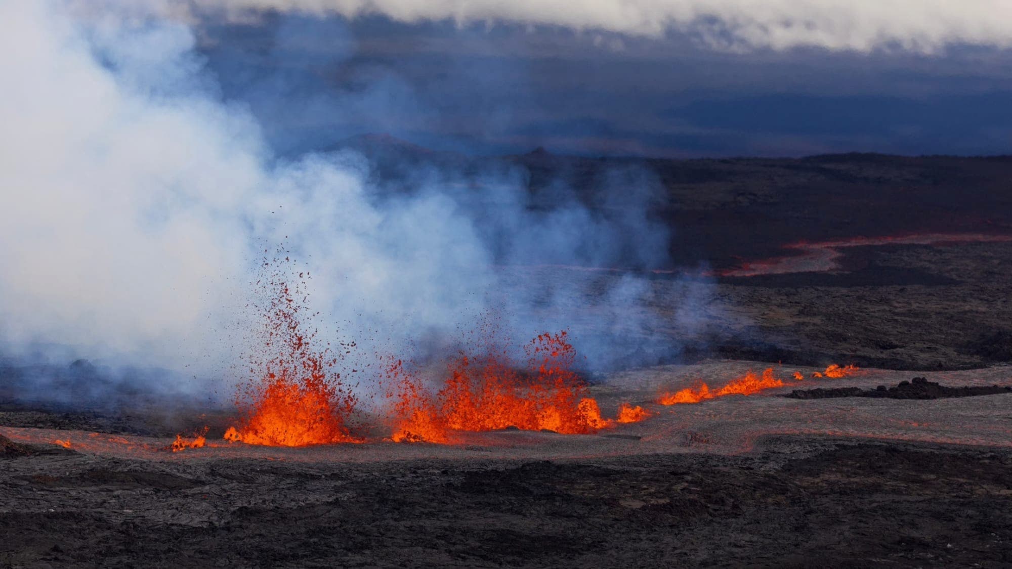
Lava fountaining out of fissures in the Mauna Loa summit crater. Image: Paradise Helicopters.
By early November 29th you could already see large rivers of lava from Saddle Road
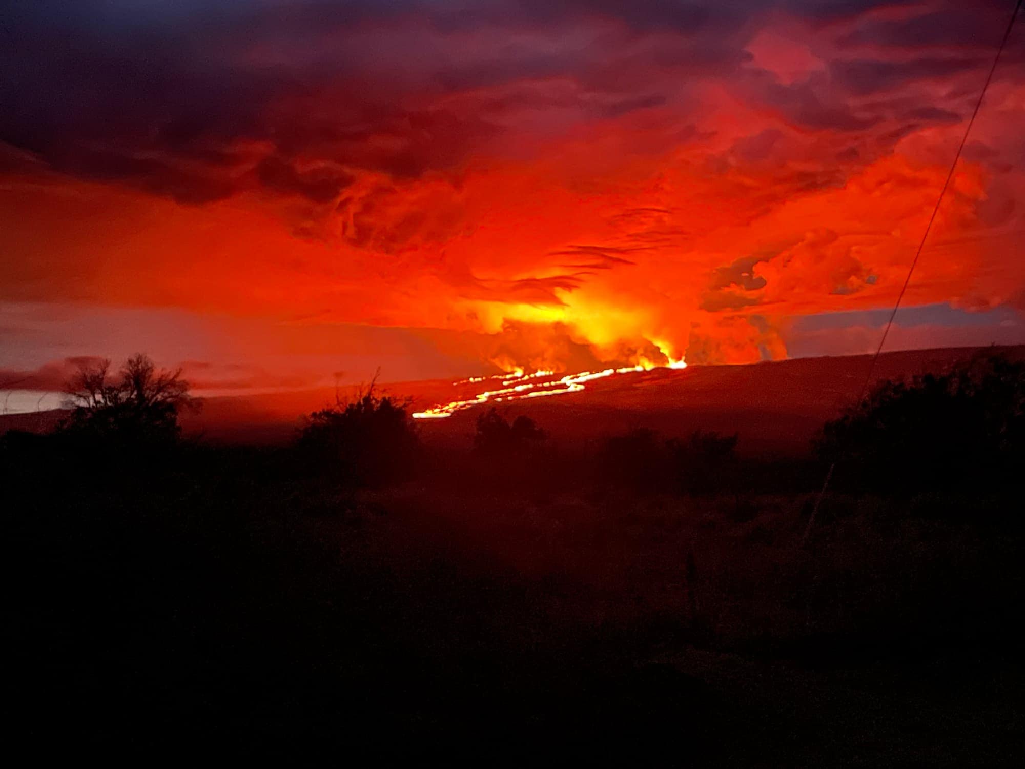
Photograph taken from Saddle Road at 6AM Hawaiʻi time on November 29, 2022 shows lava flows moving northeast downslope of Mauna Loa volcano from the Northeast Rift Zone eruption.
There are a few spots in the Hawaiʻi Volcanoes National Park from where you could see the glow from two erupting volcanoes at the same time.
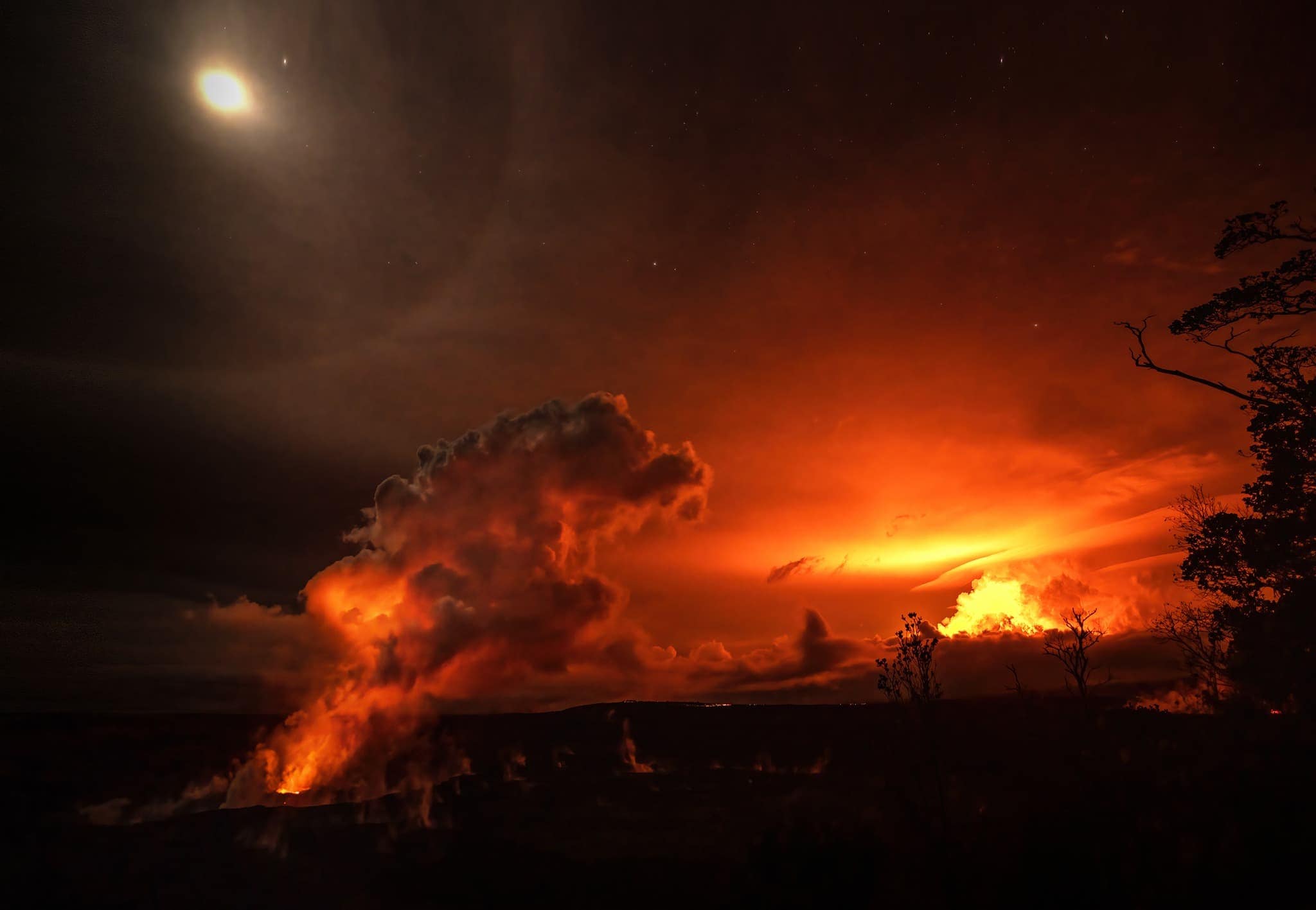
Mauna Loa and Kīlauea glowed together in the dark, a rare dual eruption inside Hawaiʻi Volcanoes National Park. NPS Photo/Janice Wei
The timelapse below was made by Matthew Wahl on 11/30/22 starting just after sunset. You can get similar views from the southern slopes of Mauna Kea.
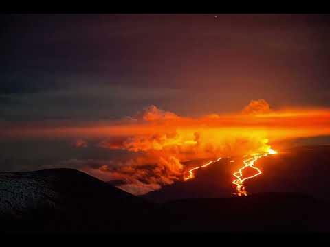
As of December 9, activity at the F3 vent had significantly reduced, with low lava fountains feeding lava flows that extended only 1.65 mi (2.65 km) from the vent in a northeast direction. The channels below this point appeared drained of lava and no longer fed the main flow front. The eruption ended entirely the next day, December 10.
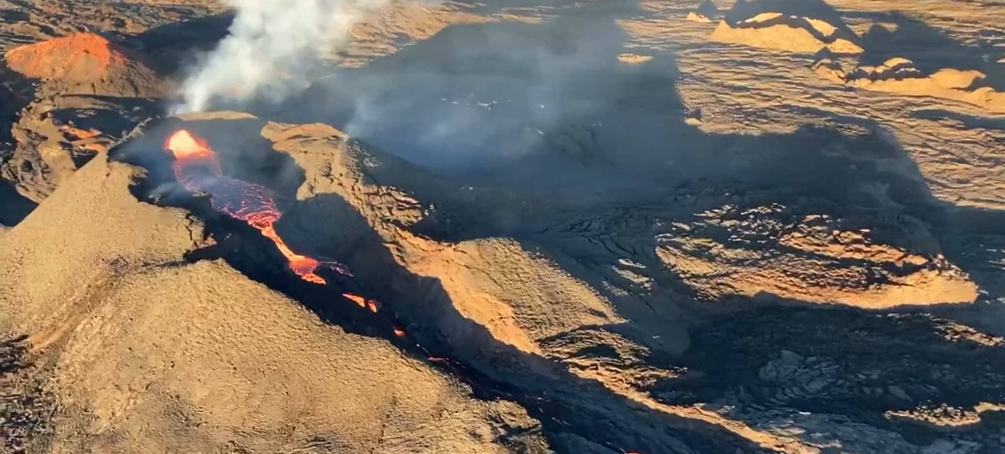
Aerial view of fissure 3 erupting on the Northeast Rift Zone of Mauna Loa on December 9, 2022. The eruption continues but the vigor has greatly reduced over the past 24 hours (note the almost empty lava channel). USGS image by M. Patrick.
Mauna Loa Eruption History
Why did people suddenly start talking about Mauna Loa?
For over a generation Mauna Loa has been all but ignored when discussing active volcanoes in Hawaiʻi. That used to make perfect sense because of the near-constant show Kilauea has been giving (see our lava viewing guide). Now, with the recent eruption of Mauna Loa, this has changed.
What got people talking is that, starting mid-September,
- Earthquake rates below the summit crater tripled (from 10–20 per day to 40–50 per day),
- Inflation recorded by GPS stations increased, and
- Inflation recorded on the Mokuʻāweoweo caldera (MOK) tiltmeter increased.
By now (late November) you can see the earthquake activity (the red line denoting the cumulative moment/energy of the earthquakes) that preceded the eruption. See the following image for the number of earthquakes per week during the past year (blue bars, December 2021 through November 2022).
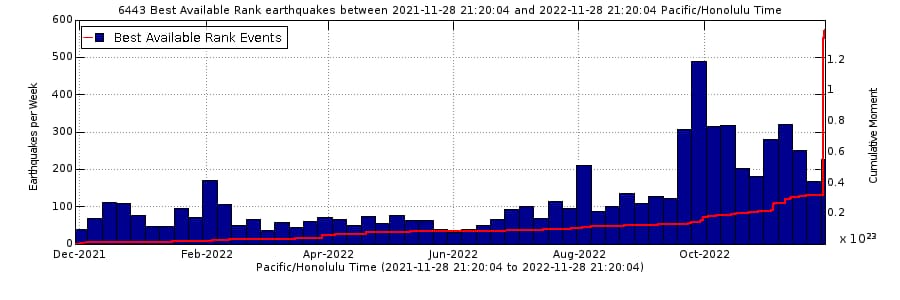
Number of earthquakes below Mauna Loa per week during the past year (blue bars). Image from the USGS website (source).
Map of Previous Mauna Loa Eruptions
Eruptions produce voluminous, fast-moving lava flows that can impact communities on the east and west sides of the Island. See the paths of the most recent (since 1843) lava flows below.
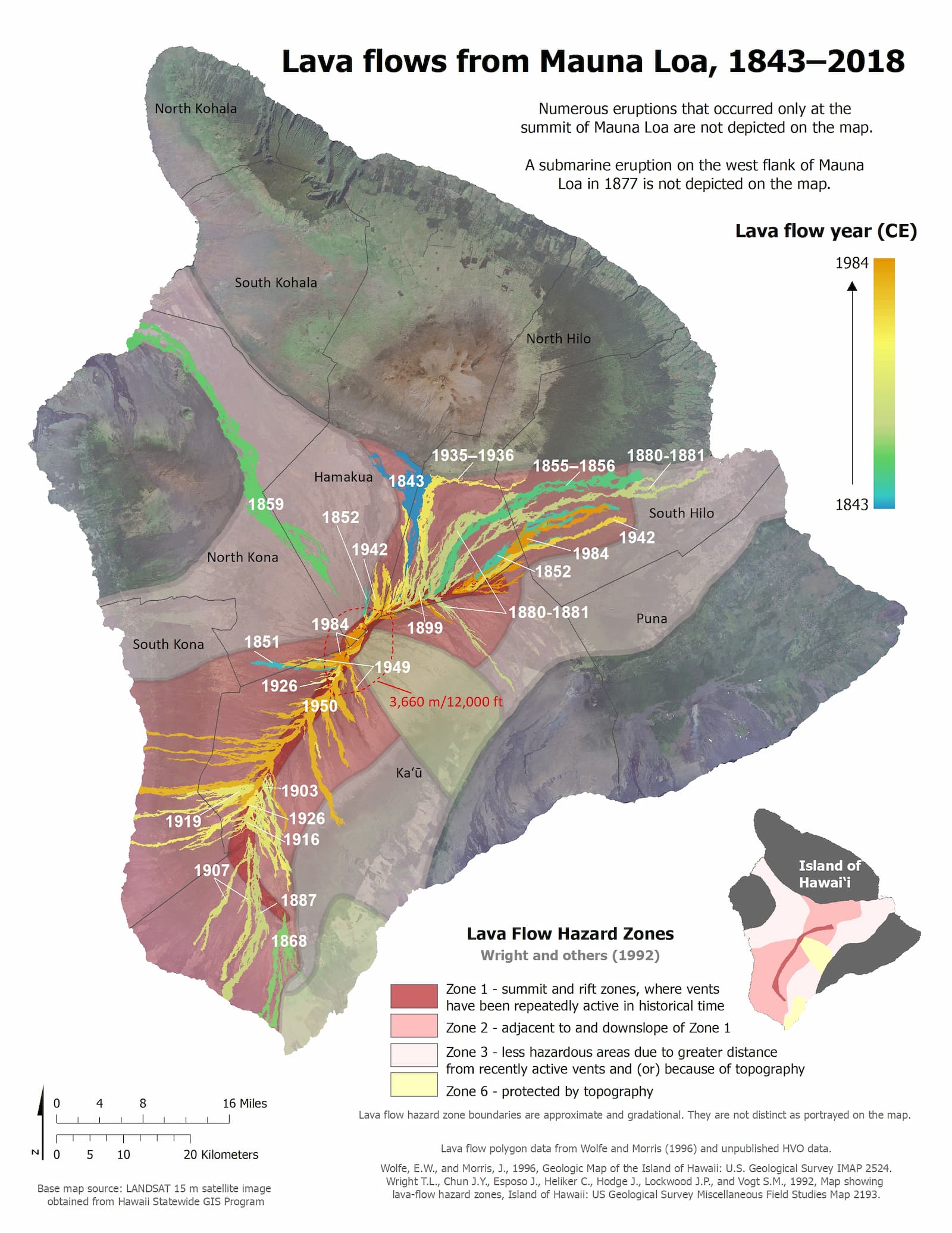
Map showing the extents of historical lava flows from Mauna Loa. Source HVO (source) – public domain.
The 1984 eruption of Mauna Loa (almost covering Hilo)
With Kīlauea dominating new cycles the past few decades, Mauna Loa’s status as an active volcano has been put firmly on the back burner. How easily we have all forgotten the eruption of 1984, when lava flows from Mauna Loa nearly wiped out Hilo.
The 1984 eruption of Mauna Loa was preceded by three years of slowly increasing earthquake activity and nine years of summit inflation. The eruption began at 1:25 a.m. on March 25, 1984, in Mokuʻāweoweo, the volcano’s summit caldera. By 5:00 p.m., the eruption had migrated down the Northeast Rift Zone, sending lava flows in a northeast direction toward Hilo.
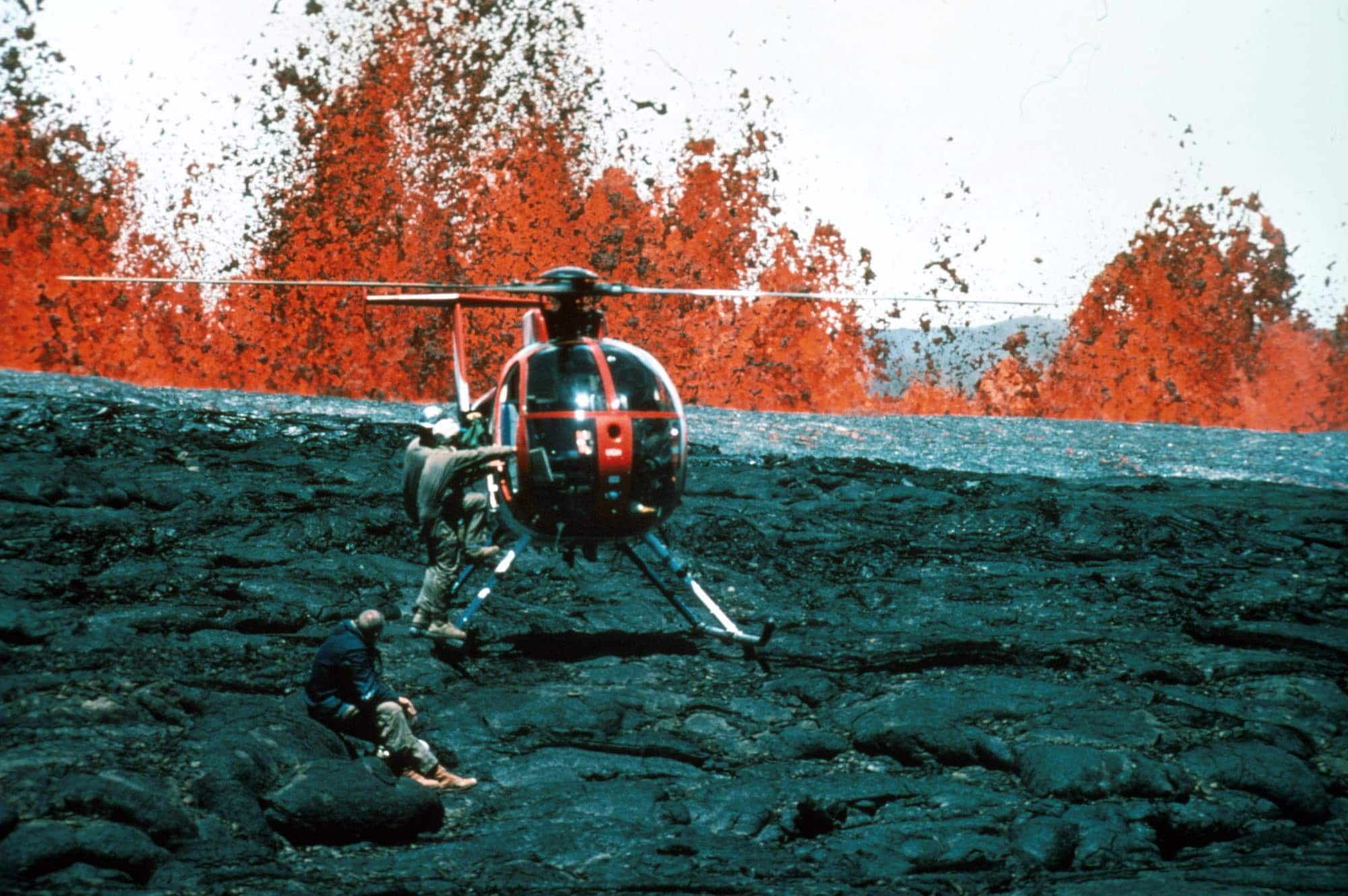
A helicopter crew near lava fountains during the Mauna Loa eruption of 1984. Image credit: USGS/RB Moore (public domain).
You can learn more about the 1984 eruption in the 4:33 minute video below: