The Hāmākua Coast is a 40-mile run of Highway 19 between Hilo and Waipiʻo Valley, where waterfalls and rainforest canyons line the road most of the way north. You see it as a full-day scenic drive, pulling off at the Pepeʻekeo detour, the botanical garden at Onomea Bay, and ʻAkaka Falls, which drops 442 feet at the end of a short rainforest trail.
This is a day for people who would rather stop a dozen times than rush one big sight. The Pepeʻekeo Scenic Drive is only 4 miles and adds about half an hour, so it earns the turn off the highway even on a tight schedule. Save Waipiʻo Valley for last: the access road is now closed to the general public, so confirm what is open before you build a plan around the drive down.
Our favorite three highlights of the Hāmākua Coast are:
Table of contents
- The Pepeʻekeo scenic drive
- The tropical and lush Botanical gardens + waterfalls
- The steep cliffs and black sand beach of Waipiʻo Valley
Table of Contents
- The Pepeʻekeo scenic drive
- The tropical and lush Botanical gardens + waterfalls
- The steep cliffs and black sand beach of Waipiʻo Valley
The Hāmākua Coast is one long scenic drive, with the Pepeʻekeo Scenic Drive as the highlight.
Good to know: you can explore everything listed on this page on a day-long scenic drive. To make the most of your day we suggest you use a GPS guide such as the North Island Jungle Adventure Loop from Shaka Guides.
Pepeʻekeo Scenic Drive
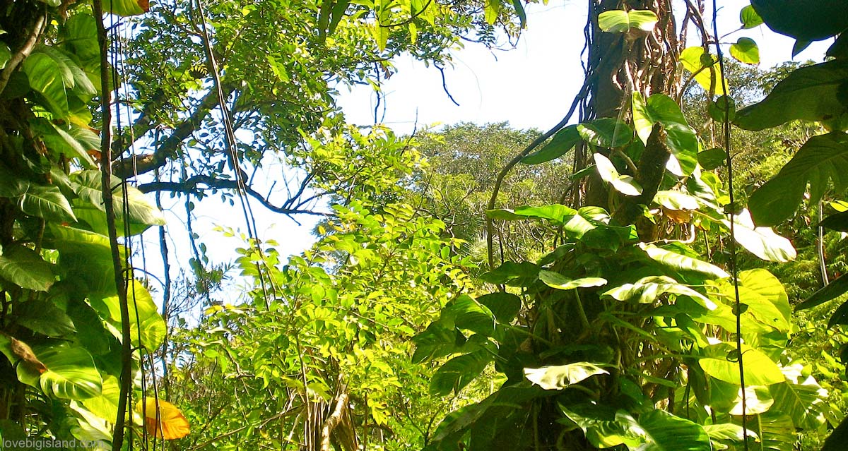
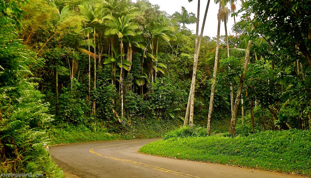
Start the day on the Pepeʻekeo Scenic Drive, a 4-mile detour off Highway 19 a few minutes north of Hilo (see our other scenic drives on the Big Island). It is signed as the “old road through old Hawaiʻi,” and it earns the name: the lane runs through former cane fields, ducks under jungle canopy, and crosses creeks below small waterfalls, all at a pace that takes about half an hour. Rain or shine, it is the easiest way to trade the highway for rainforest without adding much to your day.
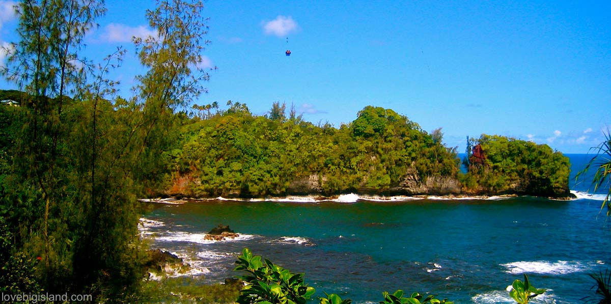
The view over Onomea Bay and the collapsed sea arch as seen from the Onomea scenic drive
Pepeʻekeo scenic drive. Slow down and take in the views.
The Best Scenic Drives on the Big Island of Hawaiʻi
A coastal road through Puna, a lava-flow dead end in the park, and a 12-mile coffee country loop: five scenic drives on the Big Island worth your time.
Gardens and Waterfalls
The Hawaiʻi Tropical Bioreserve & Garden sits at Onomea Bay, about 8.5 miles north of Hilo right off the Pepeʻekeo Scenic Drive. Its rainforest trails wind past streams and waterfalls through more than 2,500 plant species packed into a 20-acre valley. The loop drops toward the shoreline and climbs back, so it is more walk than stroll.
There are, by the way, more botanical gardens on the Hāmākua Coast.
A little farther north, the ʻAkaka Falls are the most famous waterfall in Hawaiʻi. A short paved trail off the main road reaches them through rainforest thick with giant ferns, ginger, and bamboo groves.
If you want more than one waterfall, see our 5 favorite waterfalls on the Big Island.
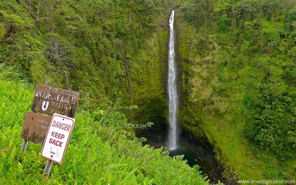
The 442 ft tall ʻAkaka Falls on the Big Island of Hawaiʻi are a pleasant stop on your way to or from Hilo
Some miles up, the multi-tiered Umauma Falls charge $10 per adult just to view them. The falls are pleasant, but the view rarely justifies the fee on its own. It comes free with their zipline, kayak, or river-swim tours, which is about the only time it is worth paying for. As you drive farther up the Hāmākua Coast, more stops worth the time include:
- The Kalōpā State Recreation Area, with an easy 0.7-mile round-trip family nature hike in a native ʻōhiʻa forest at 2,000-foot elevation [more information].
- The charmingly odd, old-fashioned former sugar town of Honokaʻa. This town is home to one of our favorite foods of the Big Island: malasadas from Tex Drive Inn. The Mauna Kea Tea farm, with tea tastings and farm tours, is also close.
- Laupāhoehoe Point Beach Park has wide ocean views and a hard history. A monument there remembers the 20 students and four teachers killed by the April 1, 1946 tsunami. There is also a Train Museum in Laupāhoehoe.
Waipiʻo Valley
Waipiʻo Valley is the dramatic finish to the Hāmākua Coast, but it is no longer a place you can simply drive into. Once the political and religious center of ancient Hawaiian culture, the “valley of kings” housed thousands of people; today fewer than 100 live among its waterfalls, taro fields, and black-sand beach.
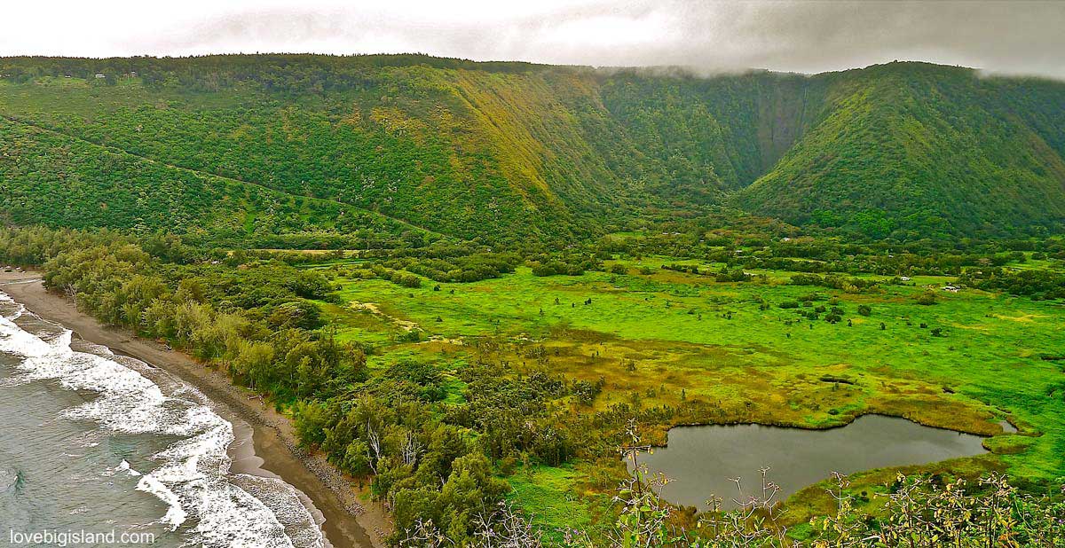
Overview of Waipiʻo Valley from the opposite side. You can see the steep Waipiʻo Valley access road, the black-sand beach, and taro fields.
Since a county emergency order in September 2022, Waipiʻo Valley Road has been closed to the general public, and that restriction has been renewed repeatedly through 2025. Only Big Island residents, county-permitted tour operators, and Native Hawaiian practitioners may travel down the road. For everyone else, the legal options are the free Waipiʻo Valley Lookout at the top, which still gives you the full view over the valley, or a permitted shuttle or tour. Do not plan to drive or hike down on your own, and check the current status before you go.
Waipiʻo Valley
Waipiʻo Valley was once a center of Hawaiian life, and it still anchors the island’s history. Cliffs nearly a thousand feet high wall in a valley floor of waterfalls and taro, with a black-sand beach at the mouth. The remoteness that once made it a stronghold is exactly what keeps the crowds out today.