Kīlauea began erupting at about 2:20 a.m. on December 23, 2024, and it hasn’t stopped. The eruption runs in episodes: the summit fountains for hours or days, pauses while the crater re-inflates, then starts again, 50 times through June 2026. It’s the only volcano erupting in Hawaiʻi right now.
None of that is unusual here. The record runs back to the explosive eruption of 1924, through an almost continuous 35-year run that ended in 2018 with lava destroying more than 700 structures around Leilani Estates. What’s changed is the rhythm: fountains have reached 1,770 feet in this eruption, and the pauses between episodes can run from days to weeks, so check the USGS status page before you drive up, and our lava viewing guide for how to time a visit.
Table of contents
Every eruption since 1924, at a glance
Newest first. Every date and figure below comes from USGS, and each row links to the section that covers it.
Details below last verified July 2026.
| Name | Duration | Dates | Where | What it did |
|---|---|---|---|---|
| 1Episodic summit eruption (Details ↓) | 50 episodes so far | December 23, 2024 to present | Halemaʻumaʻu, at the summit | Fountains to 540 m (1,770 ft) in episode 43, the tallest of this eruption |
| 2Nāpau Crater eruption (Details ↓) | 5 days | September 15 to 20, 2024 | Middle East Rift Zone | Kīlauea's first East Rift Zone eruption since 2018 |
| 3Southwest Rift Zone eruption (Details ↓) | 8.5 hours | June 3, 2024 | Southwest Rift Zone | The shortest eruption on this list |
| 4September 2023 summit eruption (Details ↓) | 6 days | September 10 to 16, 2023 | Halemaʻumaʻu and the down-dropped block | Covered 499 acres (202 hectares) in new lava |
| 5June 2023 summit eruption (Details ↓) | 12 days | June 7 to 19, 2023 | Halemaʻumaʻu | Ended when the tilt flipped from deflation to inflation |
| 6January 2023 summit eruption (Details ↓) | 9 weeks | January 5 to March 7, 2023 | Halemaʻumaʻu | Added 13 m (43 ft) of lava across 292 acres |
| 7The lava lake (Details ↓) | 14 months | September 29, 2021 to December 9, 2022 | Halemaʻumaʻu | A lake visible from the rim overlooks day and night; filled 143 m (469 ft) |
| 8Lava returns to Halemaʻumaʻu (Details ↓) | 5 months | December 20, 2020 to May 2021 | Halemaʻumaʻu | Boiled away the crater's water lake and filled 229 m (752 ft) |
| 9Lower East Rift Zone eruption (Details ↓) | 4 months | May 3 to September 5, 2018 | Leilani Estates, lower Puna | Buried 13.7 square miles and destroyed more than 700 structures |
| 10The 61g lava flow (Details ↓) | Nearly 2 years | May 24, 2016 to April 30, 2018 | Puʻu ʻŌʻō east flank to Kamokuna | An ocean entry you could reach on foot, and for a while by bike |
| 11Summit lava lake (Details ↓) | About 10 years | March 19, 2008 to May 2018 | Halemaʻumaʻu | Lava returned to the summit after 25 quiet years, then drained in 2018 |
| 12Puʻu ʻŌʻō eruption (Details ↓) | 35 years | January 3, 1983 to April 30, 2018 | East Rift Zone | The longest East Rift Zone outpouring in more than 500 years; 44 fountaining episodes |
| 13Mauna Ulu eruption (Details ↓) | 1,774 eruptive days across 5 years | May 24, 1969 to July 22, 1974 | Upper East Rift Zone | Lava falls higher than the American Falls at Niagara; buried part of Chain of Craters Road |
| 14Kapoho eruption (Details ↓) | 37 days | January 13 to February 19, 1960 | Kapoho, lower Puna | Destroyed the village of Kapoho. Every barrier built to divert the lava failed |
| 15Kīlauea Iki eruption (Details ↓) | 37 days | November 14 to December 20, 1959 | Kīlauea Iki Crater | 17 episodes, and the tallest fountains on this list: 580 m (1,900 ft) |
| 16Lower East Rift Zone eruption (Details ↓) | 88 days | February 28 to May 26, 1955 | Lower Puna | Covered 3,900 acres and destroyed 21 homes; 140 people evacuated |
| 17Explosive eruption (Details ↓) | About 2.5 weeks | May 9 to 27, 1924 | Halemaʻumaʻu | More than 50 explosions threw blocks weighing up to 14 tons. One person was killed |
| 18Mauna Loa eruption (a different volcano) (Details ↓) | 13 days | November 27 to December 10, 2022 | Mokuʻāweoweo and the Northeast Rift Zone | Stopped 1.7 miles short of Saddle Road; the first Mauna Loa eruption in 38 years |
The ongoing Kīlauea episodic eruption (December 2024 to present)
Kīlauea erupts in bursts now. The summit fountains for hours or days, then shuts off while the crater re-inflates. That refill takes anywhere from a few days to a few weeks. USGS calls these episodes, and by the end of June 2026 there had been 50.
Episode 1 began at about 2:20 a.m. on December 23, 2024, with fountains reaching 158 meters (518 feet). The eruption has grown taller since. Episode 43, on March 10, 2026, drove fountains to 540 meters (1,770 feet), the highest so far. Episode 50 ran for seven hours on June 27, 2026, with fountains to 300 meters (984 feet).
Puʻu ʻŌʻō fountained 44 times between 1983 and 1986 before settling into the long lava flow it’s remembered for, so the current eruption has passed that count. It isn’t a record, whatever you read elsewhere. Puʻu ʻŌʻō logged 61 numbered episodes across its full 35-year run, and only the fountaining ones are being beaten here.
Fifty episodes in roughly 18 months averages one about every 11 days, and most run less than a day. On any given night of a week-long trip, the summit is more likely to be paused than fountaining. When it does go, the overlook closest to the active vents is Keanakākoʻi, a 0.5-mile walk from the parking area on Crater Rim Drive in Hawaiʻi Volcanoes National Park.
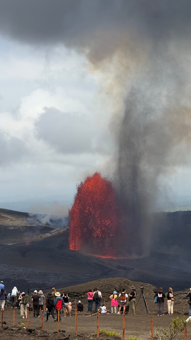
Visitors at Keanakākoʻi Overlook watch episode 47 of the Kīlauea eruption on May 14, 2026, with fountains reaching 656 feet (200 meters).
You can follow the full episode-by-episode timeline, including start times and fountain heights, on the USGS eruption information page.
Summit and rift-zone eruptions (2020 to 2024)
Between December 2020 and September 2024, Kīlauea erupted seven times. Five were summit eruptions inside Halemaʻumaʻu crater, and together they refilled the crater with about 410 meters (1,345 feet) of lava after the 2018 collapse emptied it. The other two broke out on the rift zones. None of the seven threatened homes or infrastructure.
The 2024 rift-zone eruptions
The September 2024 eruption opened vents near Nāpau Crater on the middle East Rift Zone, beginning between 9 and 10 p.m. on September 15 and ending by the morning of September 20, about five days later. The most active vents, west of Nāpau Crater, sent lava cascading into the crater below. It was Kīlauea’s first East Rift Zone eruption since 2018.
An earlier eruption in June 2024 came from the Southwest Rift Zone, southwest of the caldera. It began at about 12:30 a.m. on June 3 and was over in 8.5 hours, the shortest eruption of the group.
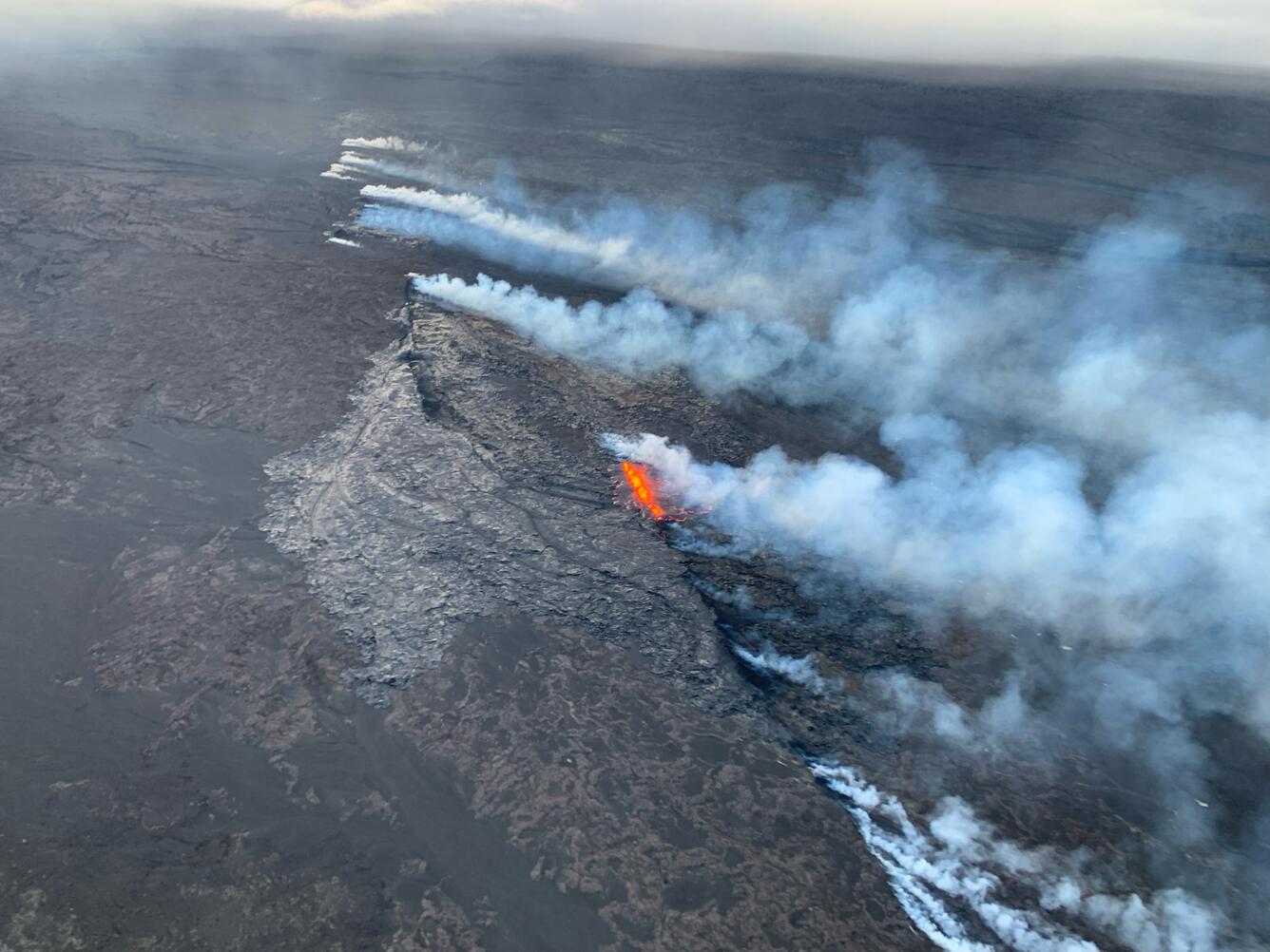
Aerial image of the Southwest Rift Zone eruption of Kīlauea, viewed during an overflight at about 6 a.m. on June 3, 2024. USGS image.
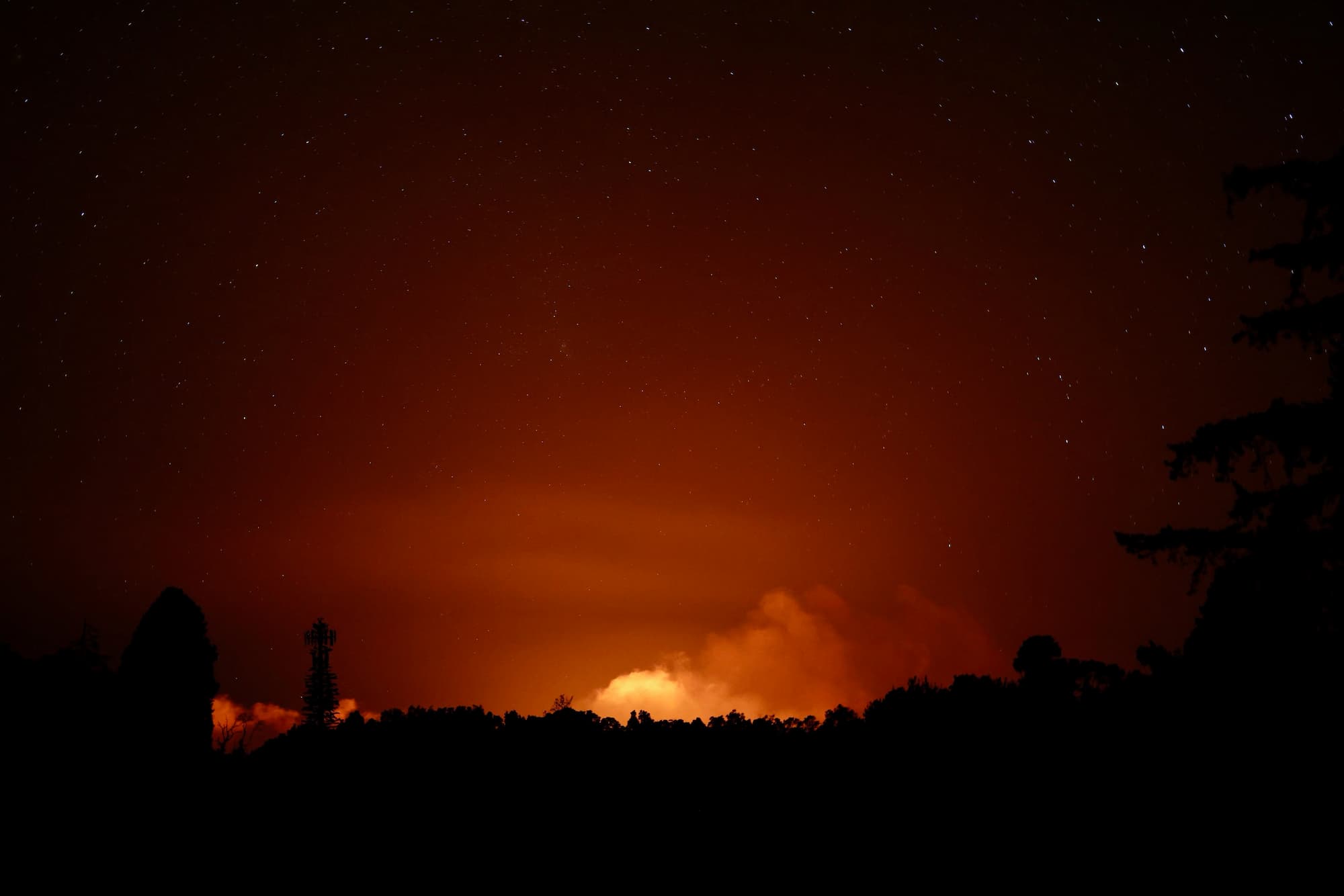
Kīlauea’s eruption plume lit from below during the early morning hours of June 3, 2024, visible from the Volcano Golf Course area. USGS image by D.A. Phillips.
The 2023 eruptions
Kīlauea erupted three times in 2023, all of them at the summit. None lasted longer than nine weeks.
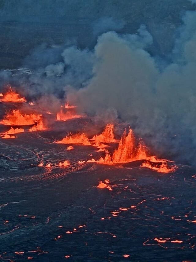
The third began on September 10 and ran six days. It erupted inside Halemaʻumaʻu and on the down-dropped block beside it, putting out 18.6 million cubic meters of lava across 499 acres (202 hectares).
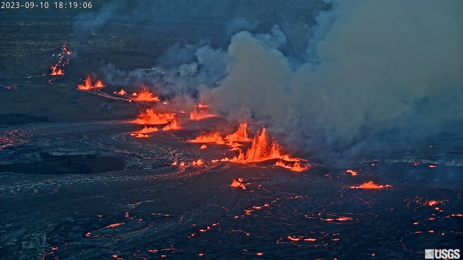
See a short summary of the September eruption in our web story:
The June eruption, three months earlier, lasted twice as long: 12 days against six. Lava broke out within Halemaʻumaʻu crater at about 4:43 a.m. on June 7 and continued until June 19. Seismic tremor dropped sharply on the afternoon of the 19th, and tiltmeters confirmed a quick shift from deflationary to inflationary tilt, marking the end.
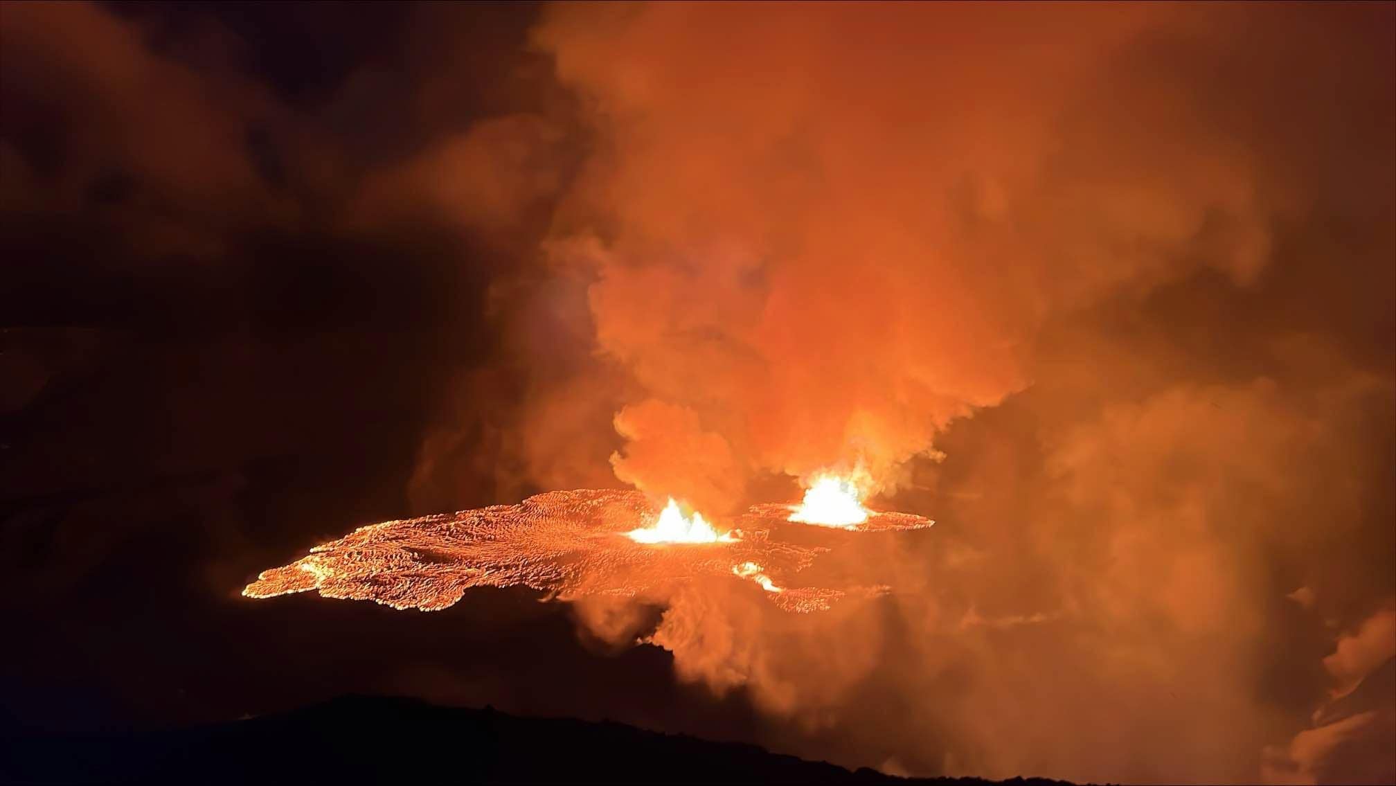
Kīlauea volcano erupted within Halemaʻumaʻu crater at about 4:43 a.m. HST on June 7, 2023. Image credit: USGS
By sunrise, the glow from the active crater was visible across the caldera:
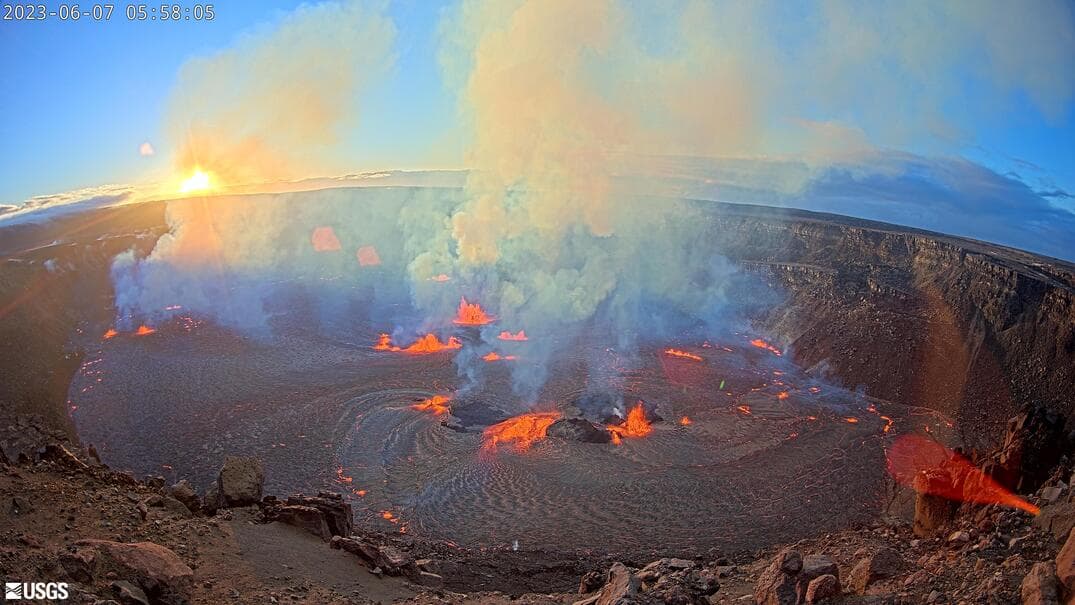
Sunrise over Halemaʻumaʻu crater during the June 7, 2023 eruption, Hawaiʻi Volcanoes National Park.
The year’s first eruption ran from January 5 to March 7 and was the quietest of the three. It added 13 meters (43 feet) of lava across 292 acres (118 hectares), roughly 2% of what the 2018 collapse removed.
The lava lake (September 2021 to December 2022)
For 14 months a lava lake sat in Halemaʻumaʻu, visible from the caldera rim overlooks day and night. Kīlauea erupted continuously from 3:21 p.m. on September 29, 2021 to December 9, 2022.
The lake filled 143 meters (469 feet) of crater depth and spread across 295 acres (119 hectares), about 110.8 million cubic meters of lava in all. That still only replaced about 14% of what the 2018 collapse took out.
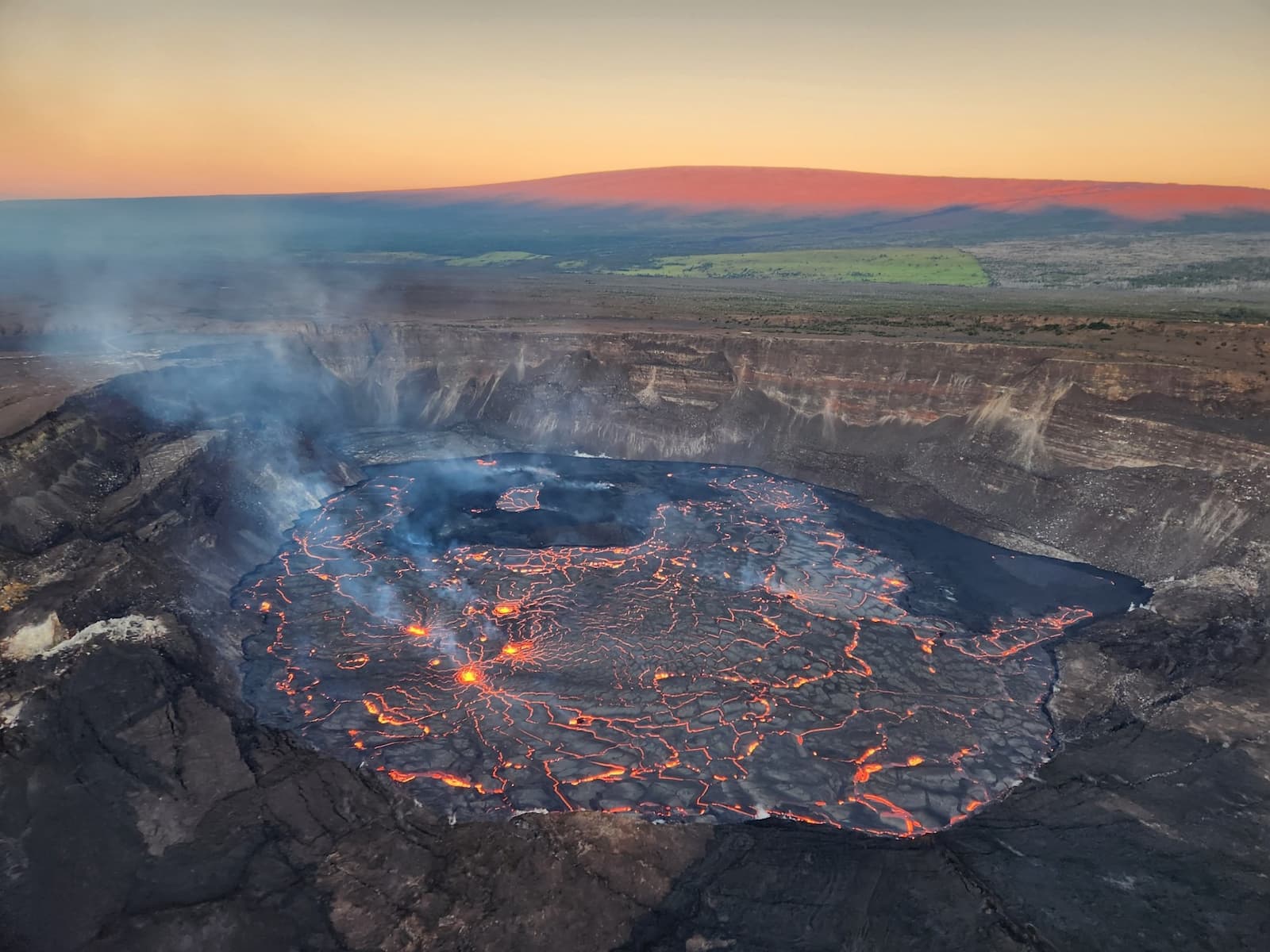
Aerial view of the eruption within Halemaʻumaʻu crater. The lava field covered nearly 300 acres (120 hectares) of the crater floor. Mauna Loa is visible in the morning light in the background. Image credit: USGS.
Lava returns to Halemaʻumaʻu (December 2020 to May 2021)
Kīlauea had been quiet since the 2018 collapse when lava returned to Halemaʻumaʻu at about 9:30 p.m. on December 20, 2020. A water lake had been forming on the crater floor over the preceding two years, a first in Kīlauea’s recorded history. The lava boiled it away.
The eruption filled 229 meters (752 feet) of the crater with 41 million cubic meters of lava across 112 acres (45 hectares). USGS observed the last activity on the lava lake surface on May 23, 2021.
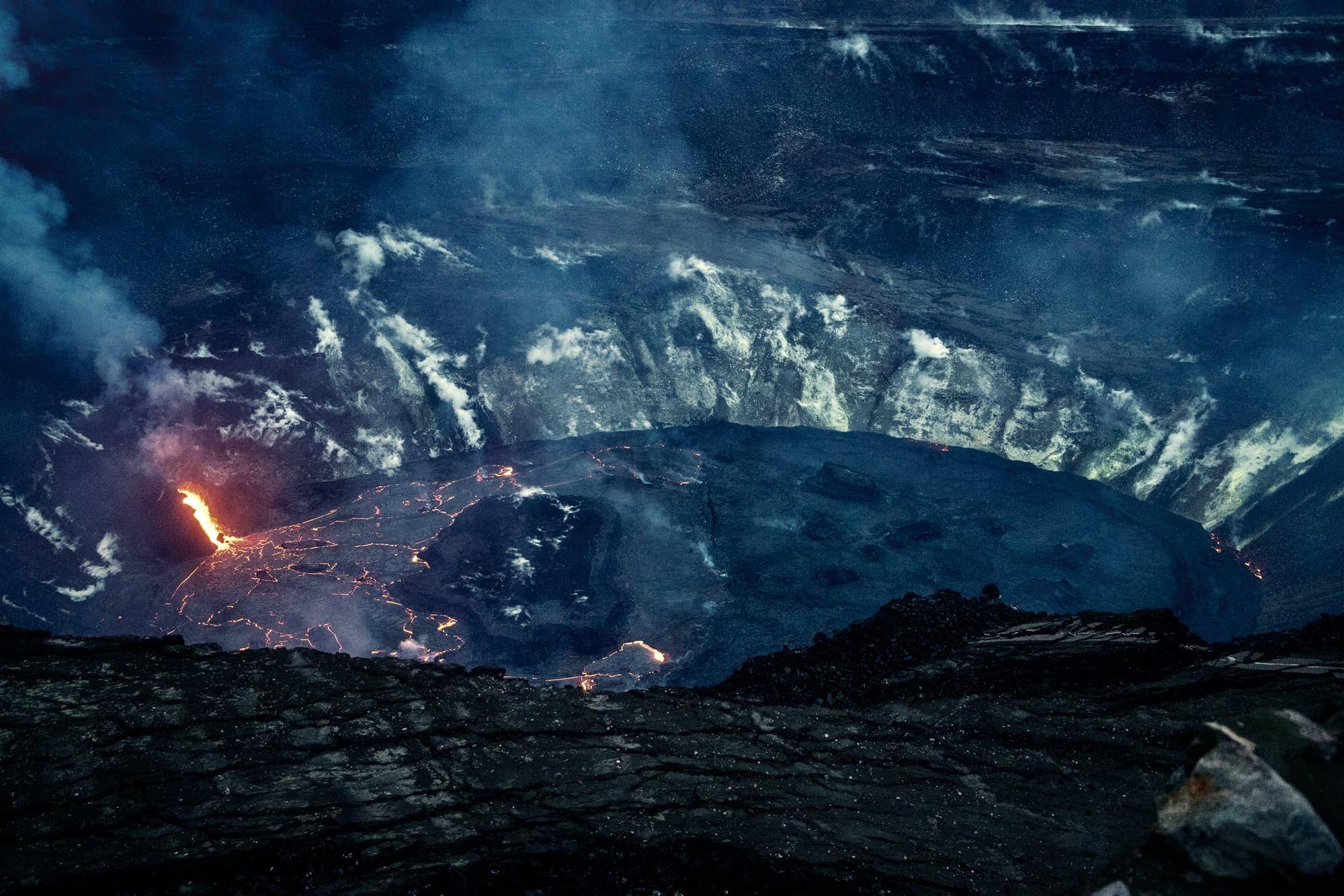
The slowly filling Halemaʻumaʻu crater lava lake, photographed January 19, 2021, by a HVO scientist from a section of the park not accessible to the public. USGS photo by H. Dietterich (public domain).
The 2018 lower East Rift Zone eruption
The 2018 eruption is the one that changed lives. It buried 13.7 square miles of lower Puna over three months and destroyed more than 700 structures.
The Puʻu ʻŌʻō vent gave way on April 30, 2018, and the Halemaʻumaʻu lava lake began draining two days later, on May 2. On May 3, fissures opened inside the Leilani Estates subdivision. Lava was last visible in fissure 8 on September 5, 2018.
You can find a detailed scientific summary of the eruption in the journal Science (start with the figures and the chapter “Synthesis of 2018 activity”). USGS also published a thorough overview of the eruption and the summit collapse that ran alongside it.
The 2018 Lower East Rift Zone eruption in numbers:
- 13.7 square miles of land covered by lava (35.5 square kilometers, or the surface of almost 6,631 football fields)
- 875 acres of new land created by ocean entries
- more than 700 structures destroyed by lava
- about 30 miles (48 km) of roads covered by lava
- about 1.5 cubic kilometers of lava erupted (roughly 2 billion cubic yards, enough to fill some 600,000 Olympic-size swimming pools)
- more than 60,000 earthquakes accompanying the summit collapse
- a summit caldera deepened by more than 500 meters (1,600 feet) across 62 separate collapse events
Watch the 2018 eruption
Of the many films made about the 2018 eruption, this is the one worth your time.
ʻAilaʻau: Forest Eater
A short film by Lance Page from Page Films that takes viewers through the 2018 eruption of Kīlauea’s lower east rift zone. No narration: 8 minutes of footage and sound that puts you on the ground.
The seven major eruptions (1924 to 2018)
Hawaiʻi has six active volcanoes. Five are on the Big Island: Kīlauea, Mauna Loa, Hualālai, Mauna Kea, and Kamaʻehuakanaloa, which is still growing beneath the ocean off the south coast. The sixth is Haleakalā on Maui. Kīlauea is the youngest and most active of them all.
About 90% of Kīlauea’s surface is covered by lava younger than 1,000 years, and roughly a fifth of that is less than 200 years old. Its first lavas erupted onto the ocean floor between 210,000 and 280,000 years ago, though the oldest rock you can stand on, the Hilina Basalt, is 50,000 to 70,000 years old.
The last hundred years break down into seven major eruptions. Each entry links to the USGS summary.
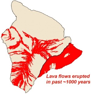
The Island of Hawaiʻi with lava flows erupted in approximately the past 1,000 years shown in red. Image credit: USGS
- The May 1924 explosive eruption of Kīlauea in Halemaʻumaʻu (the most powerful explosions at Kīlauea since the early 19th century)
- The Kīlauea 1955 Lower East Rift Zone Eruption in Lower Puna (the first eruption in historic times to occur in any populous area in a U.S. territory)
- The 1959 eruption of Kīlauea Iki Crater (580 m / 1,900 ft lava fountains)
- The 1960 Kapoho eruption (barriers were built in an attempt to divert lava flows)
- The 1969-1974 Mauna Ulu Eruption (lava falls higher than the American Falls at Niagara)
- The Kīlauea summit eruption, 2008-2018 (lava lake viewing at the summit)
- The 1983-2018 Puʻu ʻŌʻō Eruption
Did you know the Air Force once bombed a lava flow threatening Hilo in 1935? Read about the volcanic history of Hawaiʻi in our blog on the six volcanoes that built the Big Island.
The 61g lava flow (2016-2018)
The 61g flow was the final episode of the long-running Puʻu ʻŌʻō eruption and the direct predecessor of the 2018 LERZ. A breakout from the east flank of Puʻu ʻŌʻō on May 24, 2016 sent lava toward the coast along a path active since June 27, 2014. That earlier flow came very close to reaching the town of Pāhoa.
This breakout was named the 61g flow (Episode 61, “g” lava flow). It reached the base of the Pulama Pali by the end of June 2016 and entered the sea at Kamokuna on July 26, 2016. Between July 2016 and March 2018, visitors could watch the ocean entry of the 61g flow near Kamokuna from land and by boat. The Puʻu ʻŌʻō crater collapse on April 30, 2018 ended the 61g eruption and triggered the LERZ event that followed.
The 61g eruption was unusually accessible. The lava moved slowly across terrain open to the public, and a gravel road ran close enough that the hike was short. For a while you could even rent a bike to get there.
Mauna Loa: the 2022 eruption
Mauna Loa erupted at 11:30 p.m. on November 27, 2022, inside its summit caldera Mokuʻāweoweo, for the first time in 38 years. It lasted 13 days. Lava traveled 12 miles down the Northeast Rift Zone and stopped 1.7 miles (2.8 km) short of the Daniel K. Inouye Highway, better known as Saddle Road, before the eruption ended on December 10, 2022.
The 2022 Mauna Loa eruption is over. The alert level is back to normal and there’s no lava visible on the surface.
The Mauna Loa eruption is over
Read our complete Mauna Loa Update Summary, with a Q&A and photos from the 2022 Mauna Loa eruption.
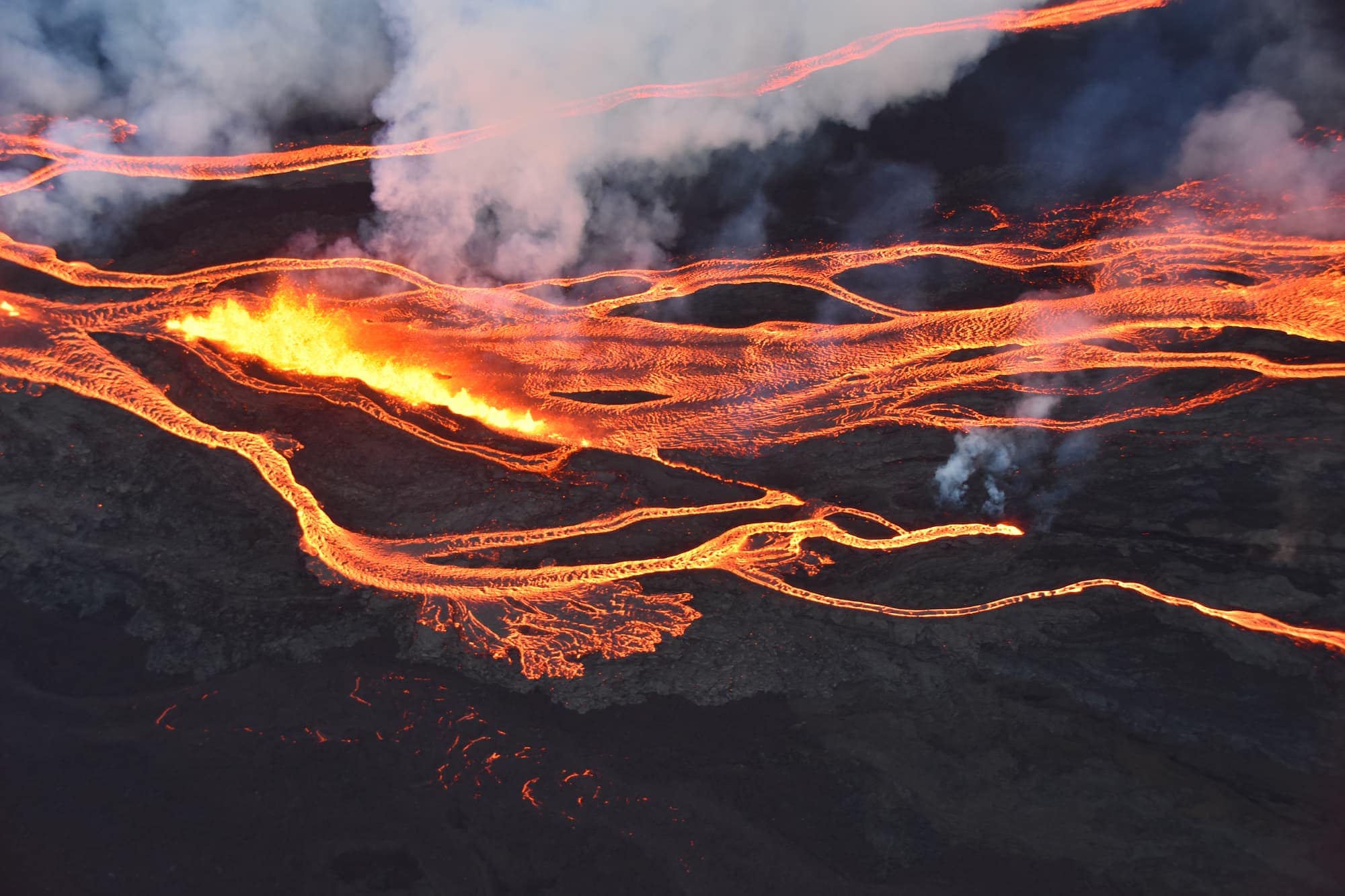
Aerial photo of the Mauna Loa eruption showing a line of fissure vents erupting above 10,000 ft elevation on the Northeast Rift Zone. Image courtesy of Civil Air Patrol.
Track the eruption yourself
Eruption reporting in mainstream media is often exaggerated. For what Kīlauea is doing today, go to the source.
- The daily USGS volcano update for Kīlauea, which gives the current alert level and says whether the summit is fountaining or paused between episodes.
- The USGS eruption information page, which carries the episode-by-episode table: start time, end time, duration, and maximum fountain height for every episode so far.