Lava update: The Halemaʻumaʻu eruption of Kīlauea is paused. Preliminary models suggest the forecast window for the onset of episode 44 lava fountaining is March 28 to April 12. Read more.
Lava viewing is a must-do activity if you are lucky enough to be on the Big Island while one of the volcanoes is actively erupting. Hawaii wouldn’t exist if it were not for the continuous volcanic activity that created all the islands, and seeing this happening in “real-time” is, for many people, a once in a lifetime experience.
Table of contents
- Lava FAQ
- Where to see lava now? (2026)
- Lava Tours + DIY lava viewing (including tips on what to do when there is no lava)
- Ongoing and past eruptions from Kilauea and Mauna Loa
- Lava safety
Table of Contents
- Lava FAQ
- Where to see lava now? (2026)
- Lava Tours + DIY lava viewing (including tips on what to do when there is no lava)
- Ongoing and past eruptions from Kilauea and Mauna Loa
- Lava safety
Lava Q & A
We strive to make our lava viewing guide as complete as possible, which means that it sometimes can be difficult to quickly find the information you are looking for. Because of this we answer some of the most asked (and answered!) questions about seeing lava in Hawaii below:
Yes! As of December 23, 2024, Kīlauea volcano is erupting within Halemaʻumaʻu crater in the summit caldera. See our often updated viewing tips to find out how to best see lava.
No, the ongoing eruption of Kīlauea is occurring within a closed area of Hawai’i Volcanoes National Park. See our guide to hiking to the lava flow to learn about your options when lava moves into public accessible areas.
We do not recommend paying for a lava tour if your only goal is to see lava because you can easily and safely do this yourself. We do recommend tours for people interested in the added value of fully arranged day tours during which you learn about (and see many aspects of) our volcanoes. Read more in our guided volcano tours section.
No. Lava boat tours are only organized when lava flows into the ocean. For a longer answer see our tips for choosing a lava boat tour
Following safety directions provided by the Hawaii Volcano National Park staff will allow you to see active eruptions in a safe and responsible manner. Read more about how to see lava yourself on our website.
Yes! As of December 23, 2024, Kīlauea volcano is erupting within Halemaʻumaʻu crater in the summit caldera
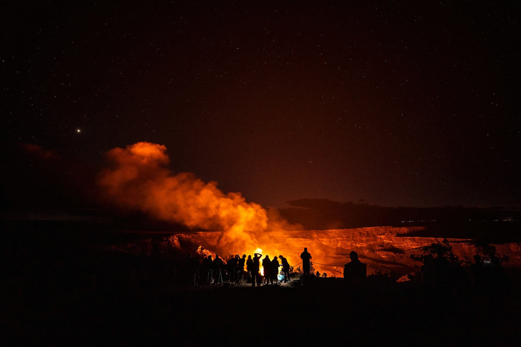
Set your alarm and go to the park to see the glow before sunrise! Viewpoints like Uēkahuna, Kūpinaʻi Pali and even Keanakākoʻi are packed at sunset, but are usually almost deserted before sun up.
Mauna Loa is not erupting. You can read more about the recent Mauna Loa eruption here.
Where is the lava located?
- Lava from the Kilauea volcano
- Lava from possible eruptions of the Mauna Loa volcano (no current eruption)
Lava from the December 2024 Kilauea eruption
The current eruption of Kīlauea started at approximately 02:20 AM on December 23, 2024. Eruptive activity is episodic, turning on and off again every few days/weeks.
This means that the answer to the question “can we see lava in Hawaii?” is currently “YES“.
-> Current Kilauea eruption status: Kilauea is erupting.
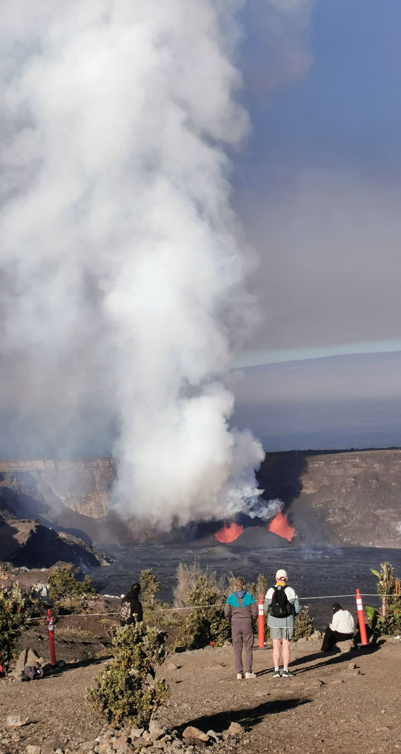
two visitors admiring episode 8 of the current eruption from the Keanakākoʻi overlook in Hawaiʻi Volcanoes National Park.
Use the following three live webcams to follow the eruption:
West Halemaʻumaʻu crater (V1cam):
![[V1cam] Kīlauea volcano, Hawaii (west Halemaʻumaʻu crater)](https://www.lovebigisland.com/wp-content/plugins/wp-youtube-lyte/lyteCache.php?origThumbUrl=https%3A%2F%2Fi.ytimg.com%2Fvi%2Ftk0tfYDxrUA%2F0.jpg)
East Halemaʻumaʻu crater (V2cam):
![[V2cam] Kīlauea volcano, Hawaii (east Halemaʻumaʻu crater)](https://www.lovebigisland.com/wp-content/plugins/wp-youtube-lyte/lyteCache.php?origThumbUrl=https%3A%2F%2Fi.ytimg.com%2Fvi%2FfiyttmA7YkA%2F0.jpg)
South Halemaʻumaʻu crater (V3cam):
![[V3cam] Kīlauea volcano, Hawaii (south Halemaʻumaʻu crater)](https://www.lovebigisland.com/wp-content/plugins/wp-youtube-lyte/lyteCache.php?origThumbUrl=https%3A%2F%2Fi.ytimg.com%2Fvi%2FgXKuUyKt8mc%2F0.jpg)
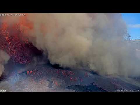
A previous version of the V3cam got destroyed on December 6, 2025 by a lava fountain during Episode 38. You can see the last 10 minutes before it got engulfed on the following video:
When, where, and how to best see the lava (in case of an ongoing eruption)
You can easily go see the activity in the park yourself (see our guide here – sunrise is the best time to skip the crowds), or join one of the many excellent tours that are organized by our local companies.
- Where? Kilauea is erupting within the Halemaʻumaʻu crater.
- How? The current eruption is located in the southwest corner of Halemauʻumaʻu crater visible from several viewpoints along the Crater Rim Trail: Uēkahuna, Kīlauea Overlook, Wahinekapu (Steaming Bluff), Kūpinaʻi Pali (Waldron Ledge), behind Volcano House (see photo below), Keanakākoʻi (see photo above), and other overlooks.
- How to avoid the crowds? (only relevant with ongoing eruptions) The best time to see the lava is when its dark. One or 2 hours before sunrise is the best time to skip the crowds, or late at night (after 10 pm) if you don’t like to wake up early. Sunset viewing is of course also possible, but you are likely to be stuck in a traffic jam together with other lava enthusiasts if you visit the park between 6 pm and 9 pm.
- Prepare in advance: Don’t forget your flashlight, warm attire, rain gear, and sturdy shoes. Keep an eye on the weather as rain and fog can obstruct the eruption view.
- Stay safe! Stay out of closed areas – rope lines and hazard signs are in place to safeguard you from dangerous volcanic fumes, unexpected rim collapses, and hidden cracks. Volcanic gas can be particularly risky for those with respiratory issues, young children, and pregnant women.
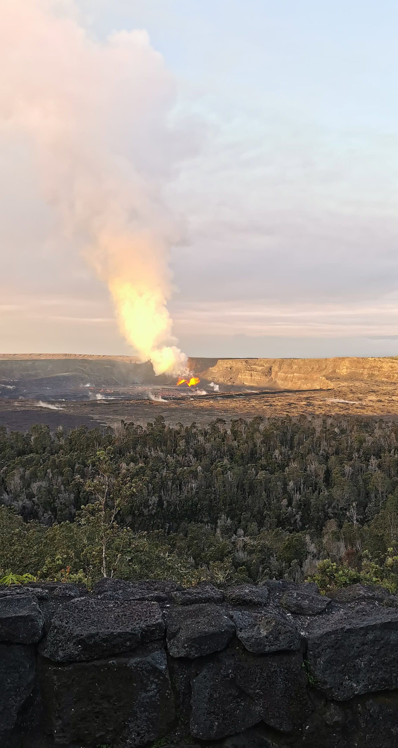
Eruption viewing from the Volcano House – also a great place for breakfast with a view! There are closer viewpoints (Keanakākoʻi Overlook is best but requires a 0.5 mile hike), but Volcano House should always be one of your stops.
Kilauea Activity Update for Friday, March 13, 2026:
The Halemaʻumaʻu eruption of Kīlauea is paused. Weak to moderate, intermittent incandescence was observed mostly from the south vent overnight. Tremor continues at the summit with less frequent bursts. Tilt continues to show inflation at rates consistent with past eruptive pauses. Preliminary models suggest the forecast window for the onset of episode 44 lava fountaining is March 28 to April 12.
Summit Observations:
Intermittent, weak to moderate glow was visible from the south vent last night with infrequent weak glow from the north vent. At this time, both vents are quiet and emitting plumes of gas when visible in the rain and clouds.
Very little incandescence from flows on the floor and near the vents within Halemaʻumaʻu crater was visible in webcams last night. A tiny amount of movement could be seen above the south vent overnight, but otherwise most of the flows have solidified but remain hot as seen on the thermal camera.
The UWD tiltmeter has recorded a total recovery of nearly 9.4 microradians of inflationary tilt since the end of episode 43, with 2.4 microradians of that in the past 24 hours
Read the most recent update here.
Lava from the 2022 Mauna Loa eruption
The 2022 Maunaloa eruption is over and there is no active lava visible on the surface.
-> Current Mauna Loa eruption status: Mauna loa is not erupting.
Big Island Lava Tours and how to see the lava yourself
Seeing the lava up-close-and-personal is an experience that few people ever forget. How close you can get to the lava depends on where the flow is active, and what lava viewing locations are accessible. Access to the flow could be restricted if local conditions are deemed unsafe or the path to the flow crosses private land. Most of the time the volcanoes on Hawaii erupt at a very calm pace (with ‘aloha’ if you will), and it is quite easy to get close to the action.
We give a very short summary of all options you have to see the lava, below:
- From up-close as it flows over the land and/or into the ocean. Conditions permitting, your options are:
- From a distance, e.g. with:
- No lava? no problem!
- Here is how to geek out on lava even when there is no ongoing eruption.
1: Hiking to the Lava: Guided Lava Tours and DIY (when possible)
Hiking to the lava is the best way to get up close. Sometimes, however, lava hikes are not possible because of no lava (there either is no lava flowing on the surface), or no access (access to the site of the eruption is restricted, too dangerous, or crosses private lands).
IF access to the flow is possible AND on public land you will be able to find several companies that offer guided hikes to the lava flow during daytime or at night.
We describe below:
- How to hike to the lava yourself, and
- When, why, and how to choose a guided Lava Lour.
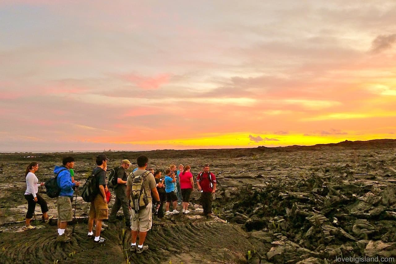
Hiking tours to the lava flow can be tiresome but are worth every drop of sweat!
Hiking to the lava yourself
Sometimes it is pretty straightforward to find your way to the lava yourself and it is good to remember that it is not always mandatory to join a lava viewing tour to see the lava. If you do plan for a DIY adventure please make sure to educate yourself on the risks, to dress properly, and to bring plenty of water and sunscreen. A good place to start doing this is by checking out our lava hiking safety chapter.
Besides safety, the most important distinction that determines whether you can hike out to the lava yourself is where the lava is flowing:
- Are the surface flows within the national park boundaries? Yay! If the park determines that access to the flow is safe you can go on a hike to see the lava. Because viewing conditions change on a daily basis you should look up the most recent information about the active surface flows shortly before you plan to see the lava yourself. The Hawaii Volcanoes National Park Visitor Center and the “what’s going on with the Volcano” web page of the Volcanoes National Park are good places to do so.
- Are the surface flows on privately owned lands? If the lava is outside of the park boundaries there is a good chance it is on privately owned lands and that you will be trespassing while hiking out. Make sure to get proper permission from the land owners before hiking up to these spots! By far the easiest way to see the lava in this case is to enlist a lava tour guide with proper permissions.
The following video by Ph.D. student-turned-filmmaker Tyler Hulett titled “Dawn of Fire” shows a time-lapse video of the slow-moving lava flows of the Kilauea volcano. This gives a good representation of what you might see when hiking to the lava:
This is one of our favorite videos to watch! It lets you get lost in the lava landscapes of the Kilauea volcano and even after dozens of repeat views we clicking back for more.
Big Island Lava Tours
Guided lava tours offer know-how, equipment, and access to restricted terrains where needed. Their guides are trained professionals that know the area intimately. The added value of using a lava tour guide is of course safety, but also getting to know the extremely interesting background information they can provide about the eruption, and, of course, the peace of mind of making a safe trek without getting lost.
These tours can last from 1 hour up to a whole day depending on how accessible the lava is. The hike almost always takes you over very uneven terrain it is important to have an honest conversation with the guides beforehand to make sure you are physically able to complete the hike.
A good option for a guided lava tour that explores the Hawaii Volcanoes National Park and stays in the park after dark to see the glow (when present) is the day-long “Volcano Unveiled” tour by Hawaii Forest & Trail:
Volcano, Chocolate, & Waterfalls (in-depth volcano experience from Kona)
This experience takes you off-the-beaten path to journey through Hawaii Island’s incredible range of ecosystems and climate zones to learn all about volcanoes. An in-depth volcano experience on the Island of Hawaiʻi. National park certified guides share a mix of natural and cultural history about the island's formation, illuminating the stories behind the ever-changing landscape of our island home.
from:
$295
What is a suggested tour?Our suggested tours are hand-picked tours that receive consistent good reviews, give back to the community, and work hard to minimize their impact on the environment. Read more about these tours on our website.A larger list of outfitters that organize hikes to the lava can be found on the price comparison website hawaiiactivities1. These hiking tours are sometimes combined with other activities so make sure to thoroughly read the descriptions before booking.
Booking a lava hike tour far in advance is risky because at the time of your visit the lava may have stopped flowing. We strongly recommend to that you carefully review the cancellation conditions and, if they are strict, not to book these tours more than a few weeks in advance.
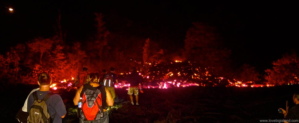
Visiting the Lava with a professional guide is a spectacular experience
2: Lava viewing from the ocean: lava boat tours (currently not possible)
If lava is flowing into the ocean you can enjoy viewing it from a close, safe distance by boat. Definitely a unique and thrilling experience!
Lava boat tours without limited entry approval from the US Coast Guard must keep a distance of 300 meters (984 feet) from the ocean entry point, and outside the designated safety zone (source). Under special circumstances tour operators are granted permission into the lava safety zone and can get closer to the point of ocean entry.
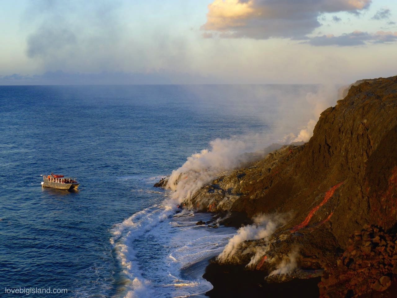
Lava enters the ocean while a lava boat gets close to the action. Photo taken in 2017 during the 61g Kamokuna ocean entry.
Safety and licensed lava boat tour operators
There are many possible risks when trying to see lava enter the ocean which we describe in our lava ocean entry safety guide and it is important that you choose your lava boat tour with care because of the many risks associated with seeing lava this way.
Make sure to always check if your tour operator is licensed to ensure that they possess the experience and training required to get you to the viewing area and back safely.
3: See the lava with a helicopter tour
Helicopter tours let you see the lava and volcanoes from above. A helicopter can get you close to a lot of action that is not accessible over land or water and gives you an impressive birds-eye perspective. Think, for example, about a look into the crater lake, seeing surface lava flows from the air, or lava burning through forests.
Helicopter tours are your best bet to see the lava when other ways such as a hike or boat tour are not possible because they are able to keep a safe distance while still offering an amazing perspective. If this is the case you should plan ahead because helicopter tours can fill up weeks in advance!
Tours that take you to see the lava depart from both Hilo and Kona – the ones from Hilo are shorter and more affordable. Still, helicopter tours are not cheap. The following tour from Hilo is an excellent way to see the current eruption activity.
- See Hilo and the Volcanoes (Blue Hawaiian Helicopter Tours)
Another tour departing from the Kona airport is the following one by Rainbow Helicopters. It takes twice as long as the tour dparting form Hilo but also costs about twice as much:
See also our own guide to helicopter tours on the Big Island for an overview of all helicopter tour operators and tour options.
4: Lava viewing at Public Viewing Areas
Most of the time when lava is flowing on the surface it is possible to see it at a safe distance from a public viewing area. From these areas active lava can be visible directly, or is accessible with a (short) hike. Public viewing opportunities change all the time but an example is the Steaming Bluff overlook of the Halemaʻumaʻu crater in the Hawaii Volcanoes National Park.
How to see the glow from the Halemaʻumaʻu Crater (there is currently no lava in the crater)
The current eruption of the Kilauea Volcano takes place outside of the Halemaʻumaʻu crater. The information below is only valid for when the lava lake in the crater reappears.
- One of the best viewpoints is the Kilauea overlook point and anywhere along the caldera rim to Kūpinaʻi Pali. The parking lot here can fill up quickly though, so be prepared to go to a quieter overlook if the park is very busy.
- The Keanakākoʻi viewing area is closed due to unsafe air quality. That big plume you see contains sulfur dioxide, other gases and shards of volcanic glass that pose a significant risk to anyone if inhaled. Stay safe and stay out of closed areas.
5: No lava? No problem! Here is how to geek out on lava even when there is no ongoing eruption.
Even when there are no surface flows, you can still engage in extremely interesting activities to learn about lava and the cultural and natural history of the volcanoes of Hawaiʻi. After all, the Big Island is 100% created by volcanic eruptions, and you don’t need to see red-hot lava to be amazed by all the remnants of its creation! Here are some favorite options:
- See the aftermath of the 2018 LERZ eruption
- Or go explore lava tubes and other volcanic remnants
See the aftermath of the 2018 LERZ eruption
The 2018 Lower East Rift Zone (LERZ) eruption zone is a very interesting place to visit, as it offers a sobering perspective on the impact of eruptions on the local people and ecology of the island.
Starting in Pahoa you can stop in for a look at the Pahoa Lava Zone Museum. This is a small building featuring artifacts from the last eruption, photographs taken by locals, and exhibits from the now-abandoned Jaggar museum.
From Pahoa you can then follow Highway 132 to the South/East. This road was only recently rebuild over the still-cooling lava flows that covered it in 2018 and it provides some of the best impressions. You can follow this road up to a point that used to be called “4 Corners”, but now is only one corner and the end of the road. Be careful with parking and touching the ground because the rocks in the area can still be very hot. From here you can see a panorama of miles of new lava rock. With clear weather you can see all the way to the ocean.
Visit the Leilani Estates
You have probably heard about Leilani Estates, ground zero of the 2018 LERZ eruption and home to Ahu‘aila‘au (at the time known simply as “Fissure 8”). Leilani Estates is still a residential neighborhood and all roads except for Leilani Avenue are private. You cannot park along Leilani Avenue and the people living here don’t appreciate what they perceive as disaster tourism. Please show consideration for the residents and don’t drive into the neighborhood. You can see enough of the area while following Highway 130 to the South from Pahoa, for example at Lava Tree State Monument.
Following Hwy 130 further South brings you to Kalapana, after which you can drive up Highway 137 to Pohoiki which was nearly covered by the Leilani Eruption, and has massively changed as a result. This is one of our favorite scenic drives on the island!
No lava on the surface? No worries!
A visit to the Hawaii Volcanoes National Park and/or one of the many lava tubes on our island are great places to start if you want to immerse yourself in our volcanoes.
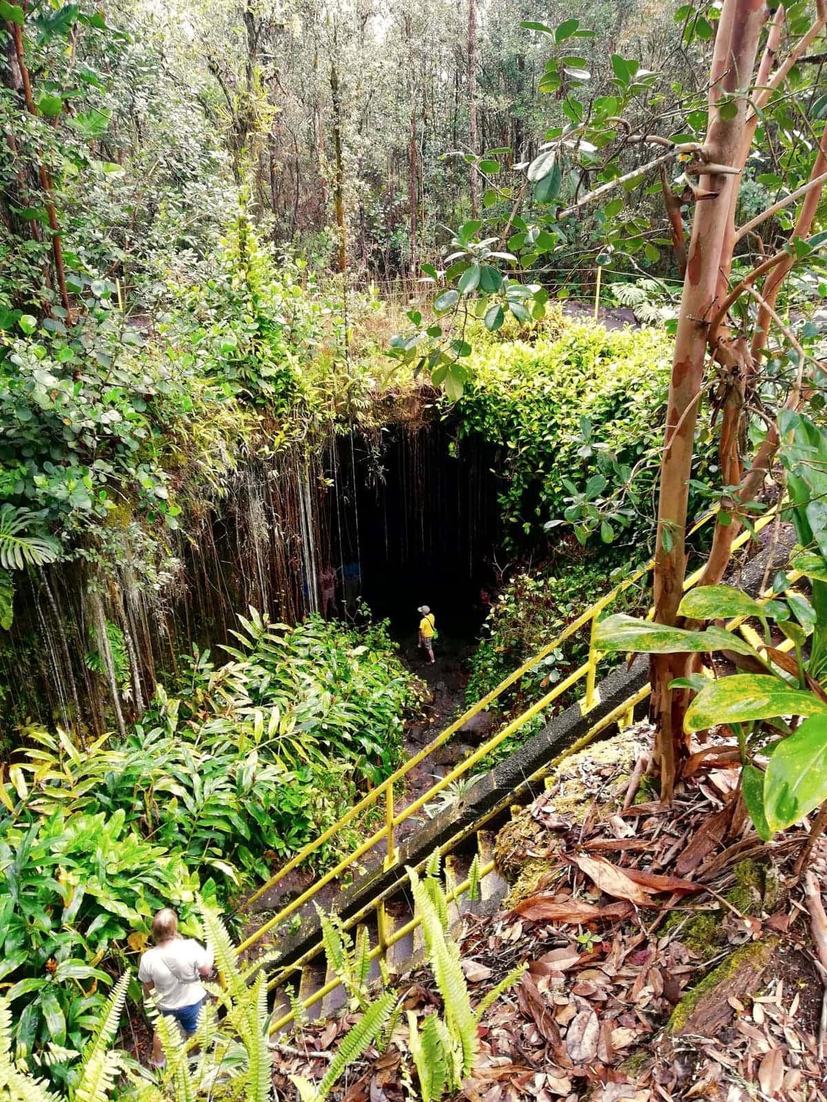
Climb down a steep ladder to get to the lava tube entrance of the Kaumana Caves close to Hilo
Guided volcano tours are perhaps an especially good option when there is no eruption. The advantage of these tours is that their guides are expertly trained and provide a wealth of volcano-related information. Volcano-related tours generally take you on fascinating hikes through the park, private lava tubes, and many other stunning places that are difficult to find or reach without a guide.
Volcano, Chocolate, & Waterfalls (in-depth volcano experience from Kona)
This experience takes you off-the-beaten path to journey through Hawaii Island’s incredible range of ecosystems and climate zones to learn all about volcanoes. An in-depth volcano experience on the Island of Hawaiʻi. National park certified guides share a mix of natural and cultural history about the island's formation, illuminating the stories behind the ever-changing landscape of our island home.
from:
$295
What is a suggested tour?Our suggested tours are hand-picked tours that receive consistent good reviews, give back to the community, and work hard to minimize their impact on the environment. Read more about these tours on our website.We list some very well-respected tour operators that offers these tours in our volcano tours section.
Ongoing and historic eruptions
There are five (!) active volcanoes in the state of Hawaiʻi: four on the Big Island (Mauna Loa, Kilauea, Hualalai and, still under water but ever growing, Kama‘ehuakanaloa) and one on Maui (Haleakalā). The Kilauea volcano is one of the most active volcanoes in the world and is currently erupting.
We summarize for you below the most recent eruptions:
Kilauea
- The December 2024 Kilauea summit eruption
- The September 2024 Kilauea summit eruption
- The June 2024 Kilauea summit eruption
- The September 2023 Kilauea summit eruption
- The June 2023 Kilauea summit eruption
- The September 29, 2021 eruption in the Halemaʻumaʻu crater
- The December 20, 2020 eruption in the Halemaʻumaʻu crater
- The lower East Rift Zone (LERZ) eruption (2018)
- The 61g eruption (2016 – 2018)
- 7 earlier eruptions
- How to best check the eruption progress yourself (online resources)
Mauna Loa:
- The November 27, 2022 Mauna Loa eruption
1: The December 2024 Kilauea summit eruption
The eruption began at approximately 2:20 a.m. on December 23, 2024, and lava fountains were observed with heights up to 80 meters (262 feet) several hours later. You can see an up-to-date timeline of the eruption episodes since then here.
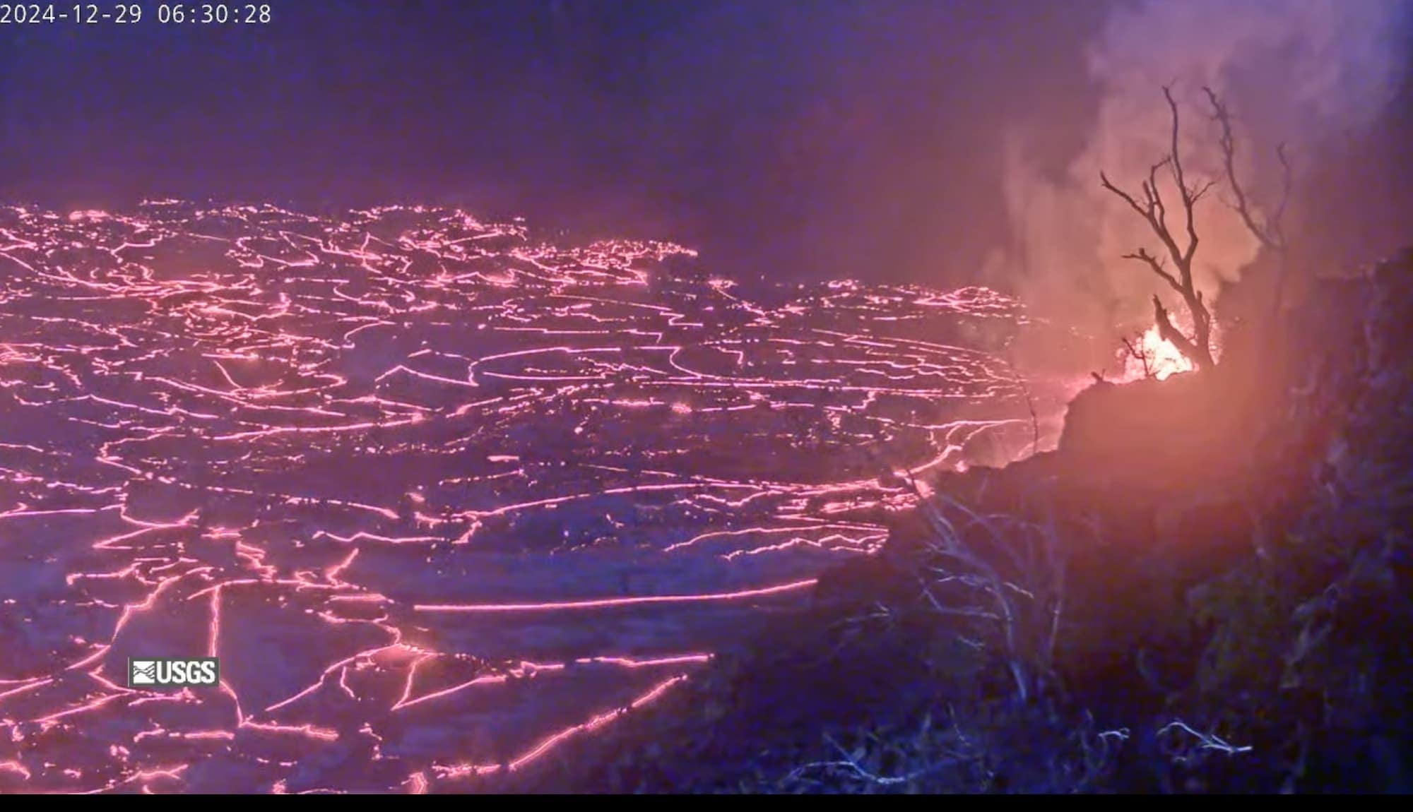
Lava fountaining within the Halemaʻumaʻu crater on the early morning of December 29, 2024. Image credit: USGS.
2: The September 2024 Kilauea summit eruption
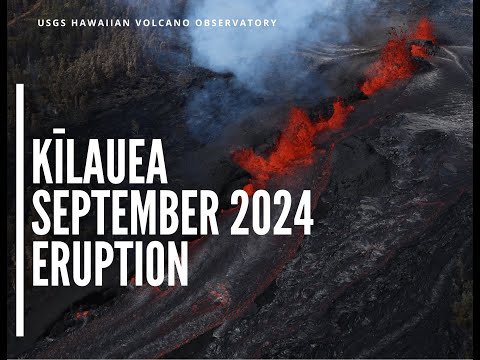
This eruption started on the night of September 15, 2024 and lasted 5 days.
Several vents within and between Makaopuhi and Nāpau Craters opened over a span of several days, with as highlight vents west of Nāpau Crater which erupted lava that cascaded as lavafalls down into the crater.
See the USGS video below for a short summary of the eruption.
3: The June 2024 Kilauea summit eruption
This very short-lived eruption of the Kīlauea volcano began at approximately 12:30 a.m. HST on Monday, June 3, 2024 and was over within 12 hours. See the pictures below for footage.
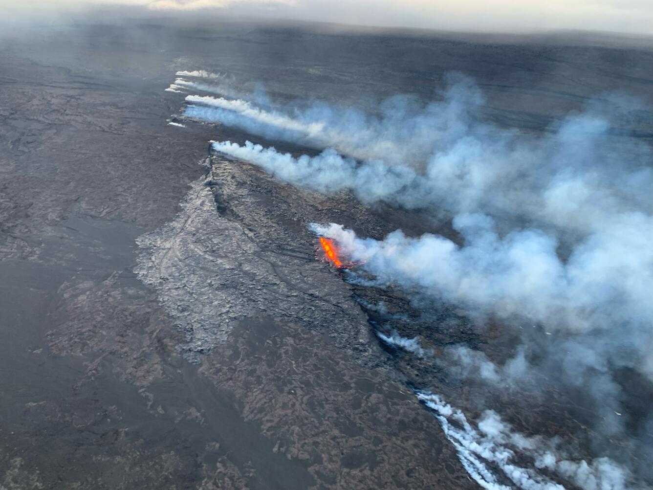
Aerial image of the Southwest Rift Zone eruption of Kīlauea, viewed during an overflight at approximately 6 a.m. on June 3, 2024. USGS image.
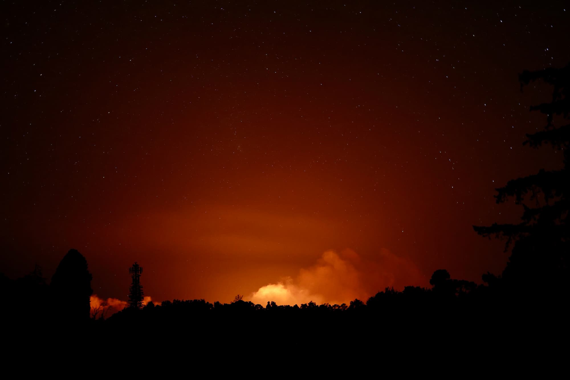
Kīlauea’s eruption plume illuminated during the early morning hours of June 3, 2024, visible from the Volcano Golf Course area. USGS image by D.A. Phillips.
4: The September 2023 Kilauea summit eruption
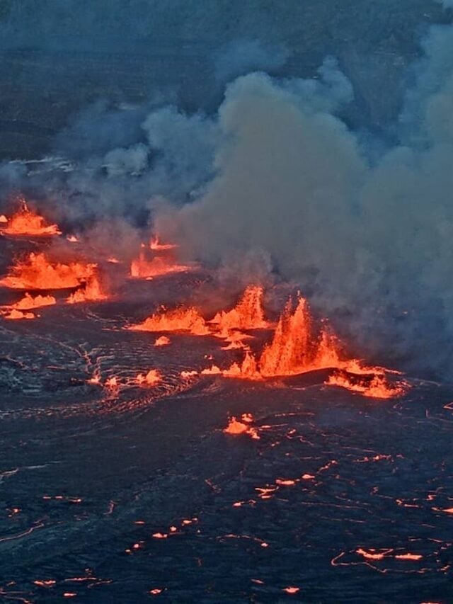
The newest eruption that began Sunday, September 10, started as a lava fountains bursting from within Halemaʻumaʻu. It ended on September 16, 2023.
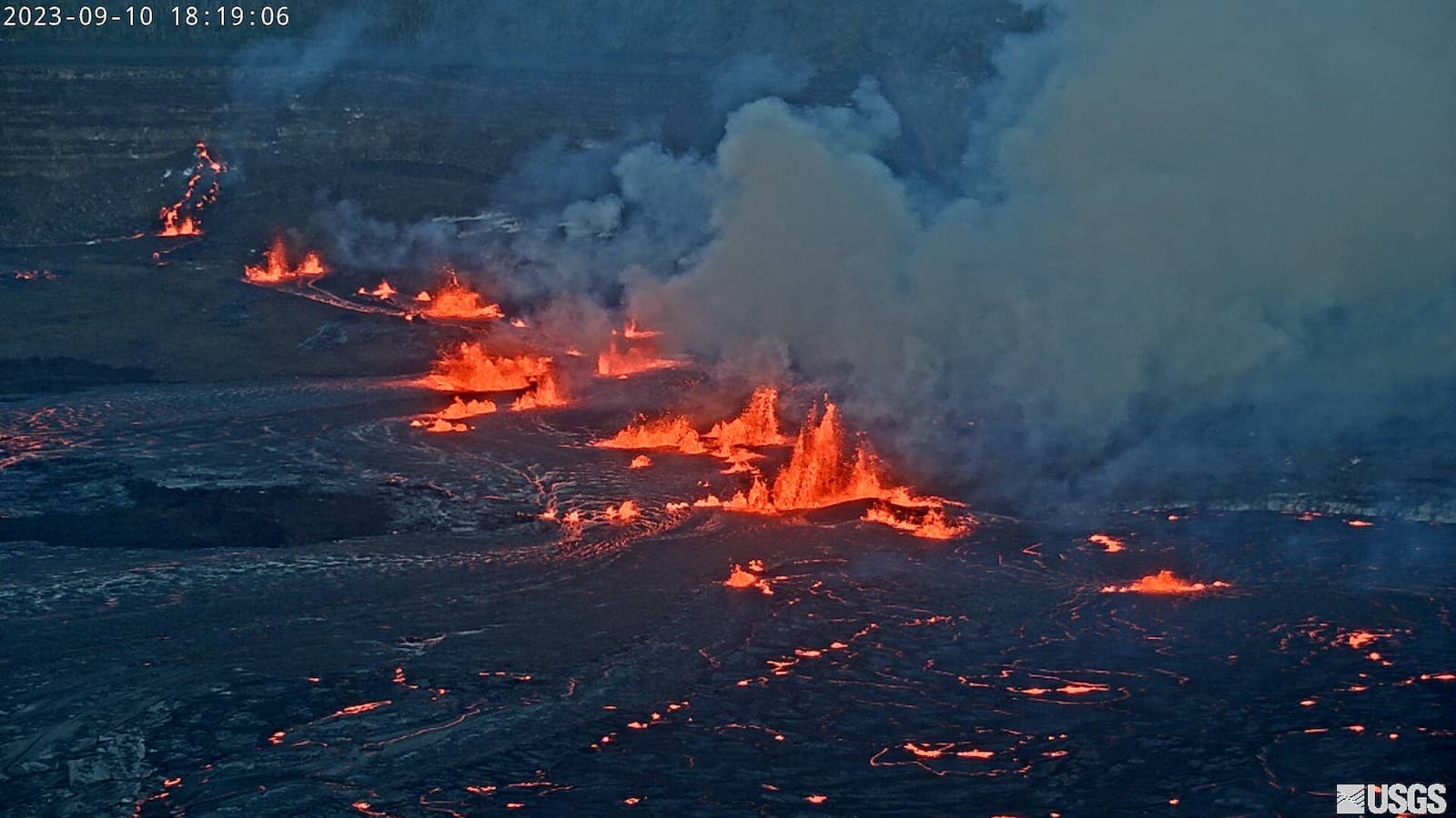
See a short summary of this spectacular but short summit eruption here.
5: The June 2023 Kilauea summit eruption
At approximately 4:43 a.m. HST on June 7, 2023, a new eruption started within Halemaʻumaʻu crater in Kīlauea’s summit caldera, within Hawai‘i Volcanoes National Park.
The eruption ended on the afternoon of June 19th. Seismic tremor—a signal resulting from subsurface fluid movement, and commonly associated with eruptive activity—started dropping around 4:00 p.m. Also, tiltmeters in the summit region detected a quick transition to inflationary tilt after tracking steady deflationary tilt since the morning of Saturday, June 17.
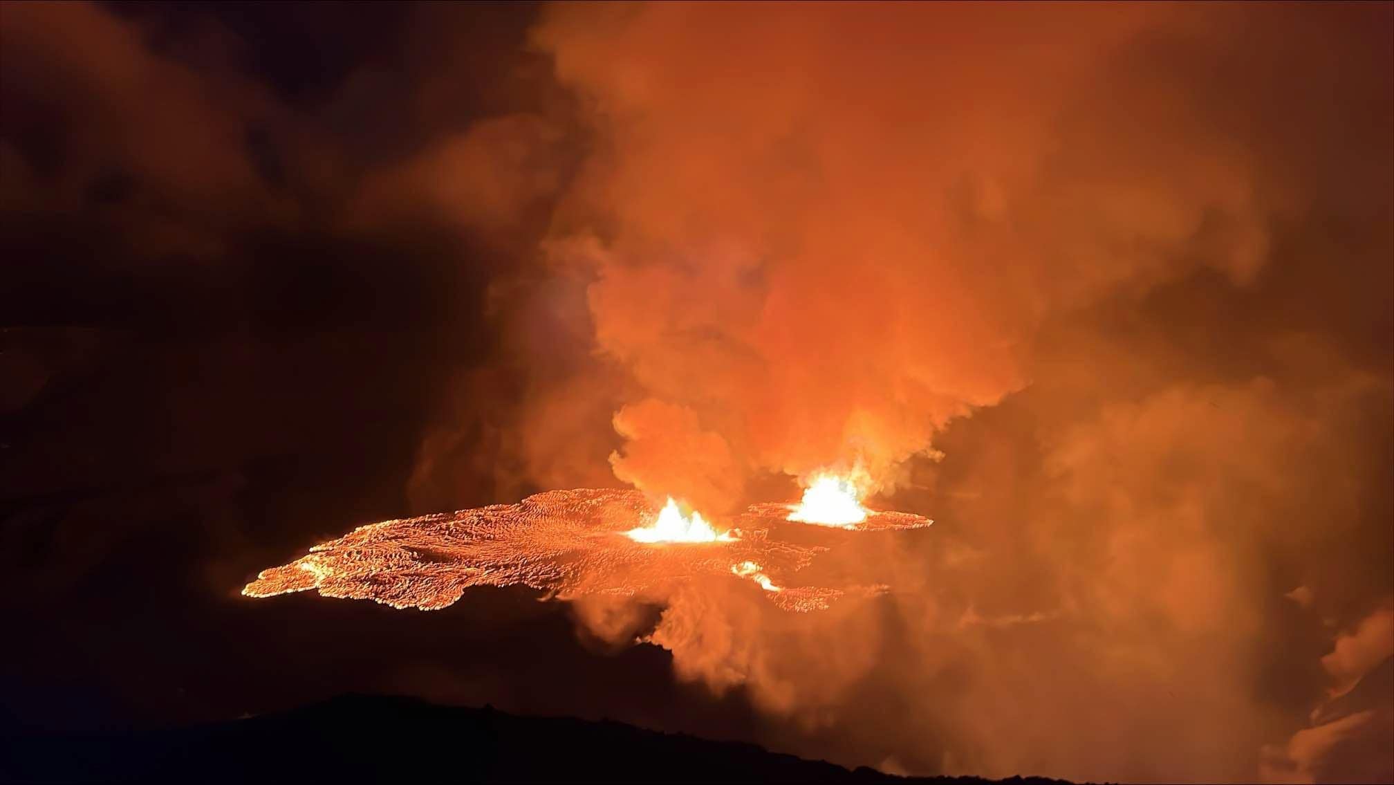
Kīlauea volcano started a new eruption in the Halemaʻuma crater at approximately 4:44 a.m. HST on June 7, 2023. Image credit: USGS
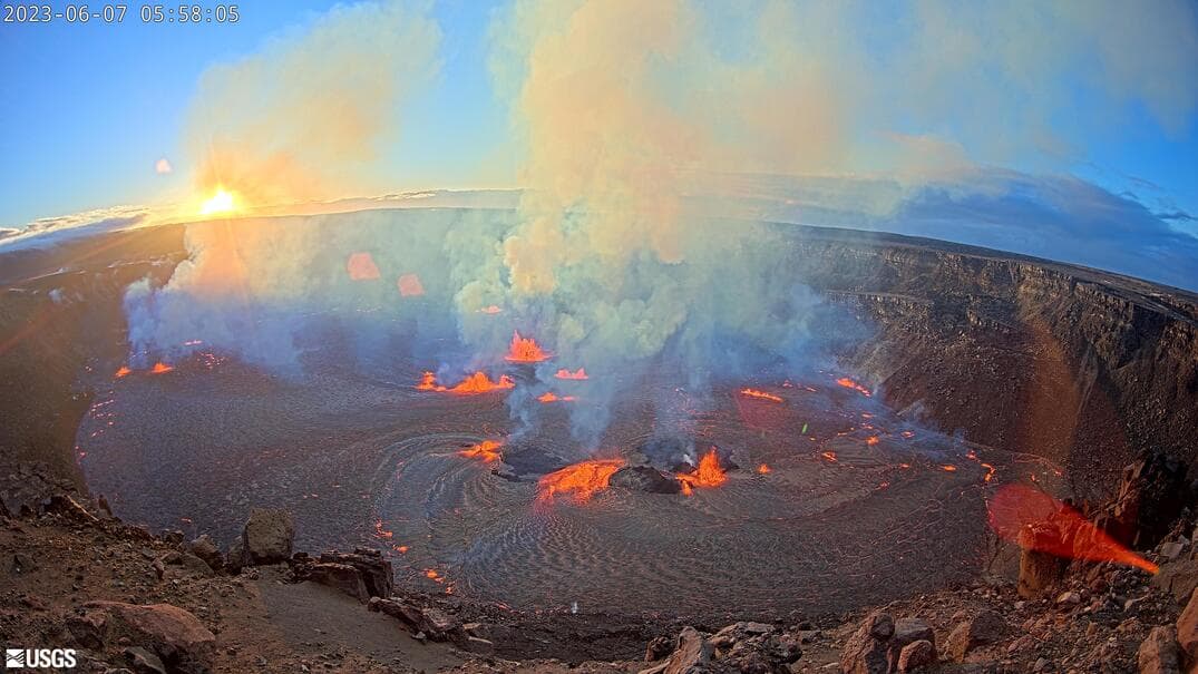
A first sunrise for the June 7, 2023 summit eruption in the Hawaiʻi Volcanoes National Park.
6: The September 29, 2021 eruption in the Halemaʻumaʻu crater
This eruption took place between September 29, 2021 and March 7, 2023.
No homes or infrastructure were threatened, and excellent views of her massive glowing, churning, flowing, fountaining lava lake were available from numerous overlooks along Kīlauea caldera rim for many months. The crater floor rose around 43 feet (13 meters) during the last 3 months and the full extent of new lava was mapped at 292 acres (118 hectares)!
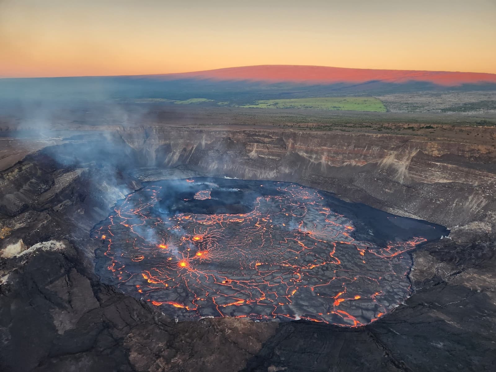
Aerial view of the 2023 eruption within Halema‘uma‘u crater. The eruption remained confined to Halemaʻumaʻu crater in the summit caldera and lava flows have inundated much of the crater floor (which is nearly 300 acres or 120 hectares). Mauna Loa is illuminated in the morning light in the background. Image credit: USGS.
7: The December 20, 2020 eruption in the Halemaʻumaʻu crater [ended]
This recent eruption within the Kīlauea’s summit caldera lasted from December 20, 2020 to mid-May 2021. The water lake that was previously forming in Halemaʻumaʻu disappeared and was replaced by a lake of lava. As of May 26, the Hawaii Volcano Observatory announced that the Kilauea Volcano is no longer erupting. Lava supply to the Halemaʻumaʻu lava lake has ceased and sulfur dioxide emissions have decreased to near pre-eruption background levels.
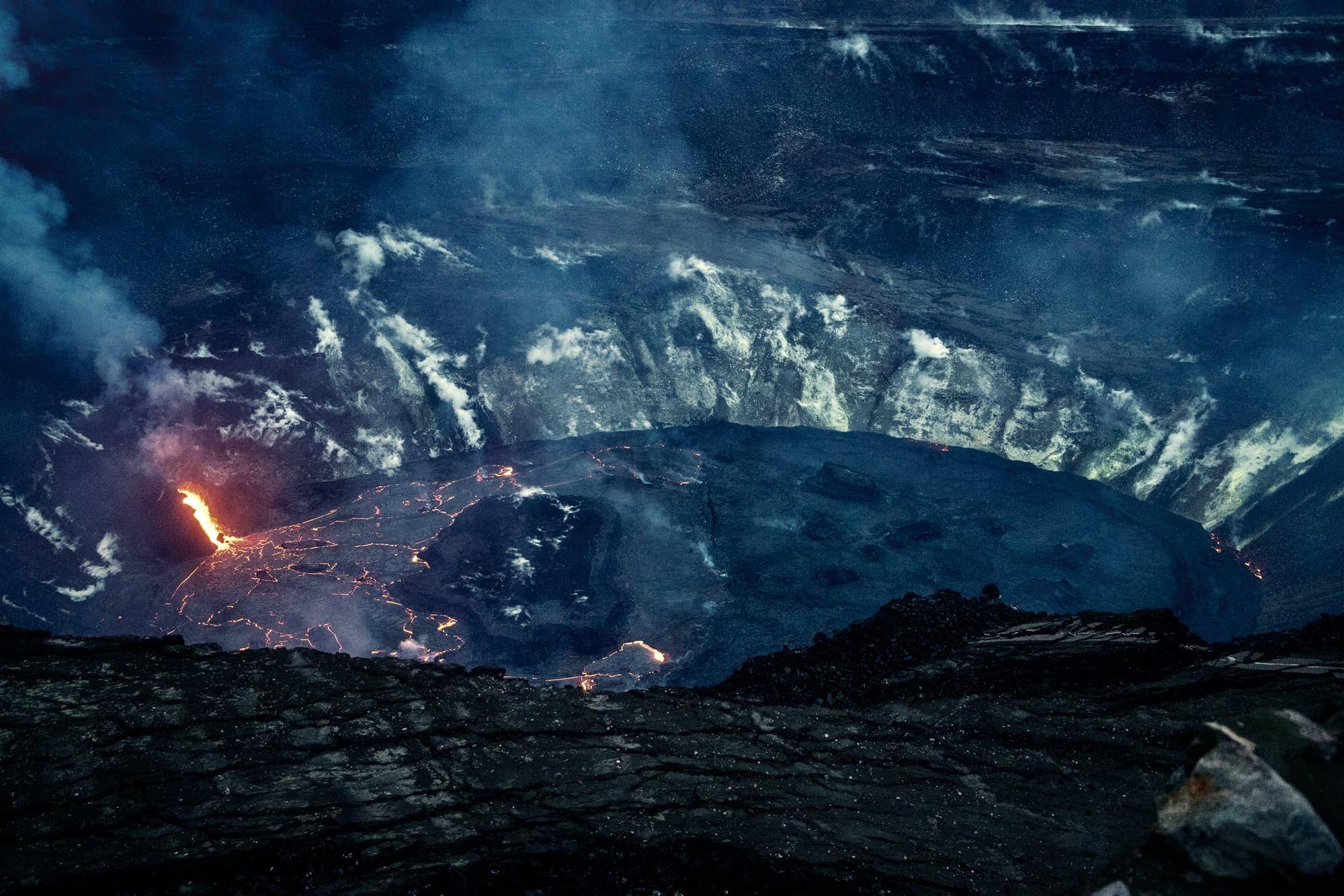
This photo, taken on January 19 2021, shows the slowly filling up Halemʻaumaʻu crater lava lake. This photo was taken by a HVO scientist from a for the public inaccessible part of the park. USGS photo by. H. Dietterich (public domain).
8: Kīlauea Volcano lower East Rift Zone / Lower Puna eruption [2018 LERZ]
The Kīlauea Volcano lower East Rift Zone (LERZ) eruption in lower Puna was preceded by the collapse of the Puʻu ʻŌʻō vent on April 30th and the onset of the draining of the Halamaʻumaʻu lava lake on May 2nd. On the 3rd of May 2018 several fissures in the Leilani Estates subdivision opened, marking the start of this new eruptive episode that didn’t stop until early September 2018: the Lower East Rift Zone eruption.
You can also find a really interesting summary of the LERZ eruption summarizing things that we have learned from this event in the journal of Science (our tip: start by browsing the figures and reading the chapter called “Synthesis of 2018 activity” to get a good overview of the article contents). Another good place to learn more is by this cool narrative put together by the USGS.
The 2018 Lower East Rift Zone eruption in numbers:
- 13.7 square miles of land inundated by lava (the surface of almost 6631 football fields!)
- 875 acres of new land created by ocean entries
- 716 dwellings destroyed by lava
- ~30 miles of roads covered by lava
- ~1 billion cubic yards of lava erupted (enough to fill at least 320,000 Olympic-size swimming pools!)
- ~60,000 earthquakes between April 30–August 4, 2018
Videos of the 2018 LERZ eruption
The best way of getting to know a volcano is to see it, and the same goes for individual eruptions. Many impressive and educational videos have been made about this eruption, but we highlight 1 here
ʻAilaʻau: Forest Eater
This is a short film by Lance Page from Page Films that takes viewers on a journey through the infamous 2018 eruption of Kilauea’s lower east rift zone. No text but 8 minutes of mesmerizing footage and sounds that make you feel like you were there. Highly recommended!
9: The 61g lava flow [2016-2018]
A breakout from the east flank of Pu‘u ‘Ō‘ō on May 24, 2016 marked the end of another fissure eruption on the flank of the Puʻu ʻŌʻō which started almost two years earlier on June 27, 2014. This was just in time for nearby residents, as the June 27th flow came very close to reaching the city of Pahoa.
This breakout was later named the 61g flow (Episode 61, “g” lava flow). It reached the base of the Pulama Pali by the end of June and entered the sea at Kamokuna on July 26, 2016.
Between July 2016 and March 2018 it was possible to see the ocean entry of lava flow 61g close to Kamukuna both from land and from the sea. In March the up-to-then stable ocean-entry plume stopped being visible, and the Puʻu ʻŌʻō crater collapse on April 30th, 2018 marked the end of the 61g eruption.
The 61g eruption was especially easy to see because the lava was slow-moving and accessible from both sides within the park. The presence of a nearby gravel road made the hike to the flow relatively easy and even allowed bike rentals to operate!
Past eruptions between 1924 and 2018
Kilauea is the youngest and most active Volcano in the state of Hawaii. The oldest lava flows belonging to Kilauea are dated between 210,000 and 280,000 years ago which is pretty young for a volcano. Its eruptions over the last 1000 years have shaped the whole south east side of the island and cover about 90% of its surface.
The last 100 years of volcanic activity can be divided in 7 eruptions. Click on the link in each episode to read an interesting summary on the USGS website.
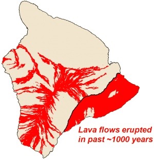
The Island of Hawai‘i with lava flows erupted in approximately the past 1,000 years shown in red. Image credit: USGS
- The May 1924 explosive eruption of Kīlauea in Halemaʻumaʻu (with the most powerful explosions at Kīlauea since the early 19th century)
- The Kīlauea 1955 Lower East Rift Zone Eruption in Lower Puna (the first eruption in historic times to occur in any populous area in a U.S. territory)
- The 1959 eruption of the Kīlauea Iki Crater (580 m (1,900 ft) high lava fountains!)
- The 1960 Kapoho eruption (when barriers were built in an attempt to divert lava flows)
- The 1969-1974 Mauna Ulu Eruption (with lava falls higher than Niagara)
- The Kīlauea’s summit eruption, 2008 – 2018 (lava lake viewing at the summit!)
- The 1983 – 2018 Pu‘u ‘Ō‘ō Eruption (read more about the latest two episodes below)
Did you know the air force once bombed a lava flow that threatened Hilo in 1935? Read about the Volcanic History of Hawaii in our blog if you want to learn more about the history of all 6 Big Island volcanoes, or the chapter below to learn about the most recent eruptive episodes of the Kilauea volcano:
Best online resources to monitor the eruption progress:
You can find a plethora of information about ongoing eruptions online, though not all of it is correct. Unfortunately, many news outlets over-sensationalize events for their own profits, which leads to a lot of misinformation.
Two official (USGS) resources that we keep an eye on and that can help you keep up-to-date with the status of possible ongoing eruptions are:
- The daily Kilauea volcano lava flow update
- The often updated USGS multimedia gallery.
The November 27, 2022 Mauna Loa eruption
The 2022 Maunaloa eruption is over and there is no active lava visible on the surface.
The Maunaloa eruption is over
Read our complete Mauna Loa Update Summary that includes a Q&A, pictures, and more information on the recent Maunaloa eruption.
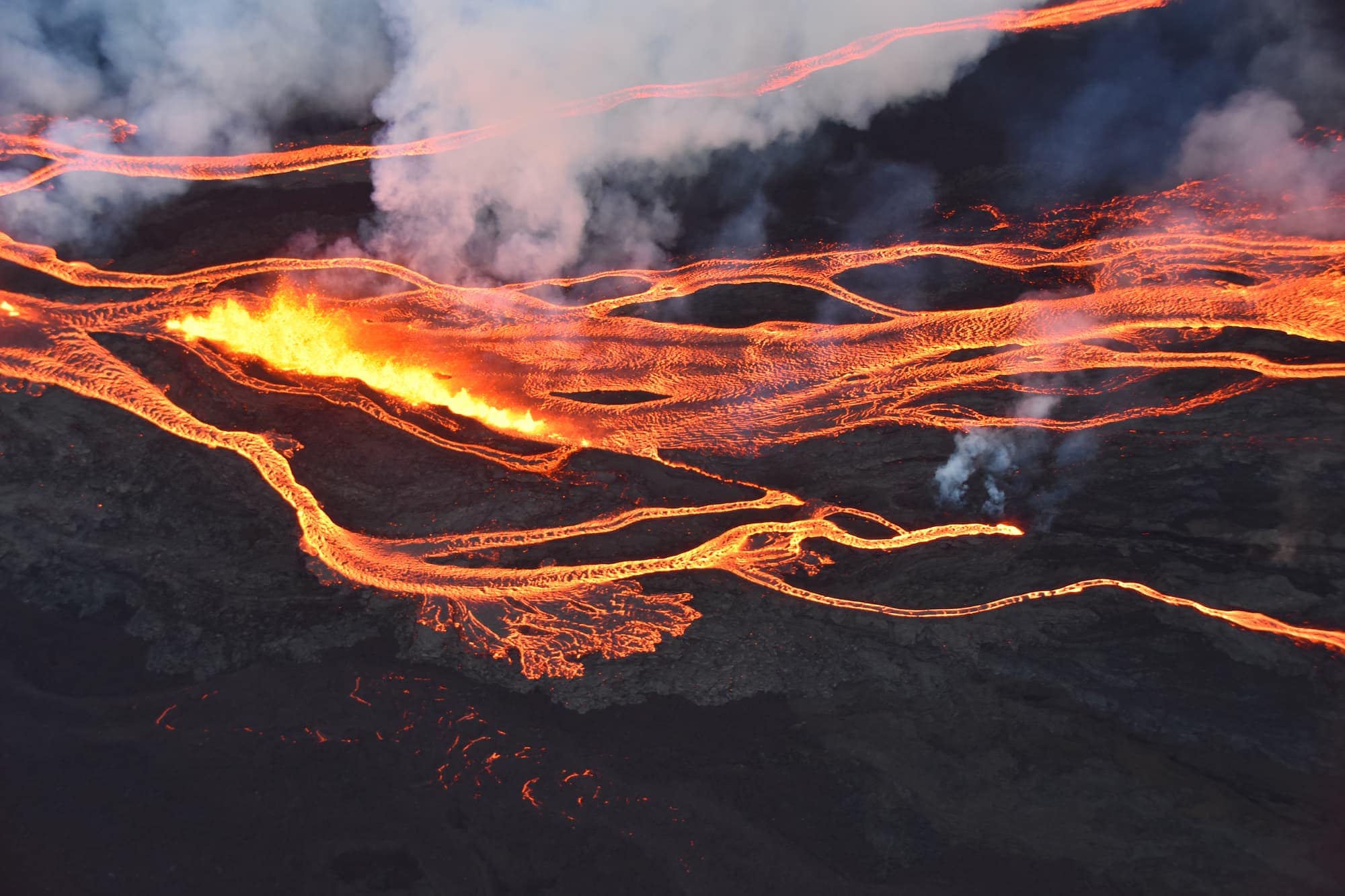
Aerial photo of the ongoing Maunaloa eruption showing the a line of fissure vents erupting above 10,000 ft elevation on the Northeast Rift Zone. Image courtesy of Civil Air Patrol.
Safety and Practical Information for seeing the lava
Volcanic fumes are hazardous to your health. Persons at risk of respiratory problems or with heart problems, pregnant women, infants, and elderly people, are all discouraged from engaging in this activity. Getting close to the lava flow is both spectacular and risky and it is very important to realize that hiking out to the lava unprepared can put you in harm’s way.
You can use the following resources to learn about these safety hazards and how to avoid them:
1: Hiking to the lava: stay out of closed areas and be prepared!
We recommended that you wear comfortable socks and walking shoes or hiking boots when hiking out. Pack sunscreen and water together with your camera. If you plan to view the lava flow after dusk, remember to bring one flashlight per person and replacement batteries. The Kilauea is a dynamic volcano, and lava viewing conditions change daily. Even if a viewing area is organized by the National Park, this does not guarantee close access of the lava. Often a 1+ hour hike over hazardous terrain is necessary to reach the flow front of the lava.
If you want to be well prepared take 4 minutes and watch this video about safe lava viewing of ocean entries made by the Hawaii Volcanoes National Park staff. It is especially good to watch if you want to get as close as possible to lava ocean entries while staying safe:
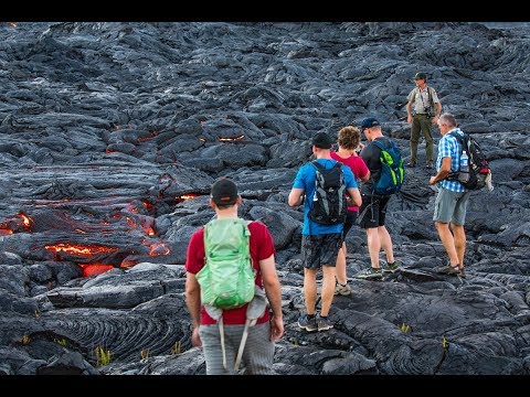
We can’t overemphasize being prepared for the hike. Far too many times, ill-prepared people (most often tourists) go on a lava hike wearing sandals and flip flops. Such footwear is not appropriate or safe for the rough lava surfaces, and wearing them may force you to return home prematurely without having seen the lava. If you plan on staying past sunset (and we highly recommend this), each person should carry their own flashlight for the walk back (see “Guided lava tours“).
2: Safety concerns at the lava ocean entry
Please be aware that lava ocean entries can create extremely dangerous conditions. The two main concerns regarding your safety if you want to see the lava flow into the ocean are:
- The stability of the new land you are standing on (the lava bench)
- The noxious gasses that are released when the lava meets the ocean.
Stability of the new land
Newly created land is inherently unstable and much of the new land will collapse back into the ocean after a while.
Park rangers keep a close eye on the stability of the lava bench and limit the lava viewing area based on what they judge to be safe. This safe distance is based on visual inspection and thermal imaging and is was set, for example, at 1/2 mile or 820 meters for the now now inactive Kamokuna episode (see image below).
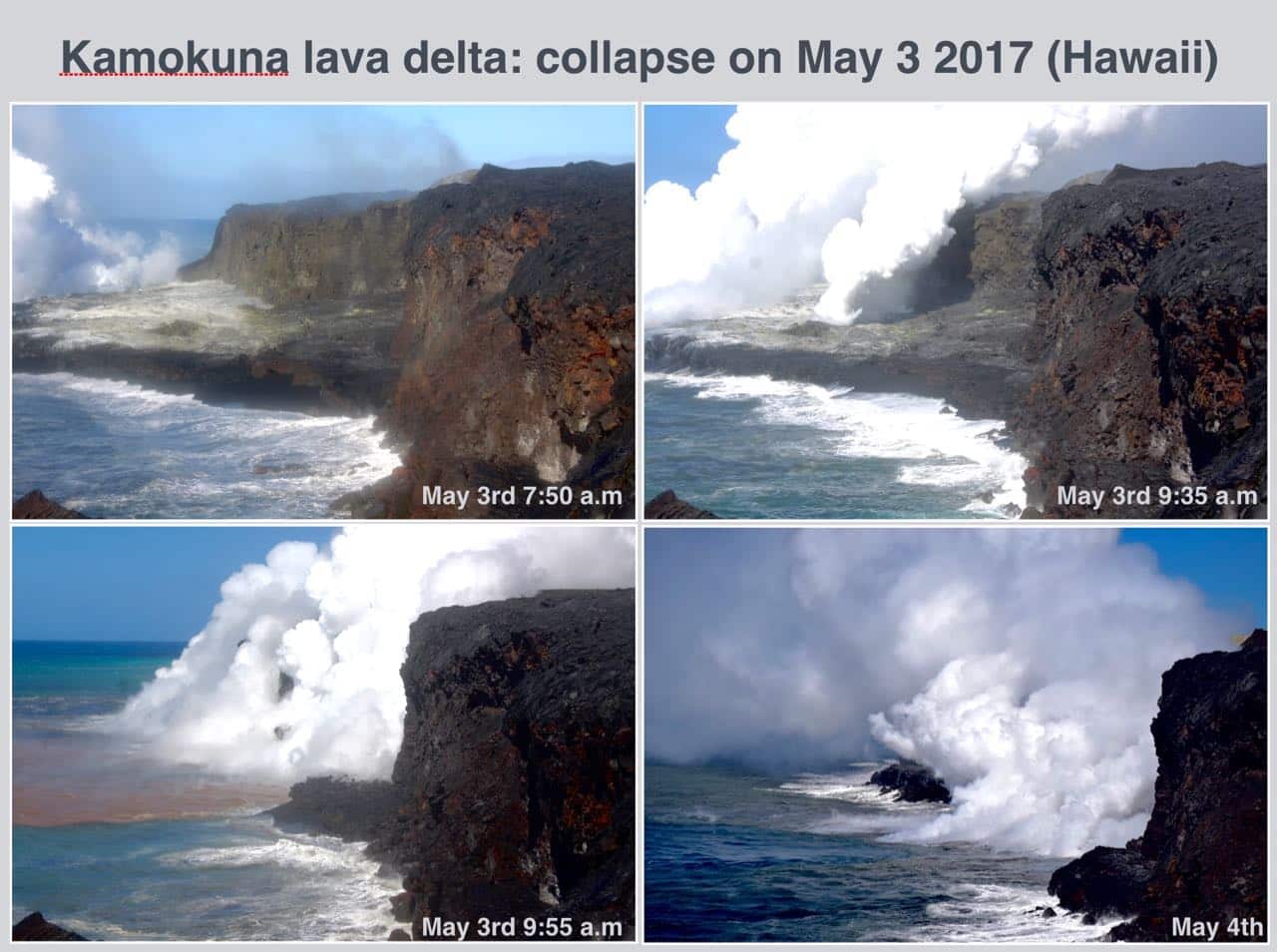
On May 3rd a large part of the Kamokuna lava delta collapsed into the ocean within minutes. Collapsing lava benches can cause a small tsunami and the associated explosions can hurl hot rocks over a large distance. Credit all images: USGS
Collapses like this may even trigger small tsunamis of scalding hot water. Please follow any instructions given by park rangers regarding a safe viewing distance.
Noxious Gases
It is very important to stay away from the plume when you are watching the lava enter the ocean. In general, the wind carries this noxious ocean entry plume offshore and out to sea during nighttime and early mornings. From mid-morning through late afternoon the wind sometimes shifts and carries the plume onshore/along the coast.
The white plume is very hot and contains super-heated steam and many chemicals that range from unhealthy to lethal. The water droplets in the plume can be as corrosive as battery acid. Read more about the dangers of scalding water, steam plumes and poor air quality on the USGS website.
3: Vog (volcanic air pollution)
Contrary to what many may expect, the Big Island has problems with air pollution during active surface flows. This volcanic pollution is called ‘vog’, a blend of the words “smog”, “fog” and “volcanic”, and it is so normal here that it is part of the common language on the Hawaiian Islands.
Vog is a form of hazy air pollution much like smog. It is created when sulfur dioxide gas emitted by the Kilauea volcano reacts with oxygen and moisture in the presence of sunlight. Just like smog, there are certain health hazards associated with vog.
You can find voggy conditions in the downwind direction of all eruptive sites. Because the dominant wind directions are east and north-east, the areas most affected by fog are those south and southwest of these sites. The USGS has teamed up with IVHHN/Durham university and HDOH to form the Interagency Vog Dashboard where you can find specific vog advice for visitors to Hawaiʻi.
1. We are part of the hawaiiactivities affiliate program. Read more about our participation. ↩