
Wake up in Volcano Village rainforest at 4,000 feet and you can stand on a dry Kona beach by early afternoon, though the drive takes a good two hours each way. One base for the whole island means long daily drives. The Big Island has four main regions, each a different climate and a different base: rainy Hilo on the windward east, warm and dry Kona with the beaches and snorkeling, rainforest Volcano Village beside the national park, and cool cowboy country in Waimea at 2,676 feet.
Pick your bases by what you want to wake up to, not by what looks central on a map. Spend a few nights in two or three regions, and use the driving-distance map below to decide how many.
Table of contents
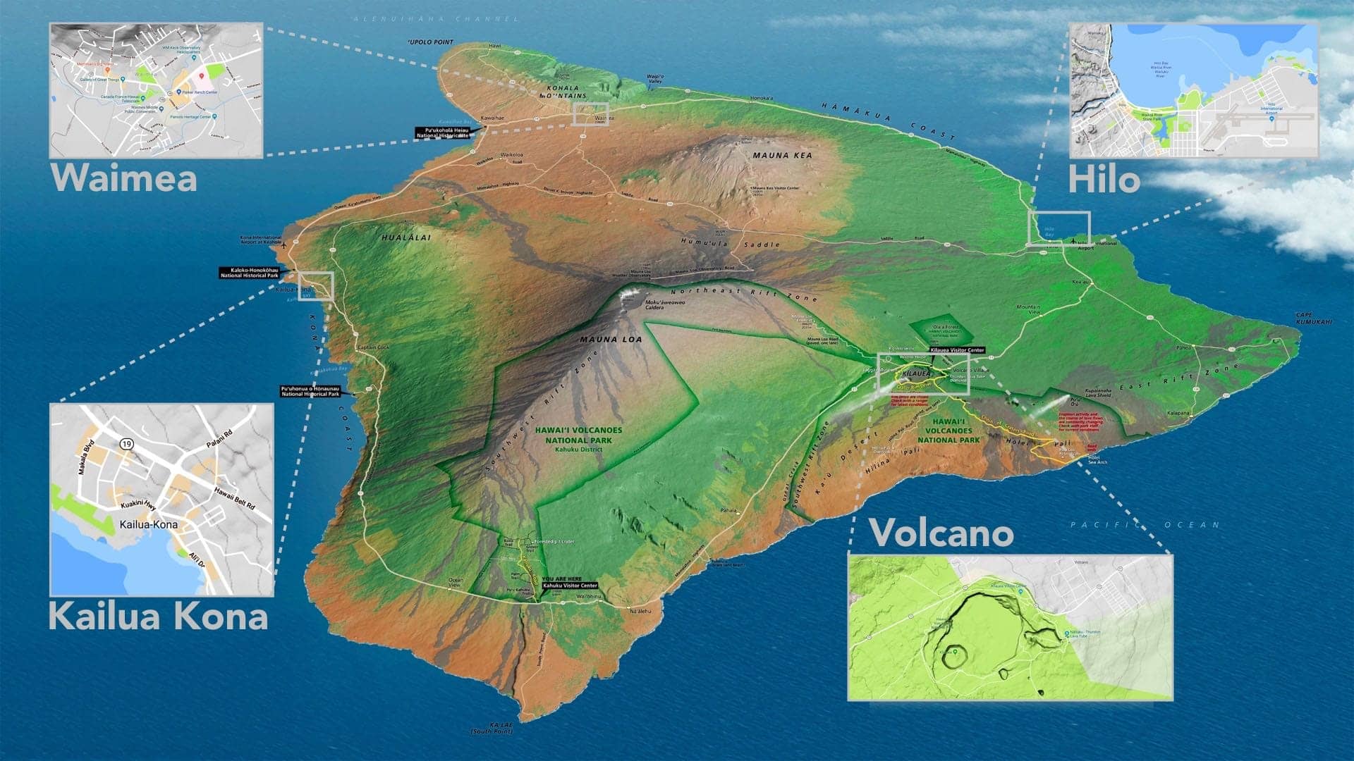
The four best places to use as a home base: Hilo (the capital), Kailua-Kona (sun and beaches), Waimea (valleys and cowboys), and Volcano Village (rainforest and the national park).
Map of the Big Island
The Big Island is big: about 4,000 square miles, larger than all the other Hawaiian islands combined, with a wet windward east and a dry leeward west split by two 13,000-foot volcanoes. The map below shows the four regions, the main towns, and the driving times between them. Saddle Road (the Daniel K. Inouye Highway) cuts across the middle, so the Hilo-to-Kona crossing over it is the island’s fastest.
The main towns, by region:
- East (Hilo and Hāmākua): Hilo, Honokaʻa, Laupāhoehoe, Pāhoa
- West (Kona): Kailua-Kona, Hōlualoa, Kealakekua, Captain Cook
- South (Volcano and Kaʻū): Volcano Village, Pāhala, Nāʻālehu
- North (Waimea and Kohala): Waimea (Kamuela), Waikoloa, Hāwī, Kapaʻau
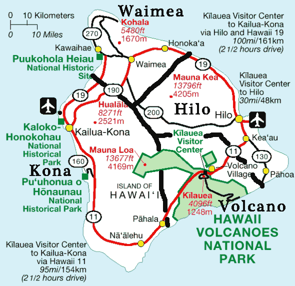
Map of the Big Island with driving distances and time estimates for trips based in Volcano Village.
Where to stay: the four home bases
These next four regions are where we would sleep: one distinct climate each, and enough nearby to fill your days. The four districts after them, Puna, Kaʻū, Kohala, and the Hāmākua Coast, are worth a day out from a nearby base, but not a place to unpack for several nights. Traveling with kids, our Big Island with kids guide covers these same bases for families, plus the drive times that matter most with children in the car.
Hilo (the rainy capital)
Hilo is the island’s capital and its rainy side, a working town on the windward east coast that gets rain and clouds, not resort sunshine. It rains often and the pace is slower than in Kona, It is tropical and low-key. This is our favorite city on the Big Island. Read more in our Hilo area guide.
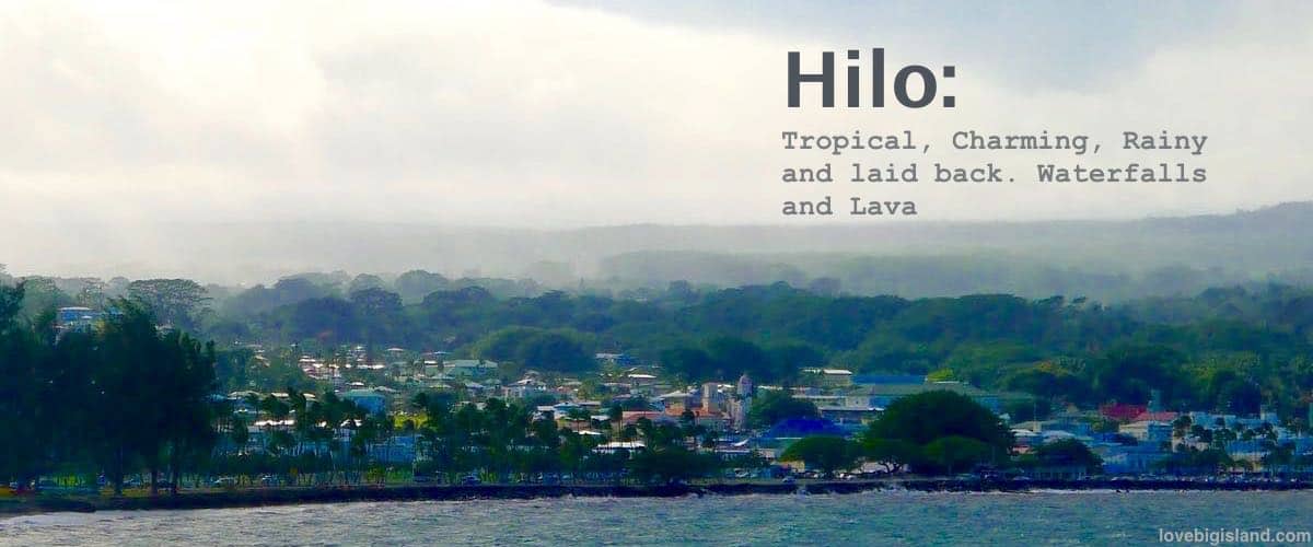
Hilo is the capital of the Big Island
Kailua-Kona (sun and beaches)
Kona is the dry, sunny side, warm almost every day with the odd afternoon shower. The white-sand beaches sit to the north, and the snorkeling and Kona coffee farms run down the lava coast to the south. Kailua-Kona has the most nightlife on the island: a compact strip of restaurants, bars, and two brewpubs. Read more in our Kailua Kona area guide.
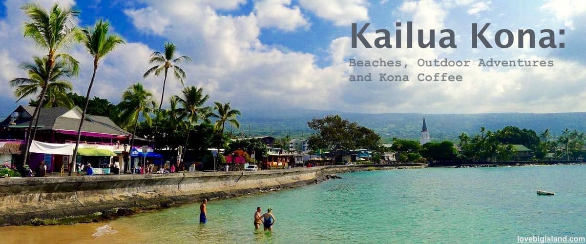
Kailua Kona is the outdoor-capital of the Big Island. Beaches, water sports and Kona Coffee
Volcano Village (rainforest and the park)
Volcano Village sits in cool rainforest at the 4,000-foot line, right at the entrance to Hawaiʻi Volcanoes National Park. It rains often and the nights turn cold, a different Hawaiʻi than the coast. With no traffic, no crowds, and no streetlights, it is our favorite base for a few nights at the park and the nearby Puna and Kaʻū districts. Read more in our Volcano Village area guide.
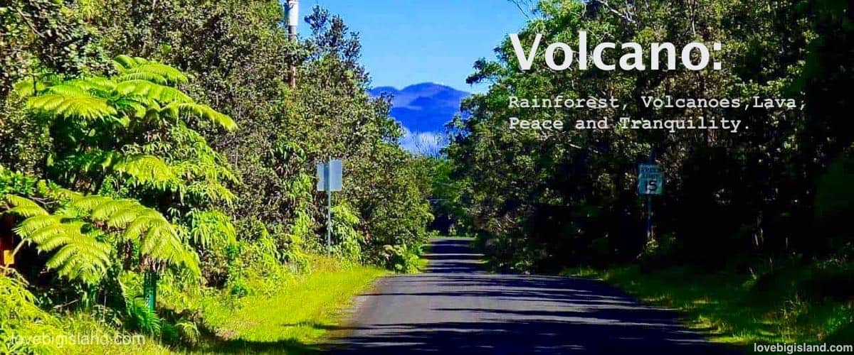
Volcano Village on the Big Island is a good base for exploring Hawaiʻi Volcanoes National Park
Waimea (cowboy country)
Waimea sits at 2,676 feet on the flank of Kohala, the oldest of the island’s five volcanoes. The nights are cool and the skies dark and clear, and the rolling green hills are cattle country worked by Hawaiian cowboys, the paniolo. From here you have quick access to the Waipiʻo and Pololū valley lookouts and the white-sand beaches of the Kohala Coast. Read more in our Waimea area guide.
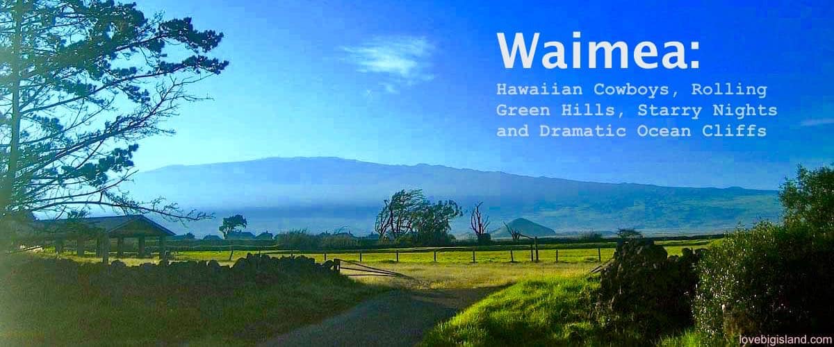
Waimea sits at 2,676 ft, in the cool, dry Hawaiian highlands.
Compare nightly rates across the bases
Nightly rates vary a lot across the four bases. This chart tracks vacation rental rates per region from Hawaiʻi Tourism Authority data;.

Four more districts worth a day trip
Each makes a good day trip from the nearest region.
Puna
Puna is the island’s raw volcanic east, just past Hilo on Kīlauea’s East Rift Zone. The 2018 eruption buried homes in Leilani Estates and reshaped the coast, and you can still see it: new black-sand beaches at Pohoiki and Kaimū, the Red Road that lava crossed in places, and the Lava Tree monument. Pāhoa is the one real town, with Uncle Robert’s kava night on Wednesdays and the big Makuʻu farmers market on Sundays. Tread lightly here, because these communities are still rebuilding.
Read more in our Puna guide.
Kaʻū
Kaʻū covers the island’s empty southern tip, the stretch you cross between Volcano and Kona and the least-visited district on the island. Punaluʻu black-sand beach has green sea turtles hauling out on the sand, and Papakōlea is one of the few green-sand beaches anywhere, reached by a 2.5-mile walk with no shade. South Point (Ka Lae) is the southernmost spot in the United States. Fill the tank and pack food before you go: gas stations, restaurants, and cell service are scarce out here.
Read more in our Kaʻū guide.
Kohala
Kohala is the island’s oldest and northernmost corner, split in two. North Kohala is small-town and green: Hāwī and Kapaʻau, the original Kamehameha statue, and the Pololū Valley lookout, where a steep half-mile trail drops to a black-sand beach. South Kohala is the dry resort coast, with the island’s best easy-swimming beaches like Hāpuna and Mauna Kea Beach, and it wraps around Waimea. From December to March you can spot whales from the pullouts along Highway 270.
Read more in our Kohala guide.
Hāmākua Coast
The Hāmākua Coast is the green, wet stretch of about 40 miles running north from Hilo toward Waipiʻo Valley. It is one long scenic drive: the old Pepeʻekeo Scenic Drive past Onomea Bay, ʻAkaka Falls dropping 422 feet a short walk from the road, and former sugar towns like Honokaʻa, where Tex Drive Inn sells malasadas. Waipiʻo Valley sits at the north end, though descending into the valley is restricted and often closed, so plan on the overlook. Give it a full day.
Read more in our Hāmākua Coast guide.
Where is Waikoloa?
We leave Waikoloa off the four-region map because it straddles the Kona-Waimea border. Waikoloa sits on the border between Kona and Waimea and is the island’s resort coast, lined with big hotels and golf courses. The weather is dry and warm, the beaches are some of the island’s easiest for swimming, and the snorkeling at ʻAnaehoʻomalu Bay (A-Bay) is calm and shallow.