
Waimea Canyon is a 3,600-foot-deep gorge on the west side of Kauaʻi, and you can see it from the road. Drive-up lookouts sit at mile markers 10, 13.5, 18, and 19, so a hike is optional. Non-residents pay $5 per person plus $10 to park, with no reservation required.
Past the last lookout the road keeps climbing into adjacent Kōkeʻe State Park, with the hiking trails, the campground, and the natural history museum; one parking ticket covers both parks. Pack a layer: the rim sits near 3,500 feet and is colder than the coast. The 26-mile scenic drive fits into an afternoon; the trails, from a family loop just under 4 miles to the Kukui Trail’s 2,240-foot drop to the river, take a full day.
Table of contents
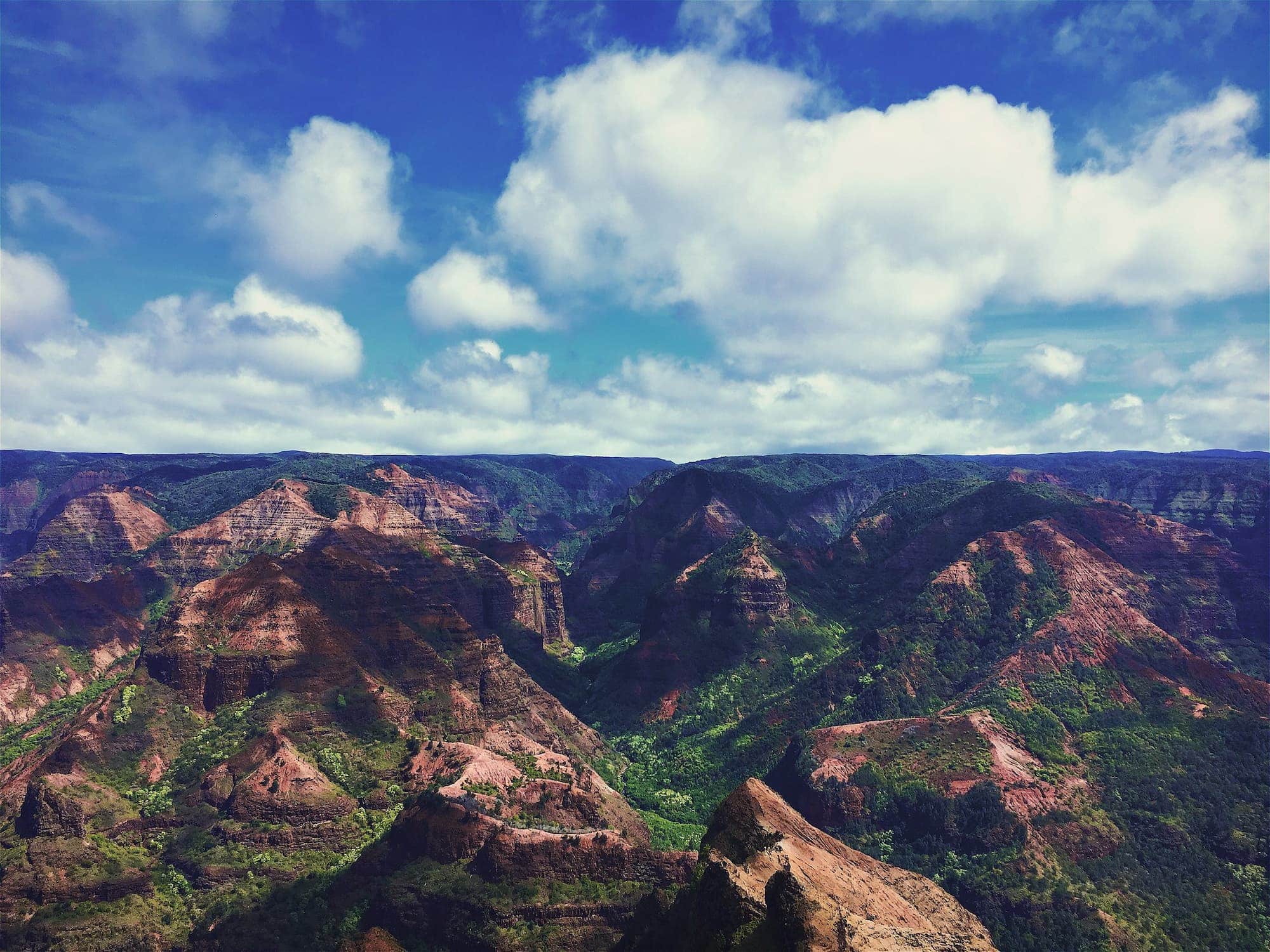
Waimea Canyon State Park, also called the “Grand Canyon of the Pacific.” Image credit: Trogers on Flickr.
How Waimea Canyon Formed
Two forces shaped it: the Waimea River steadily cutting down through Kauaʻi’s lava and basalt fields, fed by the island’s heavy rainfall, and a catastrophic collapse of the volcano that built Kauaʻi.
The name Waimea means “reddish waters”: after heavy rain, red rock washes off the walls and tints the river as it runs to the sea. The canyon is about 14 miles long and a mile wide, with walls dropping more than 3,600 ft (1,097 m), all enclosed within Waimea Canyon State Park (website).
Waimea Canyon is one of the island’s best-known sights and an easy addition to any Kauaʻi itinerary.
Waimea Canyon is ringed by hiking trails and lookouts, one of the best-known sights on the island and an easy addition to any Kauaʻi itinerary. In the following video by Chris Biela you can see a preview of Waimea Canyon:
Things to Do in Waimea Canyon and Kōkeʻe
The main activity is the 26-mile round-trip drive up one of Kauaʻi’s most scenic roads, climbing from the coast to the canyon rim. Ways to spend time in the park:
- Scenic drive
- Kōkeʻe State Park
- Lookouts and Viewpoints
- Hikes
- Camping
- Backpacking
- Tours
- Other Points of Interest
Scenic Drive
There are two highways you can take into the park: the Waimea Canyon Road (Highway 550) that starts from Waimea Town, and Kōkeʻe Road (Highway 552) departing from Kekaha a few miles to the west. Both roads merge just a few miles into the park.
Waimea Canyon Road is the easier and more scenic drive of the two. If you’re a first timer, we suggest that you take Highway 550 on your way to the canyon and head back via Highway 552 for a different view.
Kōkeʻe State Park
Kōkeʻe State Park is adjacent to Waimea Canyon State Park,. Most of the area’s marked trails start here, alongside the natural history museum, the Kōkeʻe Lodge restaurant, the cabins, and the campground. Entrance and parking fees are included in the Waimea Canyon fees: no additional payment is needed.
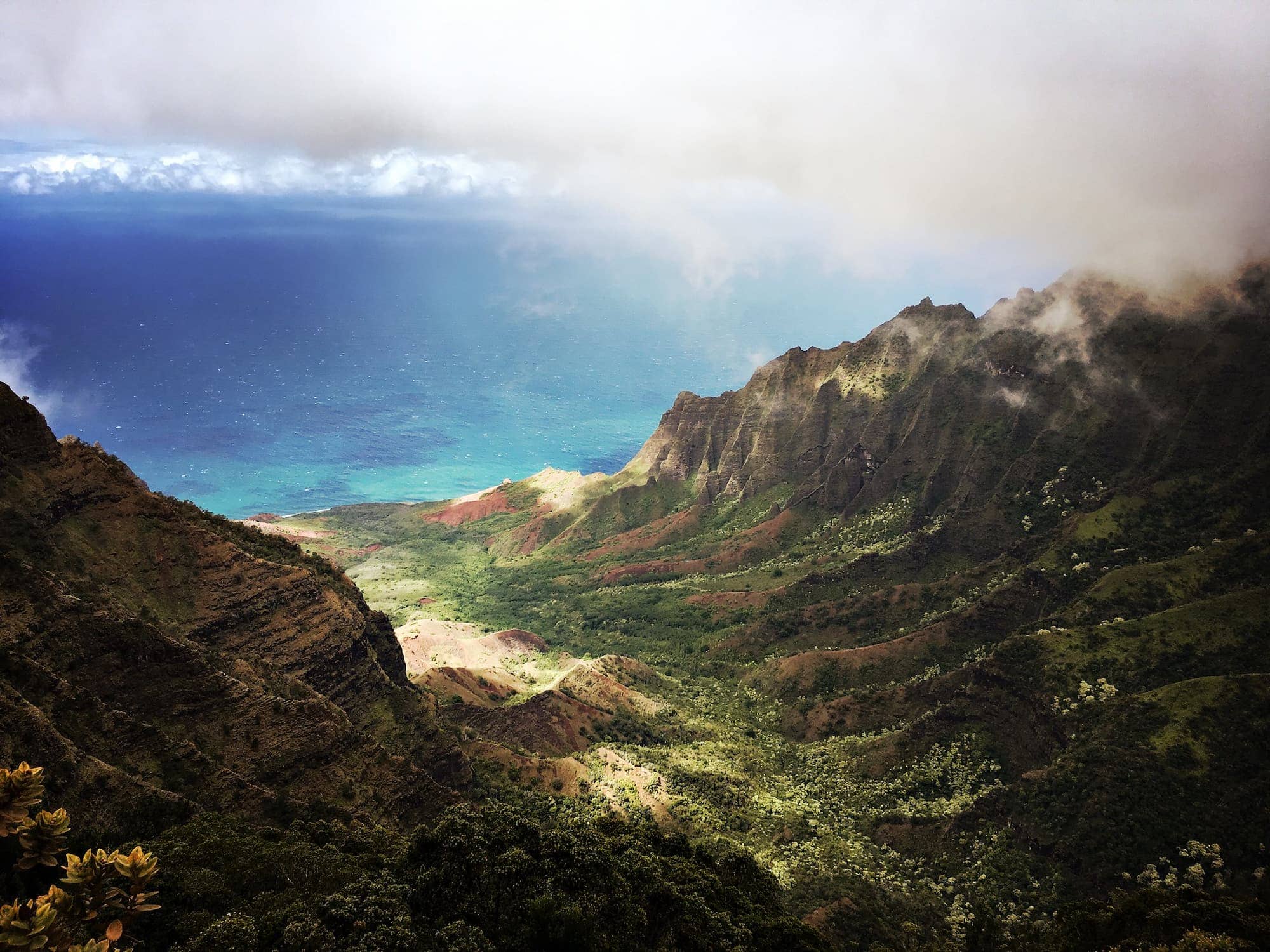
The Nāpali Coast from the Puʻu O Kila Lookout in Kōkeʻe State Park. Image credit: Trogers on Flickr.
Lookouts and Viewpoints in Waimea and Kōkeʻe
Each lookout shows a different face of the canyon, and they come in road order, so seeing all four adds little driving time.
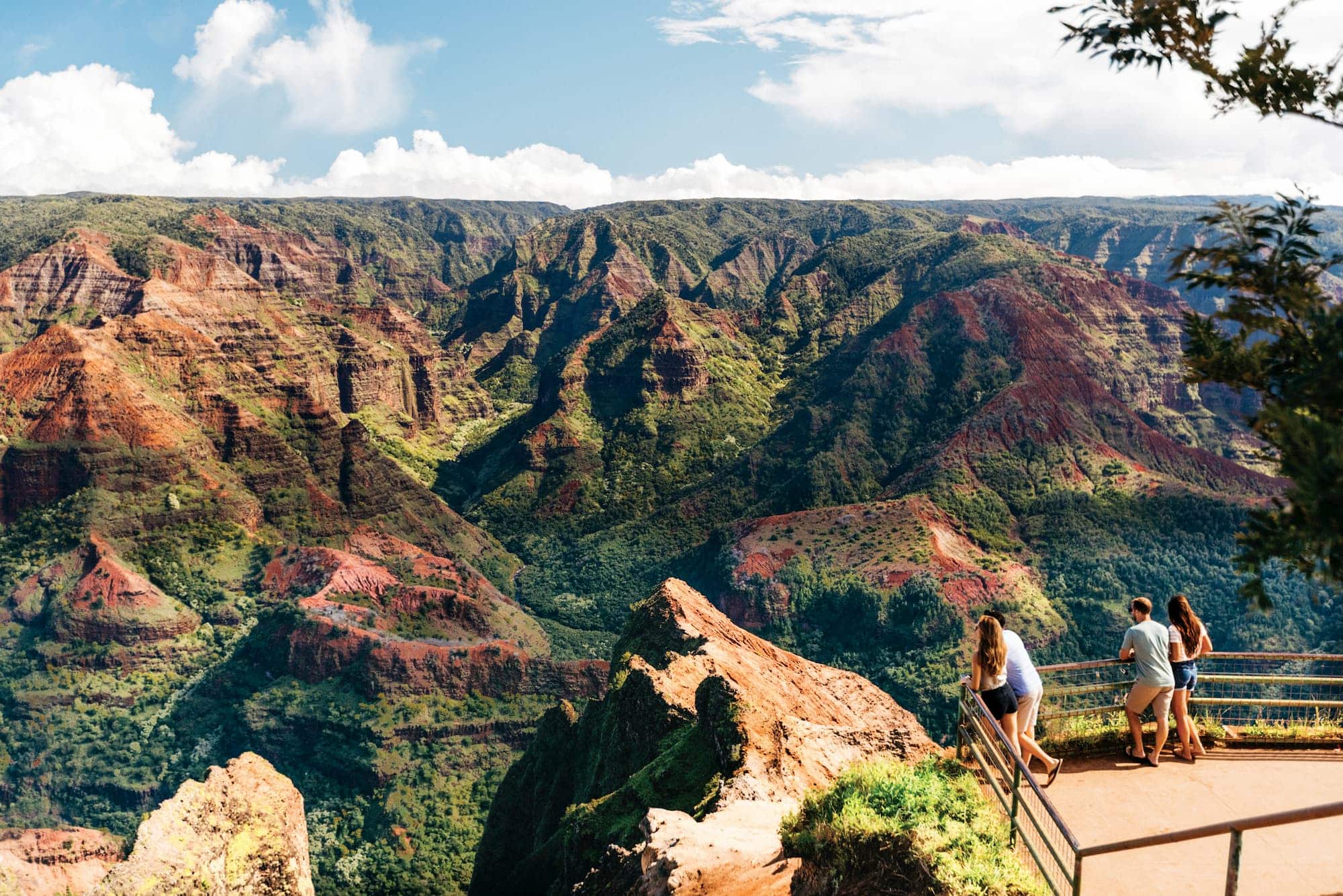
- Waimea Canyon Lookout (mile marker 10): This is the main viewing area for the canyon: you can walk right up to the rim, and no other stop gives a wider view into the gorge. It’s also the first lookout you reach, so start here.
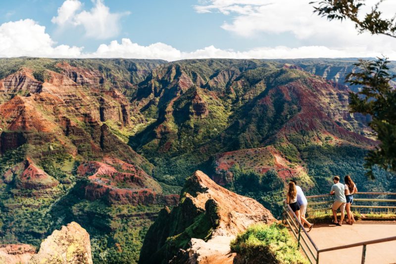

The easily accessible Waimea Canyon Lookout gives wide views of Waimea Canyon. Image credit: Hawaii Tourism Authority (HTA) / Ben Ono
- Puʻu Hinahina Lookout (mile marker 13.5): A few miles down the road is the Puʻu Hinahina overlook. It looks down into the canyon from a parallel angle (whereas the Waimea Canyon lookout gives you a perpendicular view of the canyon). From Puʻu Hinahina, you can see how the Waimea River winds its way through the canyon. From here the height and steepness of the walls are easier to judge than from the head-on view at the main lookout.
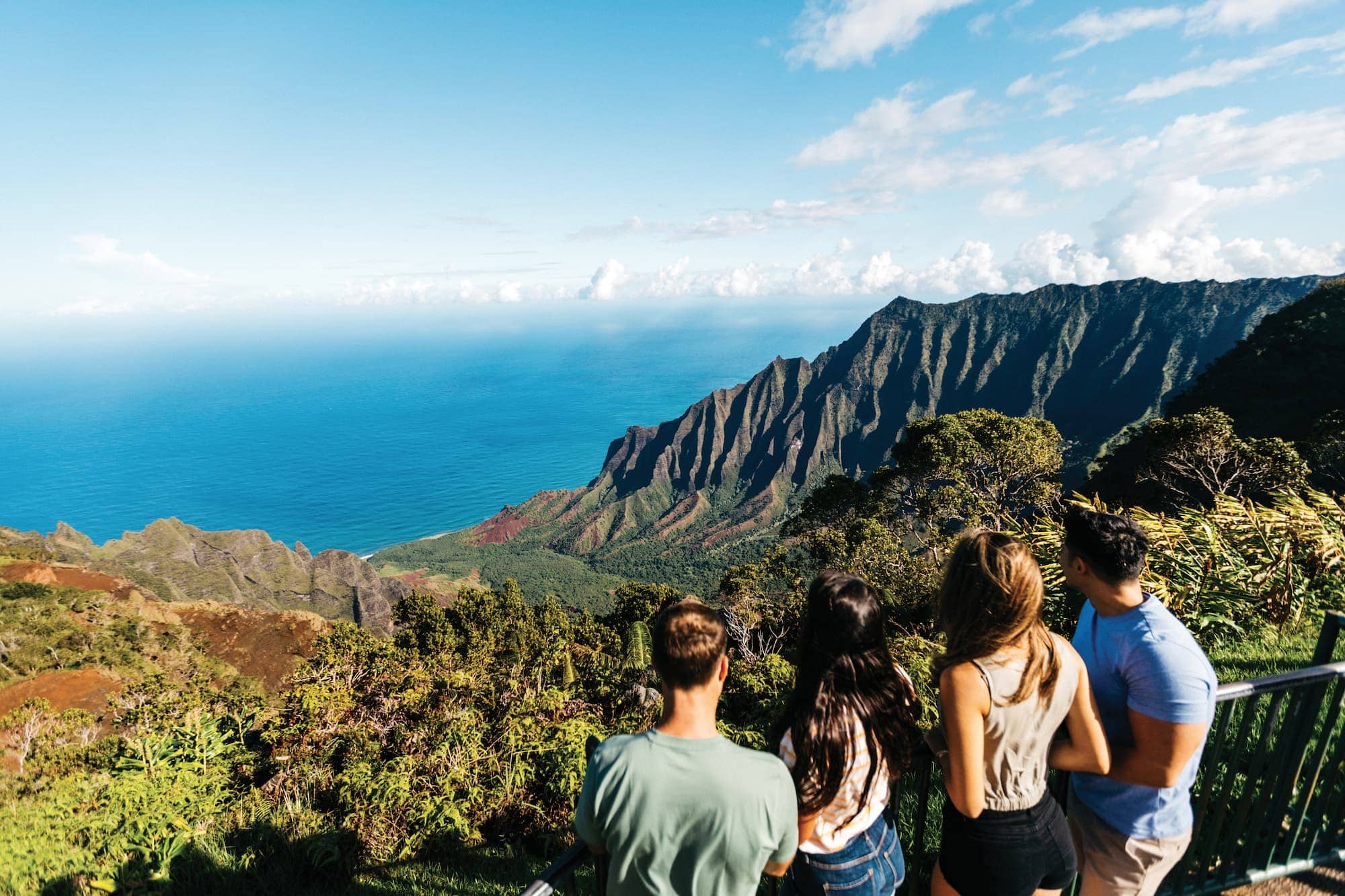
- Kalalau Lookout (mile marker 18): The view at the Kalalau Lookout takes in the tall cliffs of the Nāpali Coast and the ocean along the northwest coast of Kauaʻi. Kalalau Valley is the destination of the 11-mile Kalalau Trail which begins on the north shore at Kēʻē Beach.
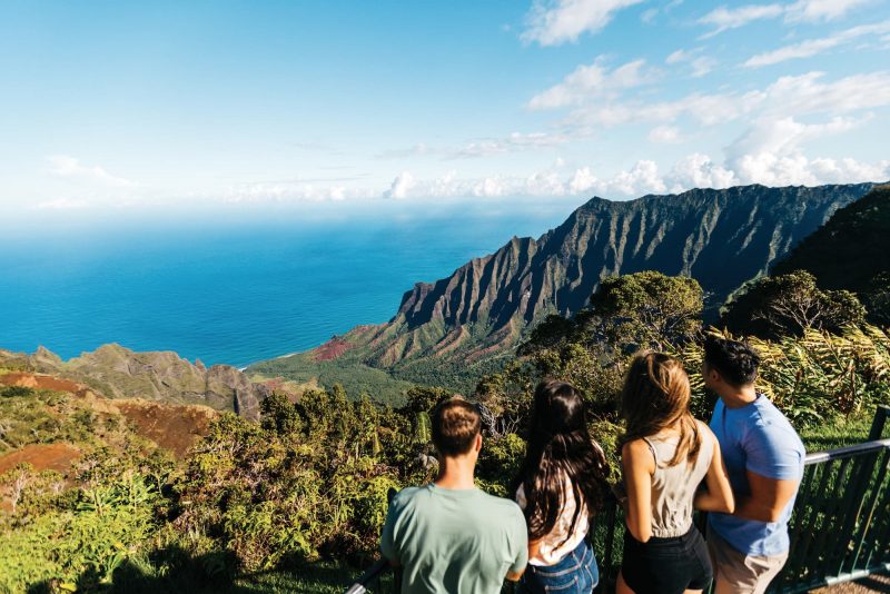
The Kalalau Lookout. Credit: Hawaii Tourism Authority (HTA) / Ben Ono
- Puʻu O Kila (mile marker 19): The road ends at Puʻu O Kila, another angle on the Nāpali Coast and Kalalau Valley.
Hikes in Waimea and Kōkeʻe
The trails range from a family loop past waterfall pools to a canyon-floor drop the state rates difficult. Here is how the main trails compare:
Details below last verified August 2026.
| Name | Duration | Difficulty | Payoff |
|---|---|---|---|
| 1Cliff Canyon + Black Pipe loop (Details ↓) | ~4 mi loop | Moderate, family-friendly | Canyon views and a pool at Waipoʻo Falls |
| 2Kukui Trail (Details ↓) | ~2.5 mi down (5 mi round trip) | Hard (2,200+ ft climb back) | All the way to the canyon floor and river |
| 3Awaʻawapuhi Trail (Details ↓) | ~3 mi down (6 mi round trip) | Moderate down, hard back | Nāpali Coast cliff overlooks |
| 4Pihea Trail (Details ↓) | ~4 mi each way | Easy grade, long and muddy | Alakai Swamp, native birds, Kalalau Valley view |
Cliff Canyon and Black Pipe Trail
The Cliff Canyon and Black Pipe Trail is a good fit for families: canyon views most of the way and a stop at the stream and pools above Waipoʻo Falls. In total, the loop is a little less than four miles.
Kukui Trail
If you want to go all the way to the bottom of the canyon, the Kukui Trail will take you there, descending about 2.5 miles down the steep cliffs to the river below. The climb back up from the bottom is about 2,240 vertical feet. It’s for experts only.
Awaʻawapuhi Trail
This trail doesn’t go into the canyon itself. Instead it drops 3.1 miles through wet native forest to overlooks hanging above the sheer cliffs and valleys of the Nāpali Coast, some of the most rugged nature on Kauaʻi. The state rates it difficult: the walk down is steady, and the climb back up gains roughly 1,180 feet, so save water for the return.
Pihea Trail
The Pihea Trail takes you into the Alakaʻi Swamp that surrounds the canyon, with many native birds, and ends at the Pihea Overlook, with views over Kalalau Valley. The state rates it moderate, with under 300 feet of elevation gain, but it is long, nearly 4 miles each way, and the trail can be muddy. A longer, harder alternative is the Alakaʻi Swamp Trail (3.5 miles one way, rated difficult).

For more hiking recommendations, visit the Waimea Canyon State Park page and the Kōkeʻe State Park page.
Camping
There is no camping in Waimea Canyon State Park, but you can tent camp or rent a cabin in Kōkeʻe. Nights up here have some of the darkest skies for stargazing on Kauaʻi, and staying over puts you at the lookouts ahead of the day trippers.
Backpacking
For experienced hikers and campers who want to get off the grid for a few days, Waimea Canyon has a series of backcountry campsites down at the bottom of the canyon, along the river, from Wiliwili at the foot of the Kukui Trail to Lonomea eight hiking hours in. Camping is by permit only; book through the state camping reservation system.
Tours
Guided tours run to Waimea Canyon:
Hiking Tours
Kauai Hiking Tours runs guided hikes in Waimea Canyon, including the trip below, and takes private bookings if you’d rather pick your own trail. A guide handles the navigation and covers the geology of the canyon as you walk.
Suggested tour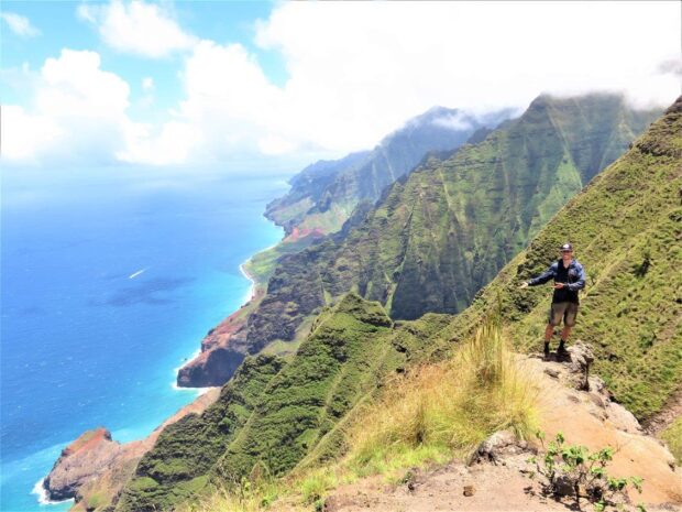

Private Nāpali Cliff Top & Waimea Canyon Hike (for up to 4 people)
The Nāpali cliff tops sit roughly 4,000 feet above the ocean, reachable only on foot from the Kōkeʻe ridge trails. A private guided hike for up to 4 people, with Waimea Canyon overlooks on the drive up.
from:
$980
What is a suggested tour?Our suggested tours are hand-picked tours that receive consistent good reviews, give back to the community, and work hard to minimize their impact on the environment. Read more about these tours on our website.Helicopter Tours
A helicopter ride over Waimea Canyon gives you the one angle the road cannot: the full length of the canyon and the Nāpali cliffs behind it in a single view. Many helicopter companies offer tours that include a flyover of Waimea Canyon (see the full list of Kauaʻi helicopter operators). We suggest this one for its value.
Biking Tours
This guided ride covers 13 miles of cruising from the canyon rim down to the coast. The ride takes about 4 hours and costs $156, ages 14 and up.
Other Points of Interest
Kōkeʻe Natural History Museum
This small museum next to the Kōkeʻe Lodge covers the settlement history of Waimea Canyon and the geology behind it. There is also a gift shop attached for small souvenirs.
Fees, Hours, and What to Bring
The canyon rim has far fewer services than the coast.
- Entrance and Parking Fees: All non-Hawaiʻi-resident visitors pay both an entrance fee ($5 per person) and a parking fee ($10 per vehicle), paid on arrival at a kiosk. No prior reservation is required. One parking ticket is valid at both Waimea Canyon and Kōkeʻe State Parks, and Hawaiʻi residents enter free with ID.
- Food & Drink: Food carts set up at the main Waimea Canyon Lookout, serving small snacks and cold drinks. In Kōkeʻe State Park, the Kōkeʻe Lodge is a full-service restaurant with a bar; the kitchen closes at 4pm, so plan on lunch rather than dinner.
- Services: Each main lookout has public restrooms, maintained by the Division of State Parks.
- What to Wear/Bring: The rim averages 3,500 feet above sea level and is cooler than the coast, so bring warm layers and a rain jacket. We also recommend bringing plenty of water and snacks from the coast rather than counting on the lookout vendors.
- Best Times to Visit: During the winter rainy months, Waimea Canyon’s walls are much greener than they are in the hotter, drier summer months, and the waterfalls flow stronger. During summer, the trails within the Park are drier and less muddy.
- Where to stay nearby: There are several places to stay in Waimea Town, just down the road from the park entrance.