
Kauaʻi has 6 of the world’s 13 climate sub-zones under the Köppen classification, and 3 of its 5 major zones. One of the rainiest spots on earth sits a short drive from a coast dry enough for cactus.
Mount Waiʻaleʻale rises near the center and pulls the trade winds straight up. Its summit takes about 350 inches of rain a year, and the wettest ground on the island, just below the summit, tops 390 inches. The same mountain casts a shadow to the west, where Waimea and Kekaha see about 20 inches and the shoreline beyond them reads as semi-arid steppe. Kauaʻi is old and worn low, so it never reaches the cold summits of its taller neighbors.
For the trip-planning version of this map, month-by-month rainfall, temperatures and cloud cover shore by shore, see our Kauaʻi weather guide.
Table of contents
How many climate zones does Kauaʻi have?
Kauaʻi packs 6 climate zones into about 550 square miles. The count depends on which system you use, and the most widely used is the Köppen scheme (Wikipedia, or explained in Hydrology and Earth System Sciences). It sorts the planet into 5 major climate zones, splits those into 13 sub-zones, and splits those again into finer groups.
Following the Köppen scheme, Kauaʻi has 3 of the world’s 5 major climate zones and 6 of the 13 sub-zones. It reaches the dry semi-arid steppe on the west side, which Oʻahu never does, but tops out below the cold summits of Maui and the Big Island.
We marked these zones on the map below. On Kauaʻi the legend colors line up one to one with the Köppen zones, so 6 colors means 6 zones. On the Big Island, where two zones are drawn in two shades each, the map shows 10 colors for 8 zones.
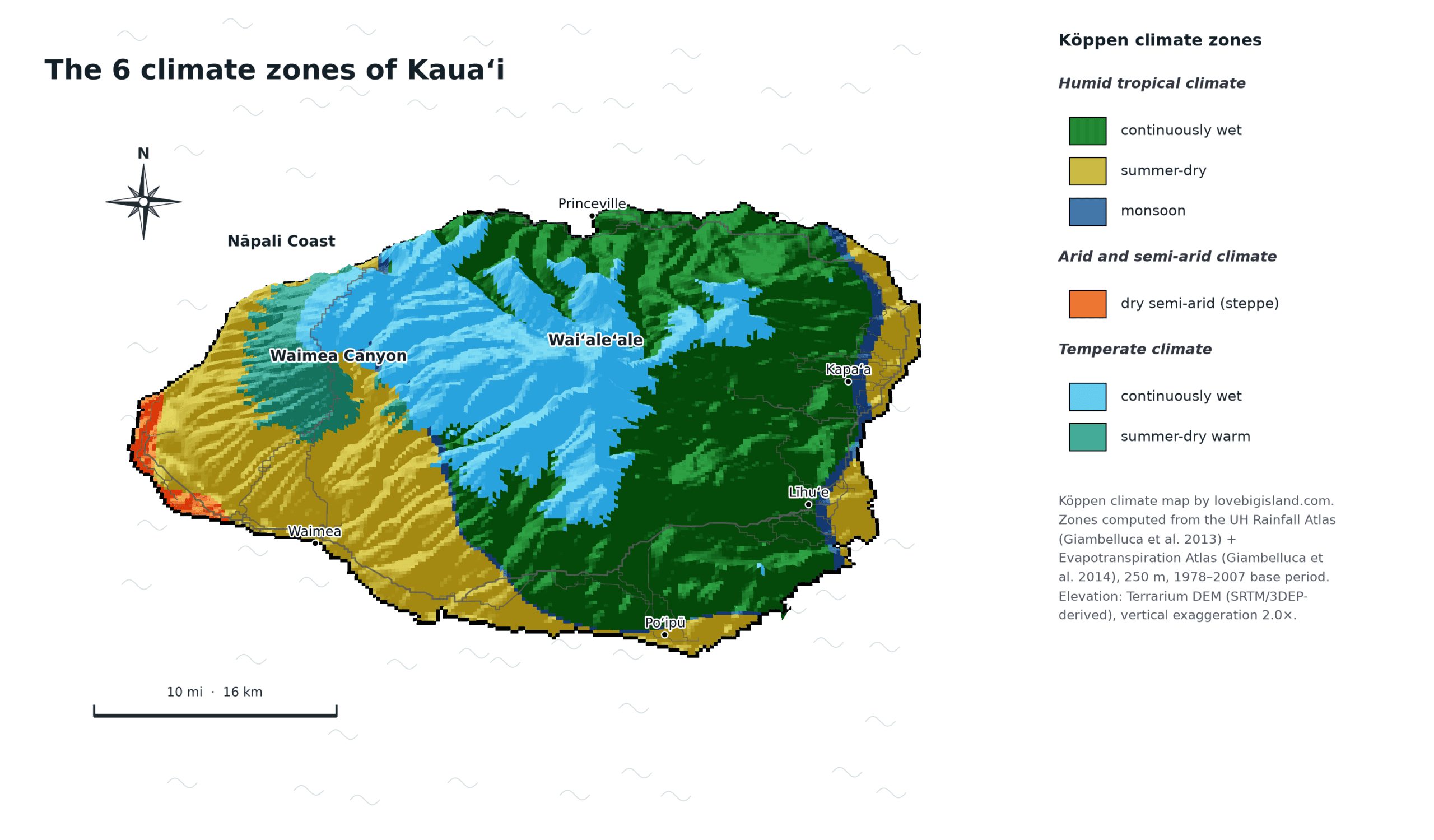
Climate map of Kauaʻi. All 6 legend colors are distinct Köppen zones. The wet interior around Waiʻaleʻale sits a short drive from the dry west coast.
Which climate zones are NOT on Kauaʻi?
Seven of the world’s 13 sub-zones do not reach Kauaʻi. Where one turns up elsewhere in the state, we note it:
- Dry arid, true desert (found on the Big Island)
- Polar tundra (found on Maui and the Big Island)
- Temperate winter dry
- Continental winter dry
- Continental summer dry
- Continental continuously wet
- Polar ice caps
The missing end of the range is the cold one. Kauaʻi’s high point, Kawaikini, reaches 5,243 feet, wet and cool but not cold enough for tundra.
How Kauaʻi compares to the other islands
Five zones are on all four main islands: tropical continuously wet, monsoon, tropical dry, temperate summer-dry, and temperate continuously wet. Only three zones separate the islands, and they stack in one order: whatever a smaller island has, the bigger ones have too.
- Big Island, 8 zones: the only true desert in the state, plus tundra on Mauna Kea and Mauna Loa.
- Maui, 7 zones: tundra on Haleakalā and steppe at Kīhei, but no desert.
- Kauaʻi, 6 zones: steppe on the west coast, and no summit high enough for tundra.
- Oʻahu, 5 zones: the narrowest range of the four, missing both dry zones and the tundra.
Kauaʻi misses the height limit. Tundra needs roughly 8,900 feet, and Kawaikini, the island’s high point, stops near 5,200. At the dry end it does reach steppe: the Mānā plain runs 3 to 32 feet, the tightest band on any of these four islands.
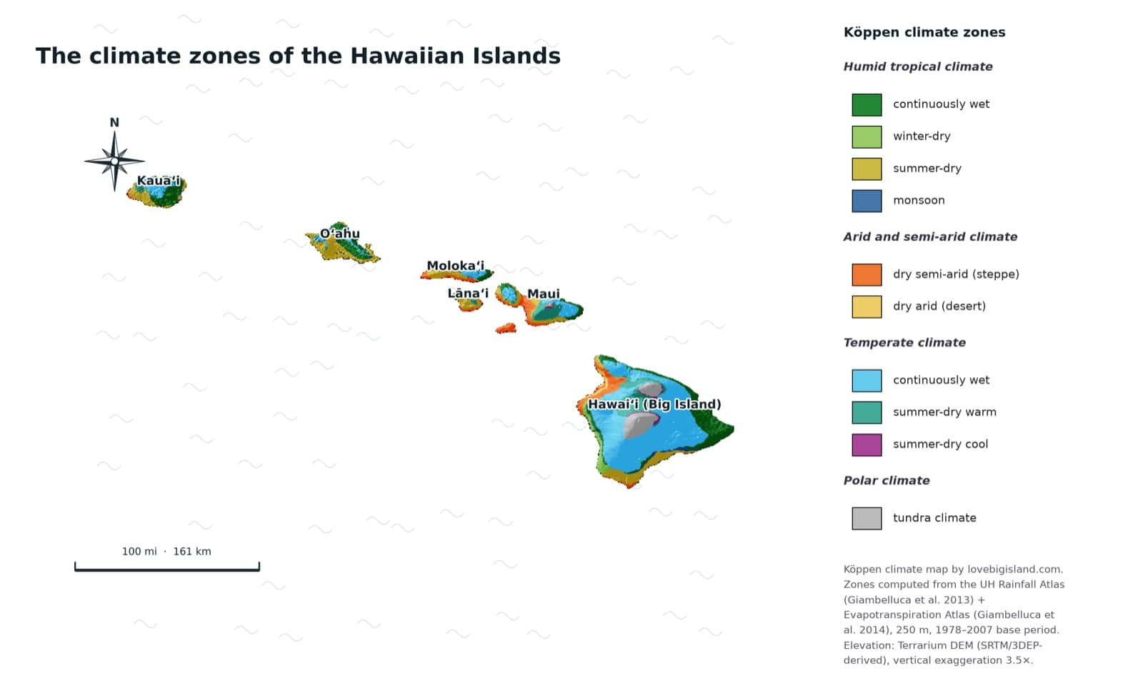
The climate zones of all Hawaiian islands on one map. The state spans 8 of the world’s 13 zones, and every one of them is found on the Big Island.
Rain timing across the year is a different question, covered in the best time to visit Kauaʻi.
The 6 Kauaʻi climate zones, region by region
| Zone | Elevation band | Where it sits |
|---|---|---|
| Dry semi-arid (steppe) | 3 to 32 ft | The Mānā plain northwest of Kekaha, deep in the rain shadow |
| Monsoon | 18 to 1,483 ft | The east-side coast around Kapaʻa and Anahola |
| Tropical dry | 9 to 1,622 ft | The south coast at Poʻipū and Kōloa, and the west side at Waimea |
| Tropical continuously wet | 79 to 1,440 ft | The north shore around Hanalei, and the east side near Līhuʻe |
| Temperate summer dry | 1,852 to 3,111 ft | The ridges along the western rim of Waimea Canyon |
| Temperate continuously wet | 1,697 to 4,349 ft | The high interior, and Kōkeʻe, the part you can drive to |
Bands are where each zone mostly sits, not hard lines.
Humid Tropical climate
In these climates every month averages warmer than 64° F (18° C) and rain is plentiful. All three tropical sub-zones appear on Kauaʻi, sorted by how the rain falls across the year.
Continuously wet
No real dry season. Rain all year. This is the largest zone on the island, about 44% of it: the flanks of the wet interior, the whole north shore, and most of the east. Color on the map
Where to find it on Kauaʻi: the slopes of Mount Waiʻaleʻale below the summit, the north shore around Hanalei, Princeville, Kīlauea and Hāʻena, the cliff-top rim above the Nāpali Coast, and the east side around Līhuʻe, which takes about 50 inches of rain a year.
Elevation: mostly 79 to 1,440 ft.
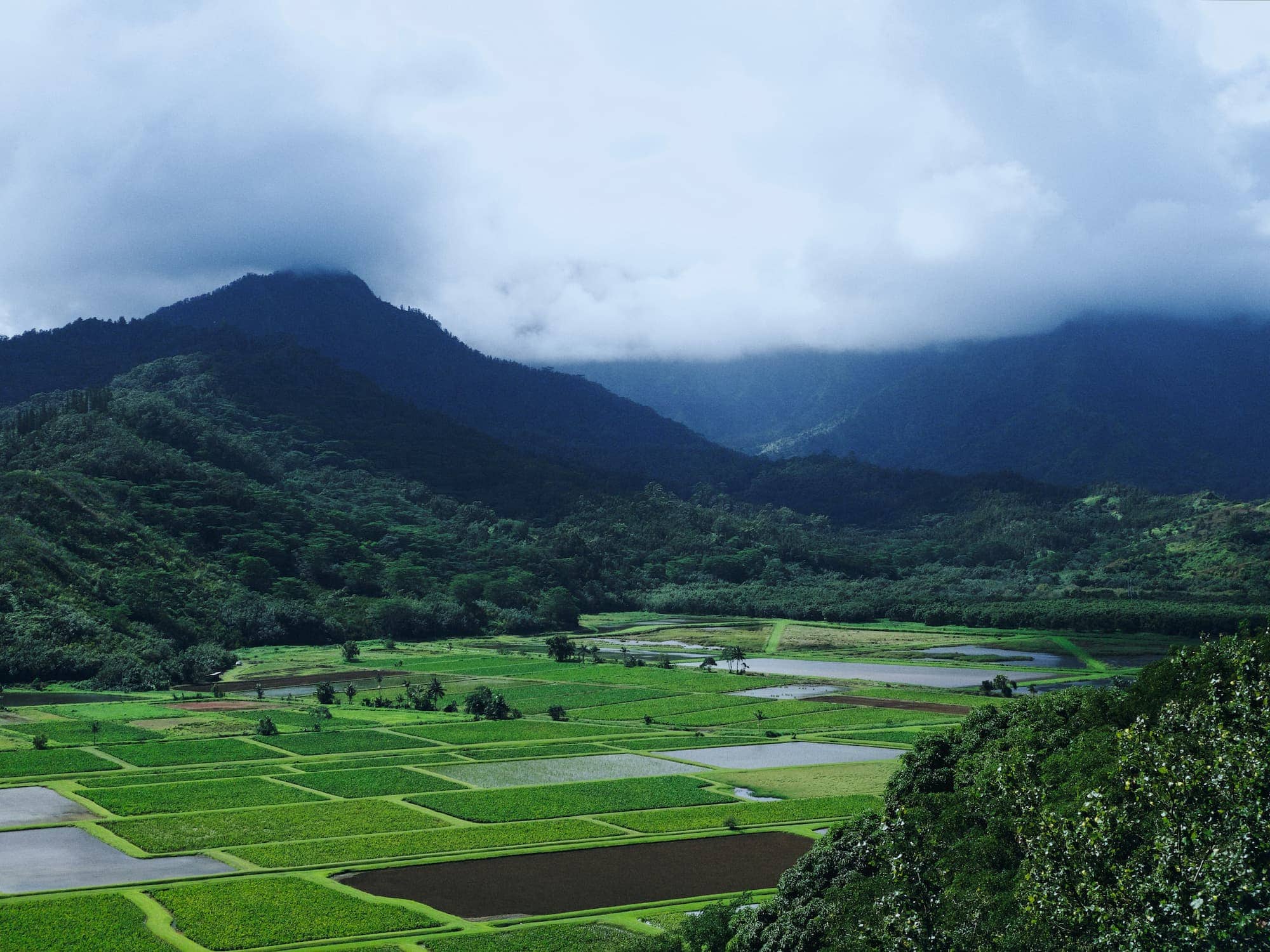
The north shore has no dry season worth the name: every month here is a wet month. Mountains ring Hanalei Valley, and the Hanalei National Wildlife Refuge covers its floor. Image by Jason Weingardt on Unsplash
Monsoon
A short dry season, but enough rain the rest of the year to keep the ground wet. On Kauaʻi it’s the thinnest zone, about 2% of the island, ringing the wetter ground as a transition band. Color on the map
Where to find it on Kauaʻi: the coastal strip on the east side around Kapaʻa and Anahola, and thin bands on the windward slopes just outside the wettest interior.
Elevation: mostly 18 to 1,483 ft.
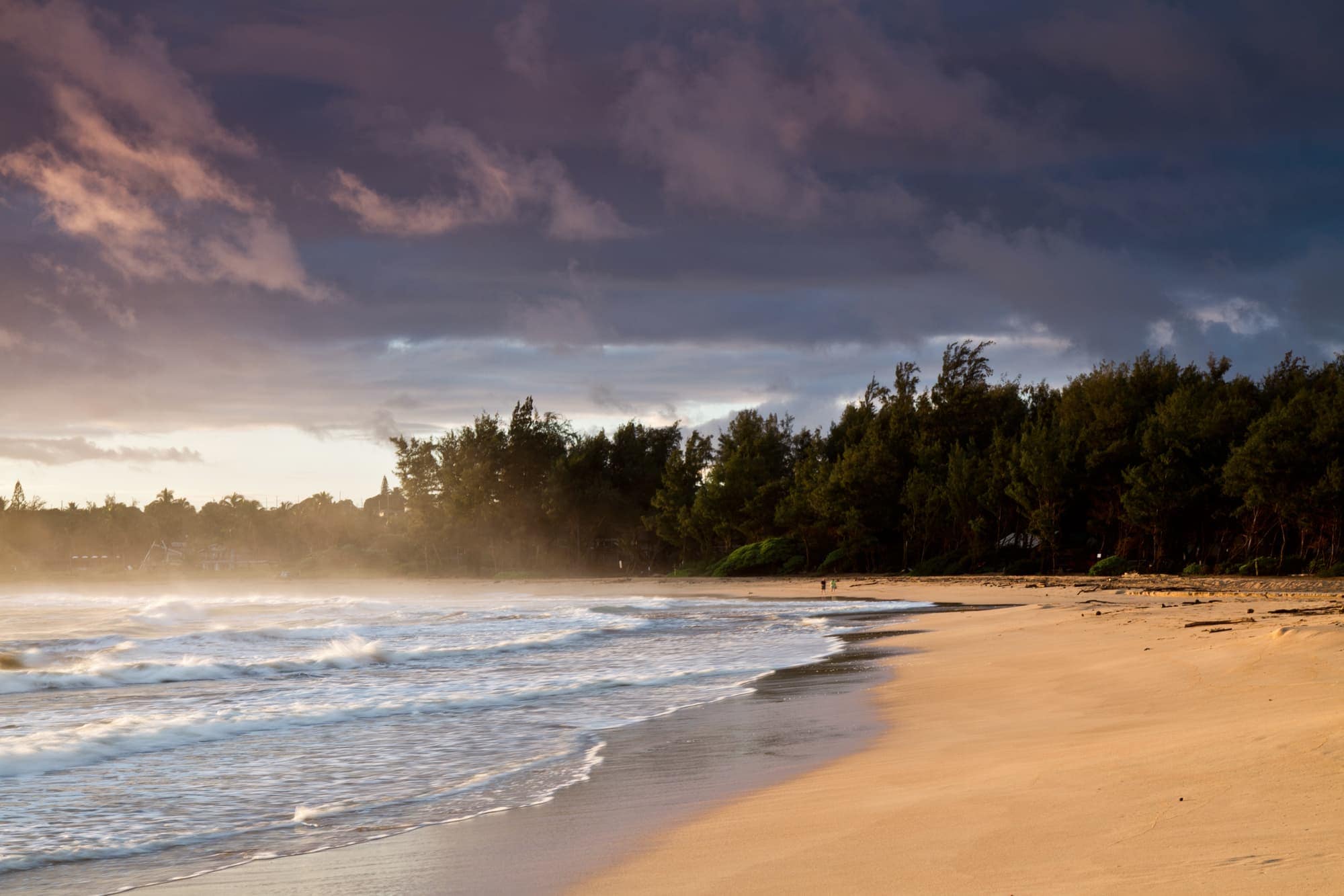
Anahola sits in the island’s narrow monsoon band, on the east coast. A windy sunrise at Anahola Beach. Image credit: Twelvizm, source.
Dry
A clear dry season, here in the summer. This is the second largest zone, about a quarter of the island, covering the south coast and the low country on the west. Color on the map
Where to find it on Kauaʻi: the sunny south coast at Poʻipū, which takes about 37 inches of rain a year, Kōloa and Hanapēpē, and the west-side towns of Waimea and Kekaha, plus the low mouth of Waimea Canyon and the beach at Polihale. The west side is dry, around 20 inches a year, but it keeps a wet enough winter to stay tropical rather than tip into steppe.
Elevation: mostly 9 to 1,622 ft.
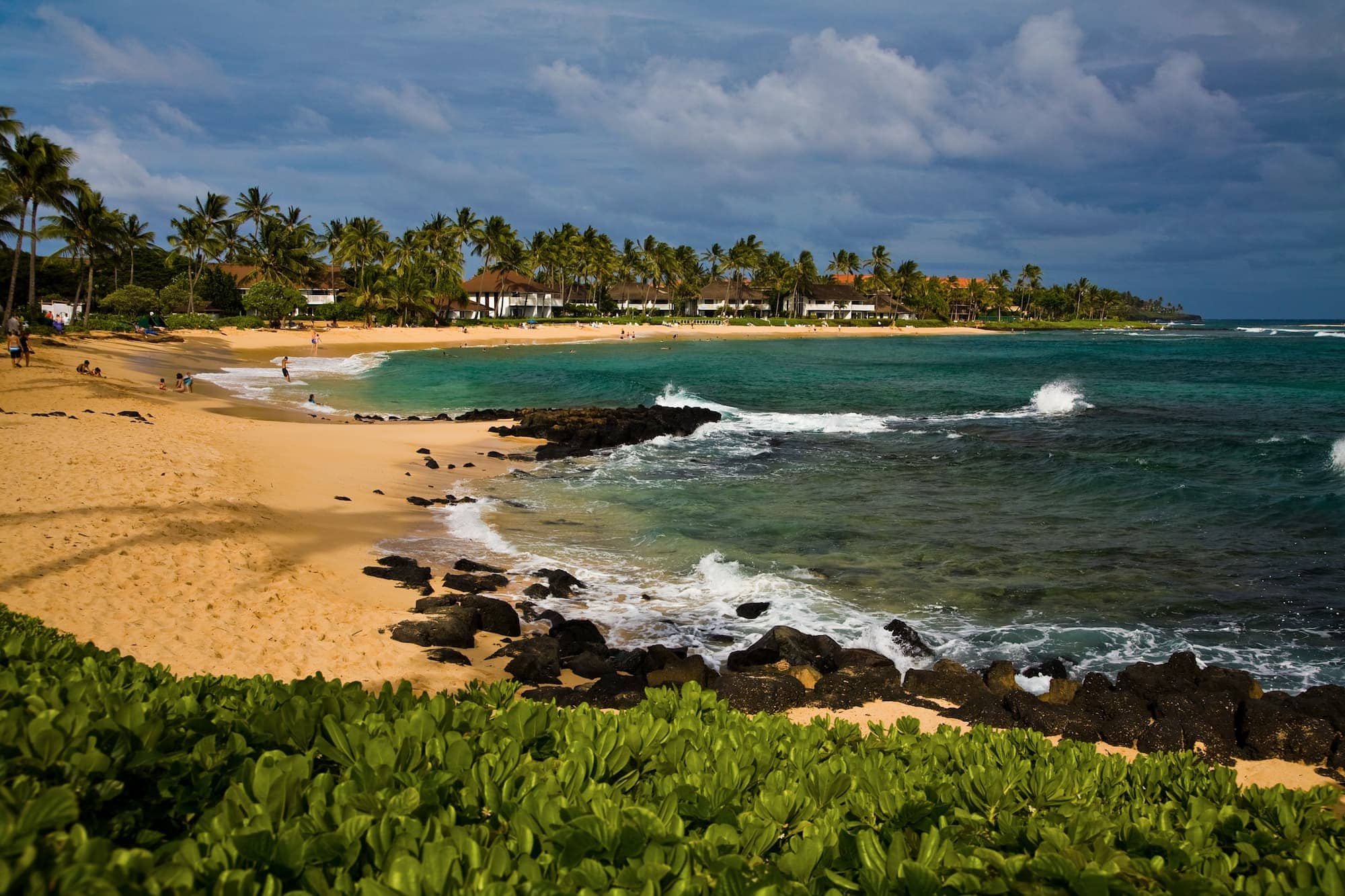
Poʻipū, on the dry-summer south coast, takes about 37 inches of rain a year. Poʻipū Beach has a shallow, protected swimming area, plus snorkel and surfboard rentals. Image: Hawaii Tourism Authority (HTA) / Tor Johnson
Dry (arid and semi-arid) climate
In this climate the yearly evaporation outpaces the rainfall. Kauaʻi reaches the semi-arid steppe but never crosses into true desert.
Dry semi-arid (steppe)
A dry grassland climate, drier than the tropics but wetter than desert. This is the smallest zone on Kauaʻi, about 1% of the island, and it’s easy to miss: a narrow shoreline strip, not a region. Color on the map
Where to find it on Kauaʻi: the coast running northwest from Kekaha beach past Barking Sands and along the Mānā plain, the driest ground on the island at about 18 inches a year, deep in Waiʻaleʻale’s rain shadow. Step half a mile inland and you’re back in the tropical dry zone.
Elevation: mostly 3 to 32 ft.
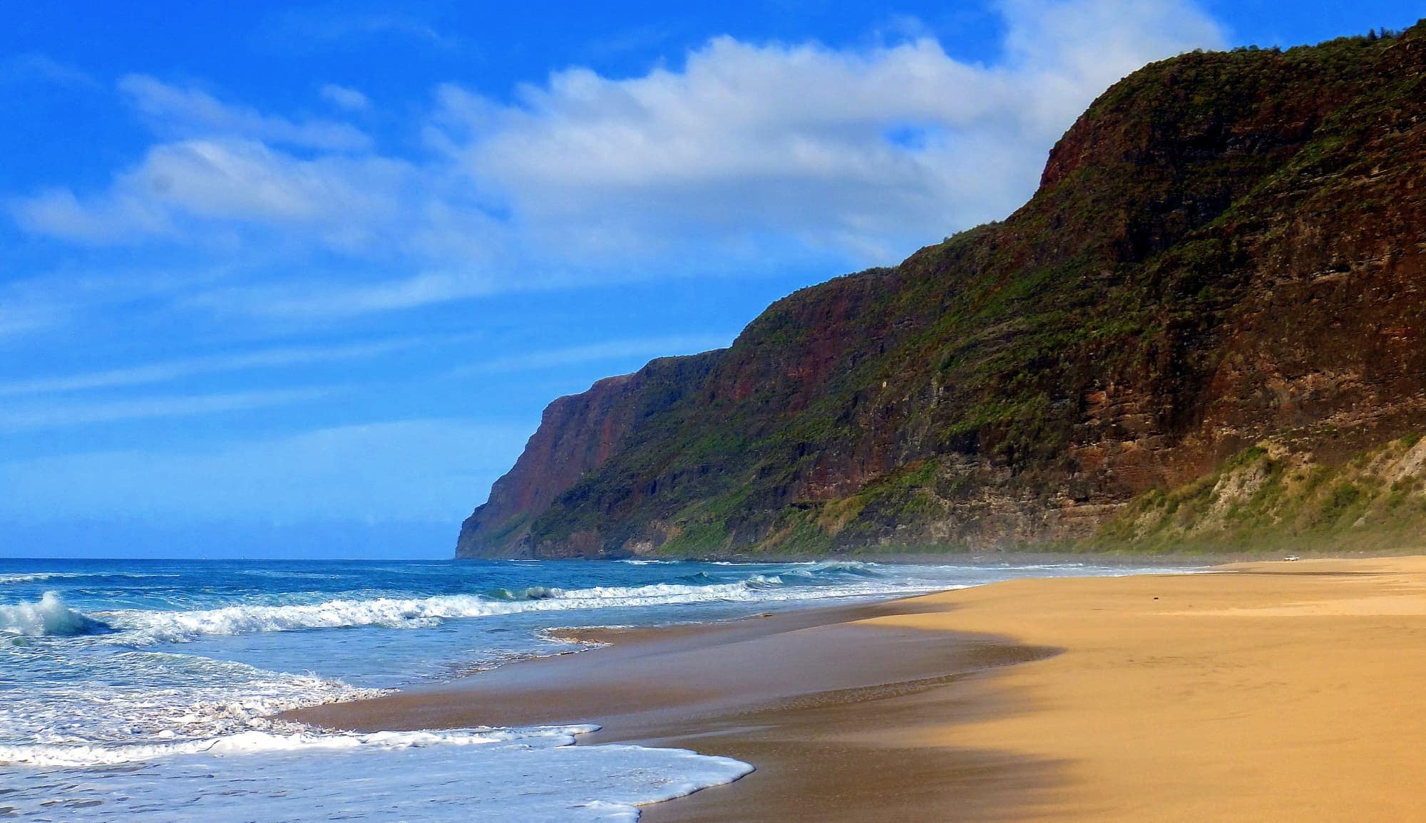
Polihale sits at the north end of the dry west coast, just beyond the steppe strip. Image credit: K E V I N, source.
Temperate climate
The coldest month averages between 27° F (-3° C) and 64° F (18° C), and the warmest month is above 50° F (10° C). Two sub-zones appear on Kauaʻi, both in the uplands.
Continuously wet
At least 30 mm of rain in the driest month, with a smaller swing between wet and dry. This is the cool wet heart of the island, and it is about a quarter of Kauaʻi. Color on the map
Where to find it on Kauaʻi: the high interior around the summits of Waiʻaleʻale and Kawaikini, most of which has no road to it, and the part you can drive to, Kōkeʻe at around 3,600 to 4,000 feet, where the air runs 10 to 15° F cooler than the coast and nights drop into the 40s.
Elevation: mostly 1,697 to 4,349 ft.
Summer dry
At least three times as much rain in the wettest winter month as in the driest summer month. A warm dry-summer pocket on the drier upland rim. Color on the map
Where to find it on Kauaʻi: the ridges along the western rim of the canyon, including the ground around the main lookouts.
Elevation: mostly 1,852 to 3,111 ft.
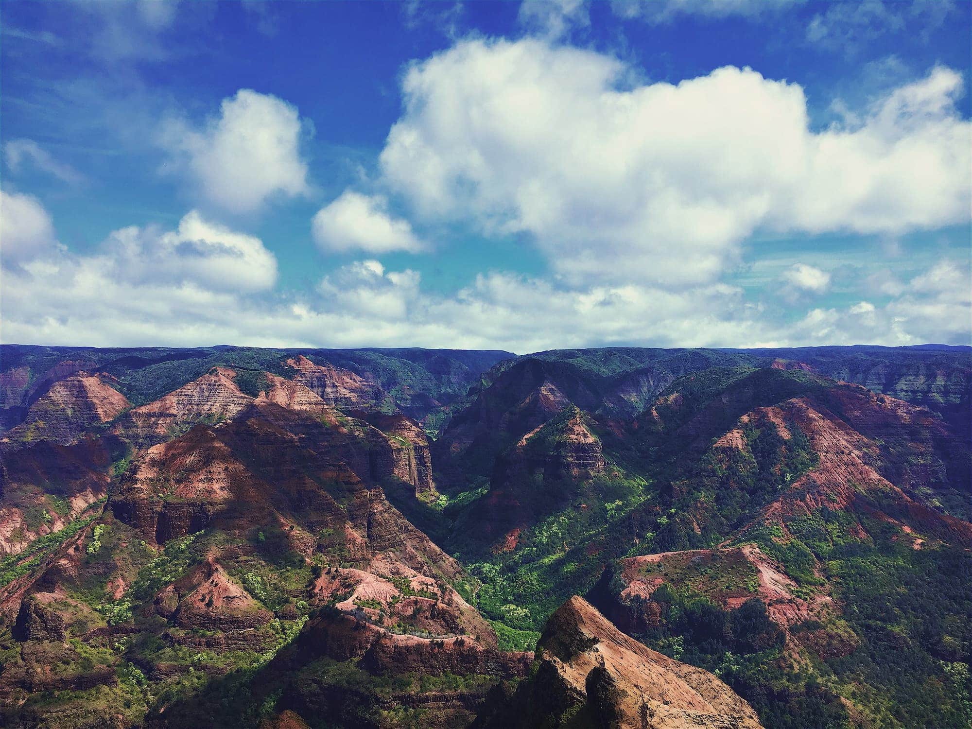
The canyon’s western rim is cool enough to count as temperate, and dry enough in summer to sit apart from Kōkeʻe up the road. Waimea Canyon State Park also goes by the “Grand Canyon of the Pacific.” Image credit: Trogers on Flickr.
Watch Kauaʻi’s climate zones move through the year
The map above compresses a year of weather into one label per place. The loop below splits that year into twelve frames, each classified from its own month’s warmth and rainfall, the same ingredients that build the Köppen zones. The moving boundaries are seasonal swings, so read the loop as a companion to the Köppen map, not a replacement for it.
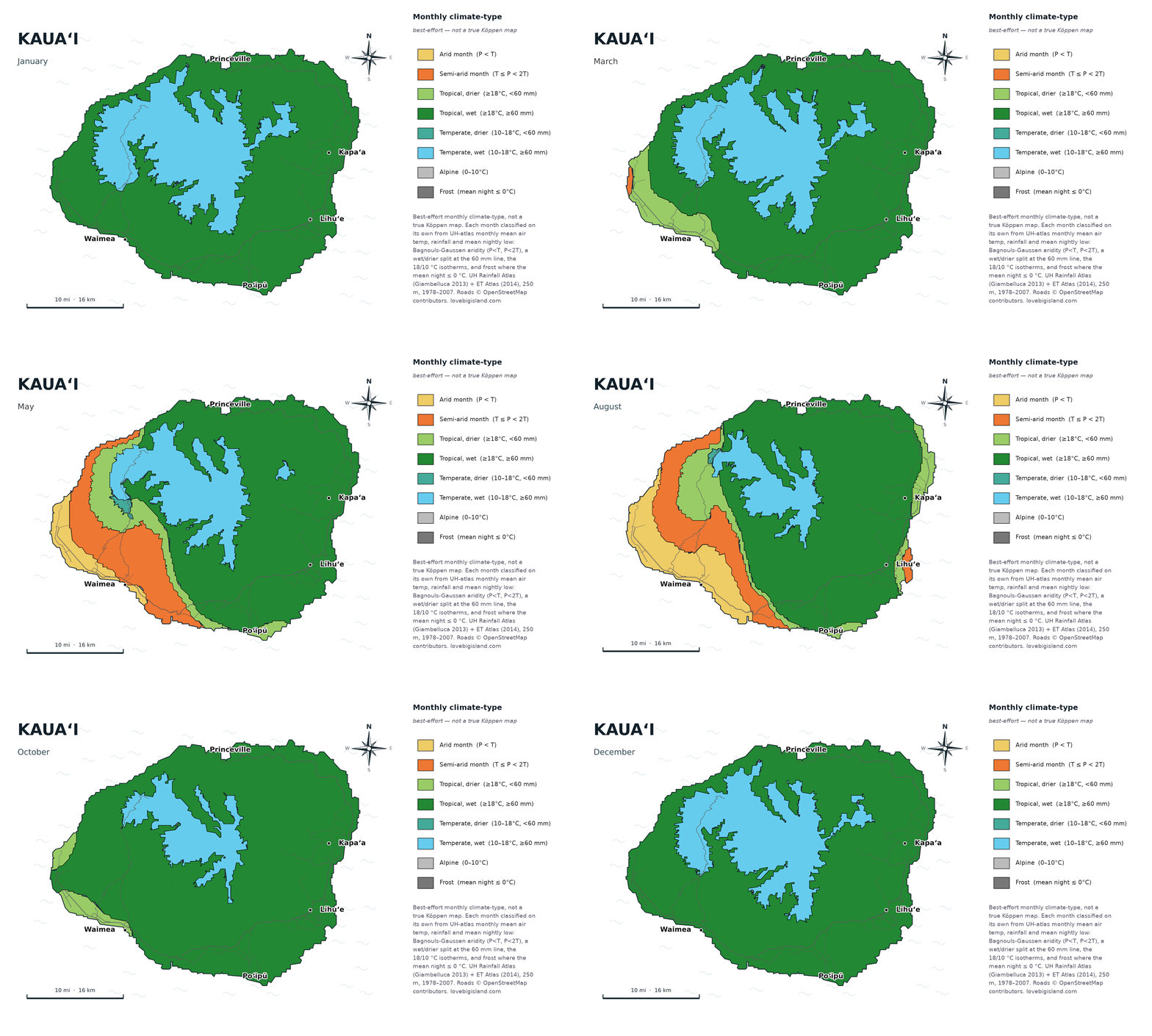
Kauaʻi through the year: the dry leeward zone from Waimea to Poʻipū grows through summer and closes again by late fall. Data: Giambelluca et al. (2013, 2014), 250 m grid. Map by Love Big Island.
Watch the south and west. Through winter Kauaʻi is nearly all green, wettest around the high center near Waiʻaleʻale. Through summer a dry zone opens on the leeward side, from Waimea around to Poʻipū, the same sunny coast people head for in the wet months. It widens as summer goes on and closes up again by late fall. The wet center of the island barely moves through the year. What shifts is the dry leeward edge.
Every frame is classified independently from University of Hawaiʻi atlas averages, with rainfall measured against temperature for the wet and dry line and temperature for the warm and cool bands. The loop shows an average year, not a forecast for yours.
How we counted the zones
The count of 6 sub-zones on Kauaʻi uses the most common form of the Köppen classification, the same one we use across this series. Köppen is a 3-tier system: 5 main climates in the first tier, splitting into 13 sub-zones in the second, and into 28 or 30 finer groups in the third. When we say Kauaʻi has 6 of the world’s 13, we mean the second tier.
On Kauaʻi the map’s colors match the Köppen zones one for one, so counting the colors gives the right answer. Our zones are computed from the University of Hawaiʻi Rainfall Atlas (Giambelluca et al. 2013) and Evapotranspiration Atlas (Giambelluca et al. 2014) at 250 m resolution. We feed the monthly rainfall and temperature for every 250 m pixel through the standard Köppen decision rules set out by Peel, Finlayson, and McMahon (2007).
Explore the data yourself: the UH Hawaiʻi Climate Data Portal publishes interactive climate maps, live readings from the Hawaiʻi Mesonet station network (live data), and monthly climate summaries.
At 250 m, the steppe strip on the west coast stays separate from the tropical dry country right behind it. A coarser map averages the two into one.
The base period is 1978 to 2007. Climate zones are built on 30-year normals, so they barely shift between one recent period and the next. Resolution changes the map more than the choice of base period does.
The elevation bands come from the same 250 m grid, sampled against a public terrain model: each one is the range the middle 90 percent of that zone’s pixels fall in. They describe where a zone mostly sits rather than a hard line, because the zones interleave windward and leeward and neither side changes at the same height.
Pack for both ends of it: about 18 inches of rain a year on the Mānā plain, and nights in the 40s up at Kōkeʻe. See Kauaʻi’s sights and destinations and Kauaʻi’s waterfalls.