The Big Island has 8 of the world’s 13 climate sub-zones under the Köppen classification, and 4 of its 5 major zones. That is the real number. The widely repeated claim that Hawaiʻi has 10, 11, or 12 comes from miscounting a map where several colors are the same Köppen zone. We counted them properly, and the answer holds at 8.
In a single day’s drive you can pass through the tropics of the Hāmākua Coast, the desert at Kua Bay, and the temperate rainforest at Volcano Village, with the polar tundra on the summits of Mauna Kea and Mauna Loa in view above it all. For what this means day to day, see our guide to Big Island weather.
Table of contents
Hawaiʻi has (10, 11 or 12) of the world’s 13 climate zones
That number counts colors on a map, not Köppen zones.
How many climate zones does the Big Island have?
Those 8 zones fit into 4,028 square miles. The count depends on which system you use, and the most widely used is the Köppen scheme (Wikipedia, or explained in Hydrology and Earth System Sciences). It sorts the planet into 5 major climate zones, splits those into 13 sub-zones, and splits those again into finer groups.
Following the Köppen scheme, the Big Island has 4 of the world’s 5 major climate zones and 8 of the 13 sub-zones. It is the only Hawaiian island with a true desert, and one of two that reach all four major zones. Maui gets there too, on Haleakalā.
We marked these zones on the map below, computed from the University of Hawaiʻi 250 m atlas. The map lists 10 different climate zones, but only 8 are distinct under Köppen. Tropical winter-dry and summer-dry both belong to the tropical dry climate, and temperate summer-dry warm and cool both belong to the temperate dry climate, each drawn in two shades to show the split.
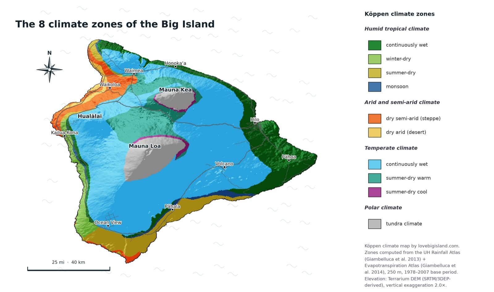
Climate map of the Big Island. The map shows 10 labels, but only 8 are distinct under Köppen: tropical winter-dry and summer-dry are one zone, and temperate summer-dry warm and cool are another.
Which climate zones are NOT on the Big Island?
Five of the world’s 13 sub-zones do not reach the Big Island, and none of them turn up anywhere else in Hawaiʻi either:
- Temperate winter dry
- Continental winter dry
- Continental summer dry
- Continental continuously wet
- Polar ice caps
The Big Island misses the three continental climates, which need cold winters it never gets, and the polar ice cap, which needs a summit frozen year round. The remaining one, temperate winter dry, does not occur anywhere in Hawaiʻi either. Hawaiʻi comes closest to the ice cap: the tundra on Mauna Kea and Mauna Loa is the coldest climate in the state.
One island, the whole state’s range
Put all the Hawaiian islands on one map and the Big Island’s oddity stands out. The state as a whole spans 8 of the world’s 13 climate zones, and all 8 of them are on the Big Island. Maui holds 7, Kauaʻi 6, and Oʻahu 5, but none of them adds a zone the Big Island lacks, so the state’s total and the Big Island’s total are the same number.
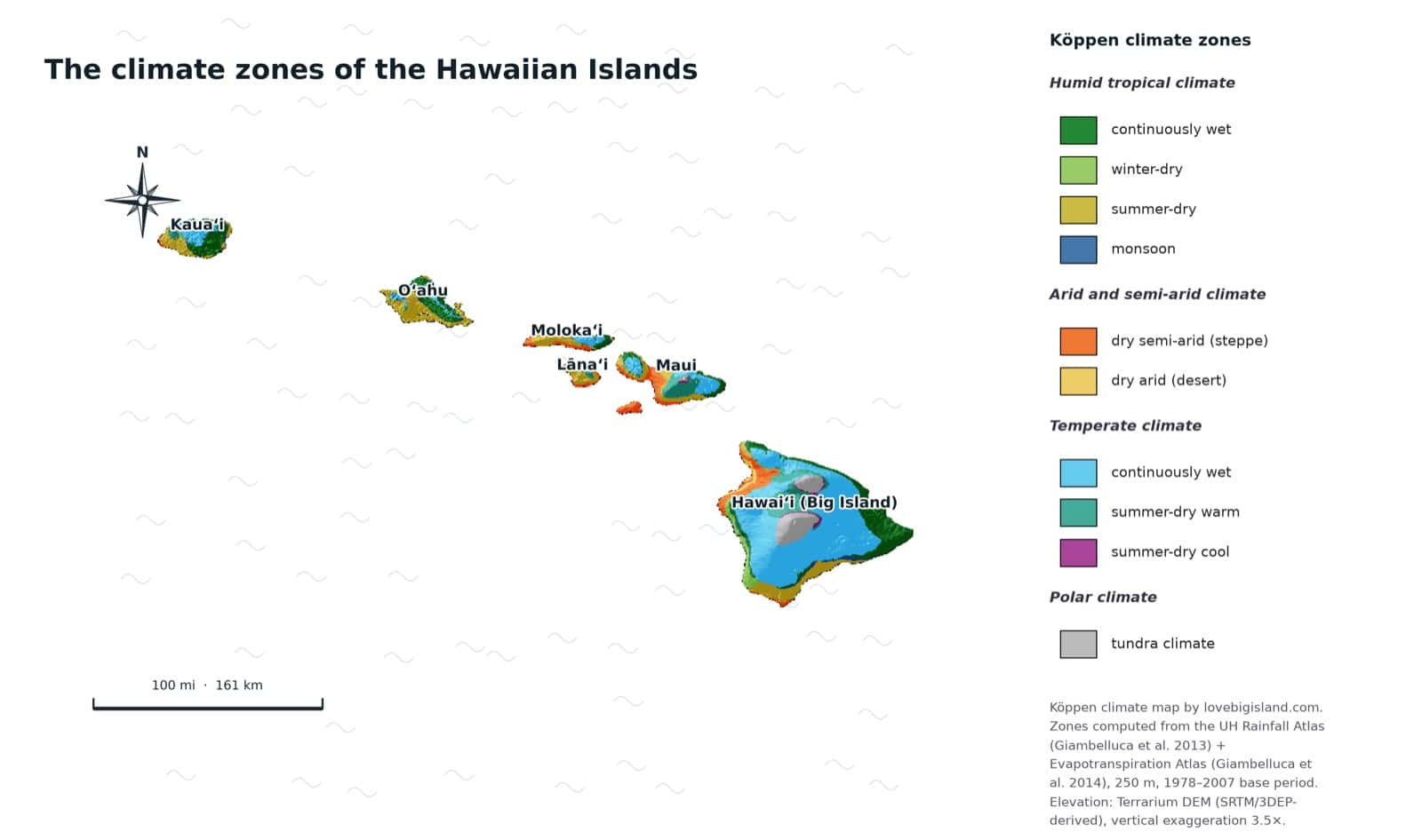
The climate zones of all Hawaiian islands on one map. The state spans 8 of the world’s 13 zones, and every one of them is found on the Big Island.
Zone for zone, here is how the four islands compare:
- Big Island, 8 zones: the only true desert in the state, plus tundra on Mauna Kea and Mauna Loa.
- Maui, 7 zones: tundra on Haleakalā and steppe at Kīhei, but no desert.
- Kauaʻi, 6 zones: steppe on the west coast, and no summit high enough for tundra.
- Oʻahu, 5 zones: the narrowest range of the four, missing both dry zones and the tundra.
Height sets one of the two limits. Tundra needs roughly 8,900 feet. Its band starts at 8,974 feet here and 8,924 on Haleakalā, while Kauaʻi tops out near 5,200 and Oʻahu near 4,000, so neither can reach it. The desert runs the other way. It sits between 3 and 639 feet, and a rain shadow puts it there rather than height.
The 8 Big Island climate zones, region by region
The eight zones sort into four families: tropical, dry, temperate and polar.
| Zone | Elevation band | Where it sits |
|---|---|---|
| Dry arid (desert) | 3 to 639 ft | The driest stretch of the Kona coast, including Kua Bay |
| Tropical dry | 12 to 1,647 ft | Transition slopes above the Kona and Kaʻū coasts |
| Tropical continuously wet | 31 to 1,655 ft | The Hāmākua Coast, along the northeast shore |
| Dry semi-arid (steppe) | 15 to 2,526 ft | Leeward Kohala slopes and the ranch land around Waimea |
| Monsoon | 139 to 1,788 ft | The windward Hilo and Puna coast |
| Temperate continuously wet | 1,961 to 7,601 ft | Volcano Village and the cool upland forest |
| Temperate summer dry | 2,916 to 8,497 ft | Mid-elevation slopes and the saddle, which Saddle Road crosses |
| Polar tundra | 8,974 to 12,903 ft | The summits of Mauna Kea and Mauna Loa |
Bands are where each zone mostly sits, not hard lines.
Humid Tropical climate
In these climates every month averages warmer than 64° F (18° C) and rain is plentiful. All three tropical sub-zones appear on the Big Island, sorted by how the rain falls across the year.
Tropical continuously wet
No real dry season. Rain all year. This is the windward rainforest coast that faces the trades. Color on the map
Where to find it: the tropical Hāmākua Coast, green and dripping along the northeast shore.
Elevation: mostly 31 to 1,655 ft.
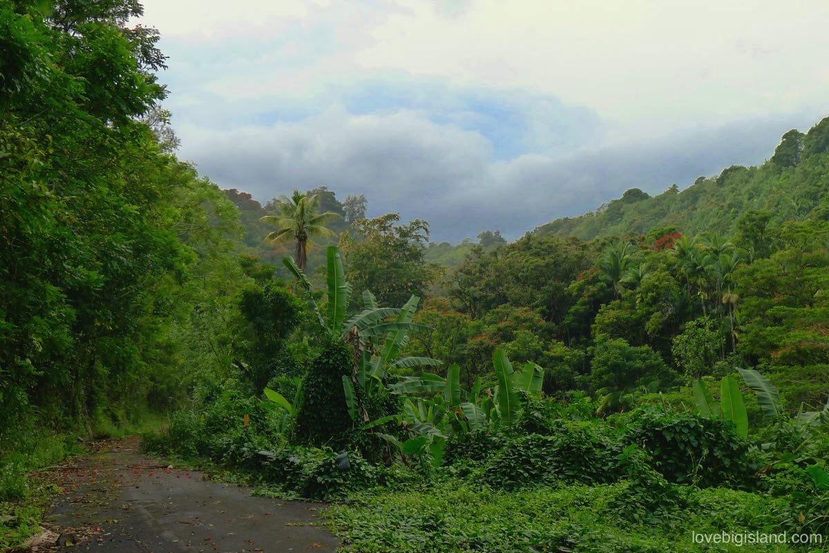
Rain most days of the year keeps the Hāmākua coast north of Hilo this green. This is the tropical continuously wet zone at sea level.
Monsoon
A short dry season, but enough rain the rest of the year to keep the ground wet. It sits between the wettest windward slopes and the drier country inland. Color on the map
Where to find it: the windward Hilo and Puna coast, where one drier stretch breaks an otherwise wet year.
Elevation: mostly 139 to 1,788 ft.
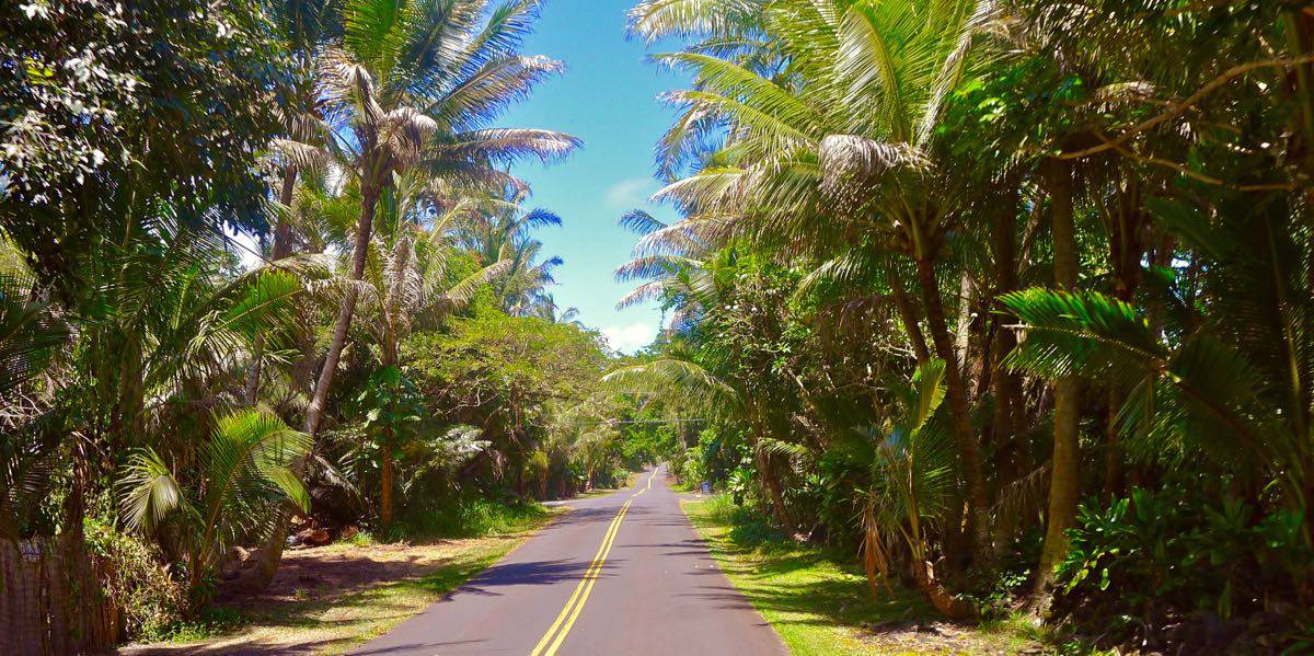
The Kapoho Kalapana road in Puna, one of the most scenic drives on the Big Island. The 2018 eruption buried its northern end. The county has been rebuilding the Kapoho stretch since January 2025, with a target of the third quarter of 2026. Drive it from the Kalapana side. At the open end sits Pohoiki, home to the island’s last easily reached warm pond.
Tropical dry
A clear dry season. On our map this splits into a winter-dry and a summer-dry shade, depending on which half of the year the dry season falls in, but both are the one tropical dry zone. This is the belt where the land dries out between the wet uplands and the leeward coast. Color for winter-dry. Color for summer-dry
Where to find it: the transition slopes above the Kona and Kaʻū coasts, below the wet uplands and above the dry shore.
Elevation: mostly 12 to 1,647 ft.
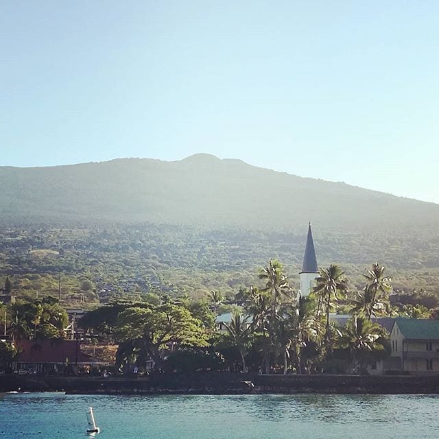
Kailua Bay, with the slopes of Hualālai behind it. The tropical dry belt is on those slopes rather than on the shore in the foreground, which is drier still.
Dry (arid and semi-arid) climate
In this climate the yearly evaporation outpaces the rainfall. The Big Island is the only Hawaiian island that reaches both steps of it, steppe and true desert.
Dry semi-arid (steppe)
A dry grassland climate, drier than the tropics but wetter than desert. On the Big Island it holds the leeward slopes and the high ranch country. Color on the map
Where to find it: the leeward Kohala slopes and the ranch land around Waimea.
Elevation: mostly 15 to 2,526 ft.
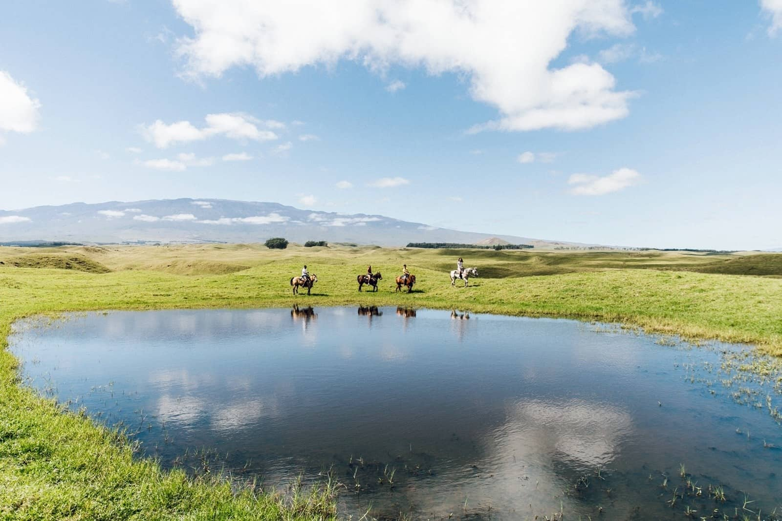
Horseback riding tour in the hills above Waimea with views of Mauna Kea.
Credit: Hawaii Tourism Authority (HTA) / Heather Goodman
Dry arid (desert)
A true desert climate. Köppen sets a dryness threshold from the annual mean temperature and how the rain falls across the year, and true desert is where the yearly rainfall comes in below half of that threshold. It is rare in Hawaiʻi, and the Big Island is the only island that reaches it. Color on the map
Where to find it: the driest stretch of the Kona coast, including Kua Bay, our favorite white-sand beach on the island.
Elevation: mostly 3 to 639 ft.
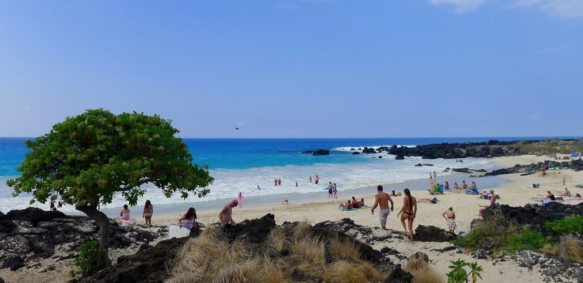
The Kua Bay beach is close to Kona airport and a good place to watch your last Hawaiian sunset if you have a late flight
Temperate climate
The coldest month averages between 32° F (0° C) and 64° F (18° C), and the warmest month is above 50° F (10° C). Two sub-zones appear on the Big Island.
Temperate summer dry
The driest summer month gets under 40 mm (1.6 in) of rain, and the wettest winter month gets at least three times as much. Our map splits it into a warm shade lower down and a cool shade higher up, but both are the one temperate dry zone. Color for the warm shade. Color for the cool shade
Where to find it: the mid-elevation slopes and the saddle country between Mauna Kea and Mauna Loa, which Saddle Road crosses.
Elevation: mostly 2,916 to 8,497 ft.
Temperate continuously wet
Rain falls year round, with no dry season in either summer or winter. These are the cool, green upland forests. Color on the map
Where to find it: Volcano Village, whose temperate rainforest stays green and cool year round.
Elevation: mostly 1,961 to 7,601 ft.
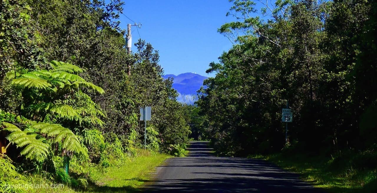
Mauna Kea from a street in Volcano Village, framed by hāpuʻu tree ferns. Our DIY stargazing guide covers visiting the summit.
Polar climate
Polar climates average below 50° F (10° C) every month of the year. One sub-zone reaches the Big Island.
Polar tundra
No month averages warmer than 50° F (10° C), and the warmest month stays above 32° F (0° C). On the Big Island this is the summit zone, the coldest climate in Hawaiʻi. Color on the map
Where to find it: the summits of Mauna Kea and Mauna Loa. Over roughly the last 180,000 years Mauna Kea went through three glacial periods when its summit carried an ice cap. The most recent, the Mākanaka, had ended by about 13,000 years ago, which is when Lake Waiau became an ice-free basin able to collect sediment (USGS).
Elevation: mostly 8,974 to 12,903 ft.
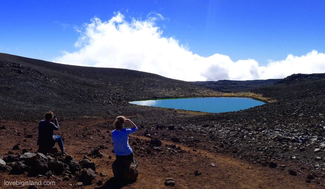
Lake Waiau sits on Mauna Kea, more than 13,000 ft above sea level. It is one of very few lakes in the state of Hawaiʻi
How we counted the zones
The count of 8 sub-zones on the Big Island uses the most common form of the Köppen classification, the same one we use across this series. It is the most widely used and understood classification, but not the only one, and the Köppen system itself has changed over time.
Köppen is a 3-tier system: 5 main climates in the first tier, splitting into 13 sub-zones in the second, and into 30 finer groups in the third. When we say the Big Island has 8 of the world’s 13, we mean the second tier.
The map carries 10 labels because we split two zones in two for readers: the tropical dry zone is drawn winter-dry and summer-dry, and the temperate dry zone is drawn warm and cool. Collapse those two pairs and you are left with 8 distinct Köppen zones.
Our zones are computed from the University of Hawaiʻi Rainfall Atlas (Giambelluca et al. 2013) and Evapotranspiration Atlas (Giambelluca et al. 2014) at 250 m resolution. We feed the monthly rainfall and temperature for every 250 m pixel through the standard Köppen decision rules set out by Peel, Finlayson, and McMahon (2007). That resolution is fine enough to catch the sliver of true desert on the Kona coast and the tundra caps on the summits that a coarser map would smooth away.
The base period is 1978 to 2007. Climate zones are built on 30-year normals, so they barely shift between one recent period and the next. A finer grid changes a climate-zone map far more than a newer base period does.
The elevation bands come from the same 250 m grid, sampled against a public terrain model: each one is the range the middle 90 percent of that zone’s pixels fall in. They describe where a zone mostly sits rather than a hard line, because the zones interleave windward and leeward and neither side changes at the same height.